Area Overview for B90 2TB
Photos of B90 2TB
Area Information
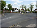
Living in B90 2TB means being part of a small, tightly knit residential cluster in the heart of Shirley, a historically significant suburb of Solihull. With a population of 2,297, the area is compact yet well-connected, sitting 3 miles southeast of Solihull town centre along the Stratford Road. Its proximity to the M42 motorway and multiple railway stations, including Shirley and Yardley Wood, makes it a convenient base for commuters. The area’s character is shaped by its roots as a farming settlement, with remnants of its past visible in local landmarks like St James’ Church. Daily life here balances suburban tranquillity with urban accessibility, offering residents a mix of practical amenities and historical context. The area’s compact size means it is less sprawling than larger suburbs, but its strategic location ensures it is never far from Birmingham’s cultural and economic hubs. For those seeking a community with a mix of stability and connectivity, B90 2TB provides a foundation built on established infrastructure and a moderate population density.
- Area Type
- Postcode
- Area Size
- Not available
- Population
- 2297
- Population Density
- 4743 people/km²
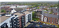
The property market in B90 2TB is largely defined by owner-occupation, with 78% of homes owned by their residents. This suggests a stable, long-term community with limited rental activity. The accommodation type is predominantly houses, which are typically larger and suited to families. Given the area’s small size, the housing stock is limited, and buyers should consider the proximity to nearby amenities and transport links when evaluating properties. The presence of houses rather than flats may appeal to those seeking more space or a traditional suburban layout. However, the compact nature of the area means that property availability is constrained, and buyers may need to look beyond B90 2TB itself to find comparable options. The high home ownership rate also indicates that the area is less influenced by transient rental markets, offering potential buyers a sense of security in their investment.
House Prices in B90 2TB
No properties found in this postcode.
Energy Efficiency in B90 2TB
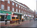
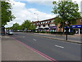
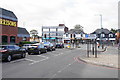
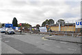
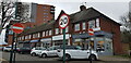
The lifestyle in B90 2TB is shaped by its practical amenities and suburban setting. Nearby retail options include Co-op Haslucks, Asda Shirley, and Aldi Shirley, providing access to essential shopping. The area’s rail connections, such as Shirley and Yardley Wood stations, offer easy access to Birmingham and beyond, while proximity to Birmingham International Airport adds to its connectivity. Though the data does not mention parks or leisure facilities, the area’s urban character suggests a balance between residential comfort and accessibility to broader services. The presence of multiple retail outlets and transport hubs indicates a community focused on convenience, with daily needs met within short distances. For residents, this means a lifestyle that prioritises efficiency without sacrificing the practicality of suburban living.
Amenities
Schools
The nearest school to B90 2TB is Haslucks Green School, a primary school with an Ofsted rating of ‘good’. This provides families with a reliable option for early education, though no secondary schools are listed in the data. The presence of a primary school with a positive rating is a key consideration for parents prioritising local schooling. However, the absence of secondary education options within the area may require families to look further afield for high school placements. The school’s rating suggests a focus on quality teaching and resources, which aligns with the area’s emphasis on stability and practical amenities. For those with young children, Haslucks Green School offers a foundational educational environment, though additional research would be needed to assess the broader school network in the region.
| Rank | School | Type | Entry gender | Ages |
|---|---|---|---|---|
| 1 | Haslucks Green School | primary | N/A | N/A |
Explore more schools in this area
Go to Schools tabDemographics
The community in B90 2TB is predominantly composed of adults aged 30–64, with a median age of 47. This suggests a mature, established population, many of whom are likely to be homeowners, as 78% of residents own their homes. The area is characterised by houses rather than flats, reflecting a preference for family-oriented living spaces. The predominant ethnic group is White, though no specific data on diversity or deprivation levels is provided. The age profile indicates a stable demographic, with fewer young families or retirees compared to other areas. The high home ownership rate implies a community with long-term residency, potentially fostering a sense of local continuity. However, the absence of detailed diversity metrics means the full range of cultural or socioeconomic dynamics remains unexplored.
Household Size
Accommodation Type
Tenure
Ethnic Group
Religion
Household Composition
Age
Household Deprivation
NS-SEC
Explore more demographic insights in this area
Go to Demographics tabPlanning
Planning Constraints
- Flood RiskPremium
- Ramsar Wetland SitesPremium
- Area of Outstanding Natural BeautyPremium
- Protected Nature ReservePremium
- Protected WoodlandPremium
- Crime RiskPremium