Area Overview for B90 2TD
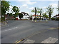
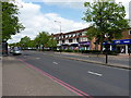
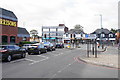
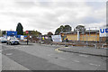
Photos of B90 2TD


Area Information
Living in B90 2TD means residing in a specific residential cluster within the urban environment of Shirley West. This postcode area covers a small population of 2,297 people, creating a tight-knit community rather than a sprawling suburb. The location sits approximately three miles southeast of Solihull town centre along the Stratford Road, placing it near the boundary with Yardley Wood in Birmingham and the Bromsgrove district to the south. History defines the character here, as the broader area was first recorded around 1240 and evolved from a farming settlement into a parish by the 19th century. Key landmarks nearby include St James' Church, built in 1832, and the historic Berry Mound Iron Age Hill Fort site at Solihull Lodge. Residents benefit from proximity to Junction 4 of the M42 motorway, which provides direct links to Birmingham and Stratford-upon-Avon. Although the area lacks major transport hubs immediately at its doorstep, it is situated just two miles from Solihull railway station. Daily life reflects the maturity of the locality, shaped by decades of development ranging from post-WWII estates to 1920s expansions. The mix of urban residential housing and historical significance offers a sense of established stability.
- Area Type
- Postcode
- Area Size
- Not available
- Population
- 2297
- Population Density
- 4743 people/km²
The property market in B90 2TD is defined by a strong preference for freestanding homes and long-term ownership rather than private renting. With 78% of homes in immediate ownership, the area functions as an owner-occupied market. This figure indicates that buyers looking for stability and community integration will find this environment suitable. The accommodation type is categorised as houses, meaning terraced or semi-detached blocks are less common than detached or semi-detached properties. Prospective buyers should expect competition from other homeowners who have chosen this established postcode over the flatter rental sectors found in some cities. The concentration of owned properties suggests lower tenant turnover and more consistent maintenance of the housing stock. When evaluating homes in B90 2TD, purchasers are entering a market where the majority of residents have purchased their dwellings rather than rented them. This dynamic often results in higher transaction values compared to areas with lower ownership rates. The specific housing mix supports those seeking traditional suburban living spaces within the broader Solihull framework.
House Prices in B90 2TD
No properties found in this postcode.
Energy Efficiency in B90 2TD
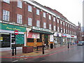
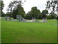
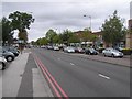
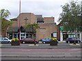
Residents of B90 2TD enjoy access to practical amenities within a short radius, balancing residential peace with commercial convenience. The retail sector offers five key facilities, including Co-op Haslucks, Asda Shirley, and Aldi Shirley. These supermarkets satisfy daily grocery needs without requiring long journeys into the city centre. For those travelling further afield, the rail network provides five nearby stations, including Shirley Railway Station and Yardley Wood Railway Station. These links facilitate easy access to Greater Birmingham and the national rail network. Major transport hubs also lie close by, with Birmingham International Airport, Grand Central New Street, and Corporation Street all within practical reach. This connectivity ensures that commuting to businesses in the West Midlands is efficient. The surrounding landscape includes historical features such as St James' Church and the Shirley Institute, founded in 1901. Nature enthusiasts can visit the Berry Mound Iron Age Hill Fort site located at Solihull Lodge. The lifestyle is characterised by a blend of suburban domesticity and accessible commercial and transport networks.
Amenities
Schools
Families living in B90 2TD have access to specific educational facilities that serve the local ward. Haslucks Green School stands as the nearest primary option, holding a good Ofsted rating. This institution provides early years education for children residing in the immediate vicinity of the postcode. For those requiring secondary education details, the provided dataset does not list specific secondary schools or their ratings in the local neighbourhood. Consequently, assessments of the full school route for families must rely on the confirmed primary provision alongside regional choices not detailed in this local data set. The presence of a good-rated primary school offers reassurance to parents considering homes in B90 2TD. The single listed school indicates that parents may need to travel further west towards Solihull town centre for additional secondary options if they are not located near other unlisted institutions. The focus on Haslucks Green School highlights the immediate educational infrastructure available within practical reach.
| Rank | School | Type | Entry gender | Ages |
|---|---|---|---|---|
| 1 | Haslucks Green School | primary | N/A | N/A |
Explore more schools in this area
Go to Schools tabDemographics
The community in B90 2TD reflects a mature household profile, with a median age of 47 years. Most residents fall into the 30-to-64-year-old age range, indicating a population dominated by adults rather than young families or retirees solely in the early or late stages of life. This demographic skew suggests a neighbourhood where long-term residents have established deep roots. Housing tenure supports this stability, as 78% of homes are owner-occupied. This high rate of ownership points to a settled community where families and individuals have invested in their local environment over time. The accommodation stock consists primarily of houses, aligning with the suburban character of the Ward within the Metropolitan Borough of Solihull. Ethnic diversity is measured, with the predominant ethnic group being white. While the area is less prosperous than some neighbouring zones, it avoids the extremes of deprivation found in parts of Shirley East or Solihull Lodge. The population size of 2,297 creates a manageable scale where local issues are likely to be addressed directly by residents.
Household Size
Accommodation Type
Tenure
Ethnic Group
Religion
Household Composition
Age
Household Deprivation
NS-SEC
Explore more demographic insights in this area
Go to Demographics tabPlanning
Planning Constraints
- Flood RiskPremium
- Ramsar Wetland SitesPremium
- Area of Outstanding Natural BeautyPremium
- Protected Nature ReservePremium
- Protected WoodlandPremium
- Crime RiskPremium