Area Overview for B9 4UA
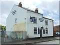
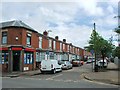
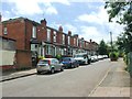
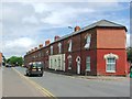
Photos of B9 4UA

Area Information
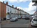
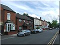
Living in B9 4UA places you at the heart of Birmingham’s historic Bordesley and Highgate ward, an area steeped in centuries of industrial and cultural heritage. This small postcode covers just 1.4 hectares, yet it is densely populated, housing 3,407 residents in a compact urban setting. The area is part of Birmingham’s central core, bordered by districts like Digbeth and Deritend, which have long been hubs of trade and manufacturing. Despite its size, B9 4UA is rich in character, with a mix of older residential architecture and modern infrastructure. The ward was restructured in 2017 to reflect evolving urban dynamics, and today it serves as a microcosm of Birmingham’s diversity. With a median age of 22, the area is notably young, though the majority of residents fall within the 30–64 age bracket, suggesting a working population. This blend of demographics shapes a community that balances youthful energy with established local ties. Proximity to the city centre, combined with nearby schools and transport links, makes B9 4UA a practical choice for those seeking convenience without sacrificing historical depth.
- Area Type
- Postcode
- Area Size
- 1.4 hectares
- Population
- 3407
- Population Density
- 5052 people/km²
The property market in B9 4UA is defined by a 51% home ownership rate, indicating that nearly half of residents live in owner-occupied homes, while the remainder are likely renters. The accommodation type is predominantly houses, which is noteworthy in such a compact area. This suggests a mix of larger properties, possibly multi-generational homes, alongside smaller units. Given the high population density, the housing stock is likely limited, with little scope for expansion. Buyers should consider the proximity to essential amenities and transport links, which may offset the area’s constraints. However, the small size of B9 4UA means that property values and availability are closely tied to the broader Bordesley and Highgate ward. For those seeking a home, the focus would be on existing properties rather than new developments, with an emphasis on practicality over luxury. The mix of house types may appeal to families, though the urban setting may not suit those preferring spacious living.
House Prices in B9 4UA
No properties found in this postcode.
Energy Efficiency in B9 4UA
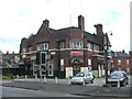
Daily life in B9 4UA is shaped by its proximity to essential amenities, including five retail outlets such as Lidl Bordesley, Asda Bordersley, and Morrisons Bordesley, which cater to everyday shopping needs. The area’s rail stations and metro connections provide easy access to Birmingham’s cultural and commercial hubs, while its historic roots offer a contrast to modern convenience. The compact size of B9 4UA means that residents can reach these amenities on foot or by bike, fostering a sense of walkability. Though the area lacks large parks or recreational spaces, its integration into Birmingham’s urban fabric ensures access to broader leisure opportunities. The mix of retail, transport, and historical context creates a lifestyle that balances practicality with the vibrancy of a city-centre location.
Amenities
Schools
Residents of B9 4UA have access to a range of educational institutions, including Bordesley Green Girls’ School & Sixth Form, which is rated ‘good’ by Ofsted and provides both primary and secondary education. Al-Hijrah School, an independent primary school, offers an alternative to state-run institutions, while City College, Birmingham, caters to sixth-form students. This mix of state and independent schools provides families with options tailored to different needs and preferences. The presence of a sixth-form college nearby ensures continuity in education for older students, reducing the need for long commutes. The ‘good’ Ofsted rating at Bordesley Green Girls’ School suggests a reliable standard of education, which is a key consideration for families prioritising academic outcomes. The diversity of school types reflects the area’s broader demographic composition, offering both traditional and alternative educational pathways.
| Rank | School | Type | Entry gender | Ages |
|---|
Explore more schools in this area
Go to Schools tabDemographics
B9 4UA’s population of 3,407 is concentrated in a small area, resulting in a high population density of 246,601 people per square kilometre. The median age of 22 contrasts with the most common age range of 30–64 years, indicating a working-age population that may drive local demand for services and housing. Home ownership stands at 51%, suggesting a balance between owner-occupied properties and rental stock. The accommodation type is predominantly houses, which is unusual for a densely packed urban area, hinting at a mix of larger family homes and smaller dwellings. The predominant ethnic group is Asian, reflecting the area’s cultural diversity. This demographic profile shapes a community with a strong focus on family life and local institutions. The high density, however, may contribute to a sense of overcrowding, though the mix of age groups and household types suggests a dynamic, multifaceted social environment.
Household Size
Accommodation Type
Tenure
Ethnic Group
Religion
Household Composition
Age
Household Deprivation
NS-SEC
Explore more demographic insights in this area
Go to Demographics tabPlanning
Planning Constraints
- Flood RiskPremium
- Ramsar Wetland SitesPremium
- Area of Outstanding Natural BeautyPremium
- Protected Nature ReservePremium
- Protected WoodlandPremium