Area Overview for B9 4TU
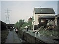
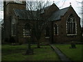
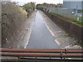
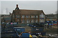
Photos of B9 4TU


Area Information
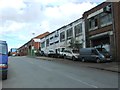
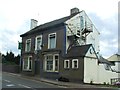
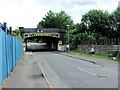
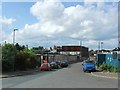
B9 4TU lies at the heart of Birmingham’s urban fabric, nestled within the Bordesley and Highgate ward. This small postcode area, home to 3,407 residents, sits just east of the city centre, blending historic charm with modern convenience. The ward encompasses parts of Bordesley, Digbeth, and Deritend—areas steeped in industrial heritage, from 18th-century manufacturing sites to 19th-century schools. Despite its compact size, the area offers a mix of residential tranquility and proximity to Birmingham’s cultural and commercial hubs. Daily life here is shaped by its central location, with easy access to transport networks, retail, and educational institutions. The community, though small, reflects the city’s diversity, with a strong presence of Asian residents and a median age of 22, suggesting a blend of young professionals and families. Living in B9 4TU means navigating a dynamic urban environment where history and contemporary infrastructure coexist.
- Area Type
- Postcode
- Area Size
- Not available
- Population
- 3407
- Population Density
- 5052 people/km²
The property market in B9 4TU is characterised by a 51% home ownership rate, with houses forming the majority of the housing stock. This suggests a community where many residents live in family homes rather than rental properties, though the relatively low ownership rate implies a significant portion of the housing stock is rented. The prevalence of houses over flats or apartments may appeal to families seeking space and privacy. Given the area’s small size, the housing market is likely tightly focused, with limited options for buyers. Those considering purchase should note the compact nature of the postcode and its proximity to Birmingham’s central amenities, which may influence property values. The mix of owner-occupied and rental properties also means the area could cater to both long-term residents and those seeking temporary housing.
House Prices in B9 4TU
No properties found in this postcode.
Energy Efficiency in B9 4TU
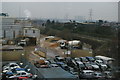
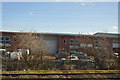
Daily life in B9 4TU is enriched by its proximity to essential amenities. Residents can access five retail outlets, including Lidl, Asda, and Morrisons, ensuring convenience for grocery shopping. The area’s transport network is extensive, with five rail stations and five metro stops, including Bull Street and Corporation Street, providing seamless links to Birmingham’s core. While the data does not mention parks or leisure facilities, the presence of multiple retail and transport hubs suggests a focus on practicality over green spaces. The area’s character is defined by its compact, urban layout, where historic industrial sites coexist with modern infrastructure. This blend offers a pragmatic lifestyle, prioritising accessibility and connectivity over expansive recreational areas.
Amenities
Schools
Residents of B9 4TU have access to a range of educational institutions, including Bordesley Green Girls’ School & Sixth Form, which holds a ‘good’ Ofsted rating and serves primary and secondary students. Al-Hijrah School, an independent primary school, offers an alternative to state education, while City College, Birmingham provides sixth-form education. The presence of both state and independent schools reflects the area’s diverse educational landscape, allowing families to choose between free public education or fee-paying options. The good Ofsted rating at Bordesley Green Girls’ School indicates a reliable standard of teaching, which is critical for parents prioritising academic outcomes. With multiple schools within reach, the area supports families at various stages of education, from early years to post-16 studies.
| Rank | School | Type | Entry gender | Ages |
|---|
Explore more schools in this area
Go to Schools tabDemographics
The population of B9 4TU has a median age of 22, though the most common age group is adults aged 30–64, indicating a mix of younger residents and established families. Home ownership stands at 51%, with houses being the predominant accommodation type. This suggests a community where many residents live in family homes rather than apartments. The area’s predominant ethnic group is Asian, reflecting broader demographic trends in Birmingham. While the data does not specify deprivation levels, the high home ownership rate and presence of independent schools suggest a stable, resourceful population. However, the median age being notably lower than the most common age range may indicate a younger demographic skew, possibly linked to student populations or recent migrants. This blend of ages and backgrounds creates a community with diverse needs and perspectives.
Household Size
Accommodation Type
Tenure
Ethnic Group
Religion
Household Composition
Age
Household Deprivation
NS-SEC
Explore more demographic insights in this area
Go to Demographics tabPlanning
Planning Constraints
- Flood RiskPremium
- Ramsar Wetland SitesPremium
- Area of Outstanding Natural BeautyPremium
- Protected Nature ReservePremium
- Protected WoodlandPremium