Area Overview for B9 4TE
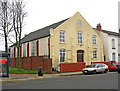
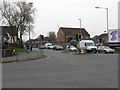
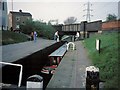
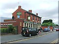
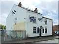
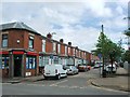
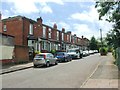
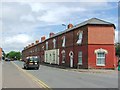
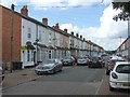
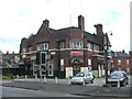
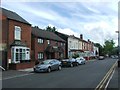
Photos of B9 4TE

Area Information
Living in B9 4TE means being part of a small, tightly knit residential cluster in the heart of Birmingham, within the Bordesley and Highgate electoral ward. This area, with a population of 3,407, sits east of the city centre, blending historic character with modern convenience. The ward includes parts of Digbeth, Highgate, and Bordesley—areas that have evolved from 18th-century industrial roots to today’s urban hubs. While the median age is 22, the most common age range is 30–64, suggesting a mix of young professionals and established families. The area’s diversity is evident in its demographics, with the Asian community forming the predominant ethnic group. Daily life here is shaped by proximity to Birmingham’s cultural and economic core, with easy access to transport, retail, and educational institutions. The compact nature of B9 4TE means residents are close to both the city’s energy and quieter, historic pockets like Digbeth, where 19th-century industry once thrived.
- Area Type
- Postcode
- Area Size
- Not available
- Population
- 3407
- Population Density
- 5052 people/km²
The property market in B9 4TE is characterised by a 51% home ownership rate, with houses being the primary accommodation type. This suggests a modest number of owner-occupied properties, likely catering to families and professionals seeking stability. The small area’s limited housing stock means competition for available homes, particularly for buyers seeking larger properties. The presence of both independent and state schools may attract families, though the area’s compact size means the immediate surroundings offer few alternatives. For renters, the market is likely constrained by the low number of available properties, with a focus on single-family homes rather than apartments or flats. Buyers should consider the area’s proximity to Birmingham’s amenities, which could offset its smaller size, but also note that the housing stock may not cater to those seeking more modern or specialist property types.
House Prices in B9 4TE
No properties found in this postcode.
Energy Efficiency in B9 4TE
Residents of B9 4TE enjoy a lifestyle shaped by proximity to Birmingham’s amenities. The area’s retail options include major supermarkets like Lidl, Asda, and Morrisons, ensuring everyday shopping needs are met without long commutes. Transport links are extensive, with five rail stations and three metro stops within reach, facilitating access to the city’s business districts, cultural venues, and leisure spots. The historic character of nearby Digbeth adds a layer of charm, though the area itself is more focused on practicality. While parks and green spaces are not explicitly mentioned, the presence of industrial heritage sites like Bordesley Hall (now demolished) hints at a past rooted in manufacturing. The compact nature of B9 4TE means residents must balance convenience with the limitations of a small, densely populated area.
Amenities
Schools
Residents of B9 4TE have access to a range of educational institutions, including Bordesley Green Girls’ School & Sixth Form, a primary school with a Good Ofsted rating. This school offers a structured environment for younger students, complemented by the independent Al-Hijrah School, which provides an alternative educational pathway. For older students, City College, Birmingham offers sixth-form education, ensuring continuity for those pursuing further studies. The presence of both state and independent schools reflects the area’s diversity, allowing families to choose between public and private options. The mix of primary and sixth-form institutions suggests a well-rounded educational ecosystem, though the absence of secondary schools may require students to commute for more advanced studies. This variety caters to different preferences and needs, supporting both local and broader educational goals.
| Rank | School | Type | Entry gender | Ages |
|---|
Explore more schools in this area
Go to Schools tabDemographics
B9 4TE has a median age of 22, but the majority of residents fall within the 30–64 age range, indicating a balance between younger and middle-aged populations. Home ownership stands at 51%, with houses being the predominant accommodation type. This suggests a mix of owner-occupied properties and rental stock, though the small area’s housing stock is limited. The Asian community forms the largest ethnic group, contributing to the area’s cultural diversity. While specific deprivation data is not provided, the presence of independent schools like Al-Hijrah and state-funded institutions such as Bordesley Green Girls’ School suggests a range of educational resources. The age profile implies a community with both young professionals and families, though the lack of data on household composition means the balance between single-person households and families remains unclear.
Household Size
Accommodation Type
Tenure
Ethnic Group
Religion
Household Composition
Age
Household Deprivation
NS-SEC
Explore more demographic insights in this area
Go to Demographics tabPlanning
Planning Constraints
- Flood RiskPremium
- Ramsar Wetland SitesPremium
- Area of Outstanding Natural BeautyPremium
- Protected Nature ReservePremium
- Protected WoodlandPremium