Area Overview for B9 4TH
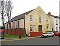
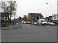
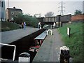
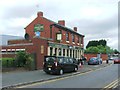
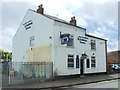
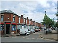
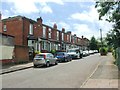
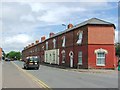
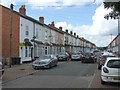
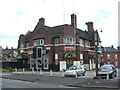
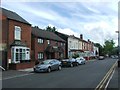
Photos of B9 4TH

Area Information
Living in B9 4TH, part of the Bordesley and Highgate ward in Birmingham, offers a blend of historical character and modern convenience. This small residential cluster, with a population of 3,407, lies east of Birmingham’s city centre, encompassing areas like Bordesley, Digbeth, and Deritend. The ward was established in 2017 following boundary changes, and its roots trace back to the 7th century, with names like *Bord’s leah* reflecting its ancient origins. Today, it is a hub of trade and industry, shaped by 19th-century manufacturing and educational institutions. Residents benefit from proximity to Birmingham’s cultural and economic heart, with easy access to rail, metro, and retail networks. The area’s compact size means a tight-knit community, though it sits within the larger Birmingham Ladywood parliamentary constituency. Its mix of historic sites, like the former Bordesley Hall, and contemporary amenities makes it a distinct choice for those seeking urban living with a touch of heritage.
- Area Type
- Postcode
- Area Size
- Not available
- Population
- 3407
- Population Density
- 5052 people/km²
B9 4TH’s property market is characterised by a 51% home ownership rate, with houses forming the majority of the housing stock. This suggests a community where many residents live in family homes, though the relatively small area means the housing stock is limited. The predominance of houses over flats or apartments implies a focus on traditional, larger properties, which may appeal to families or those seeking more space. However, the 51% ownership rate also indicates a significant rental market, potentially offering opportunities for investors or tenants. Given the area’s compact size, buyers should consider the limited availability of properties and the potential for competition in the local market. The mix of housing types may also reflect the area’s historical development, with older homes coexisting alongside newer developments.
House Prices in B9 4TH
No properties found in this postcode.
Energy Efficiency in B9 4TH
The lifestyle in B9 4TH is shaped by its proximity to shops, transport, and historical sites. Retail options like Lidl, Asda, and Morrisons offer convenience for daily errands, while metro stations such as Bull Street and Grand Central New Street provide easy access to Birmingham’s cultural and commercial hubs. The area’s industrial heritage is reflected in its architecture, though modern amenities ensure a practical living experience. Residents can enjoy the convenience of nearby rail services and the vibrancy of the city centre, all within a short distance. While the area lacks large parks or leisure facilities, its compact size means essential services are close by. This blend of accessibility and urban character supports a dynamic lifestyle, appealing to those who value both convenience and historical context.
Amenities
Schools
Residents of B9 4TH have access to a range of educational institutions. Bordesley Green Girls’ School & Sixth Form, a primary school with an Ofsted rating of ‘good’, provides education for younger students. Al-Hijrah School, listed twice in the data, operates as both a primary and independent school, offering diverse options for families. City College, Birmingham, a sixth-form institution, caters to older students seeking further education. This mix of school types—state, independent, and post-16 provision—ensures families can choose between different educational philosophies and structures. The presence of both primary and secondary institutions within proximity reduces the need for long commutes, supporting a family-friendly environment. However, the lack of secondary schools in the immediate area may require students to travel to nearby wards for comprehensive education.
| Rank | School | Type | Entry gender | Ages |
|---|
Explore more schools in this area
Go to Schools tabDemographics
The population of B9 4TH has a median age of 22, though the most common age range is 30–64 years, suggesting a mix of younger residents and middle-aged families. Home ownership stands at 51%, with houses being the predominant accommodation type. This indicates a community where many residents live in family homes, though rental properties also exist. The area’s predominant ethnic group is the Asian population, reflecting a culturally diverse demographic. While specific deprivation data is not provided, the presence of independent schools like Al-Hijrah School and a range of retail amenities suggests a balance of resources. The relatively young median age contrasts with the older adult population, hinting at a dynamic mix of life stages, from students to established professionals.
Household Size
Accommodation Type
Tenure
Ethnic Group
Religion
Household Composition
Age
Household Deprivation
NS-SEC
Explore more demographic insights in this area
Go to Demographics tabPlanning
Planning Constraints
- Flood RiskPremium
- Ramsar Wetland SitesPremium
- Area of Outstanding Natural BeautyPremium
- Protected Nature ReservePremium
- Protected WoodlandPremium