Area Overview for B80 7ND
Photos of B80 7ND
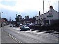
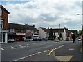

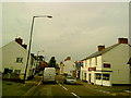
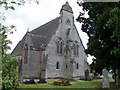
55 photos from this area
Area Information
Key information about the B80 7ND including its size, population, and administrative classification.
- Area Type
- Postcode
- Area Size
- 2.6 hectares
- Population
- 1655
- Population Density
- 249 people/km²
House Prices in B80 7ND
45
Properties
£153,190
Average Sold Price
£55,000
Lowest Price
£345,000
Highest Price
Showing 45 properties
| Address | Type | Beds | Baths | Last Sale Price | Last Sale Date | |
|---|---|---|---|---|---|---|
| 60 New Road, Studley, B80 7ND | Terraced | 2 | 1 | £200,000 | Jul 2025 | |
| 72C New Road, Studley, B80 7ND | Maisonette | 2 | - | £160,000 | Jun 2023 | |
| York House, New Road, Studley, B80 7ND | Detached | 3 | 2 | £345,000 | Jan 2023 | |
| 66A New Road, Studley, B80 7ND | Flat | 2 | 1 | £170,000 | Oct 2022 | |
| 13 New Road, Studley, B80 7ND | house | - | - | £330,000 | Sep 2021 | |
| 72A New Road, Studley, B80 7ND | Maisonette | - | - | £130,000 | Mar 2021 | |
| 74B New Road, Studley, B80 7ND | Flat | 2 | 1 | £135,000 | May 2020 | |
| 12 New Road, Studley, B80 7ND | Semi-detached | 3 | 1 | £298,500 | Jan 2020 | |
| 70B New Road, Studley, B80 7ND | Flat | 2 | 1 | £131,000 | Jun 2019 | |
| 70A New Road, Studley, B80 7ND | Maisonette | 2 | 1 | £135,000 | Mar 2019 |
Page 1 of 5
Energy Efficiency in B80 7ND
Amenities
Schools
| Rank | School | Type | Entry gender | Ages |
|---|
Explore more schools in this area
Go to Schools tabDemographics
Household Size
Two person
most common
Accommodation Type
Houses
most common
Tenure
75
majority
Ethnic Group
White
most common
Religion
N/A
most common
Household Composition
N/A
most common
Age
47
median
Adults (30-64 years)
most common
Household Deprivation
N/A
with no deprivation
NS-SEC
38
in Lower managerial occupations
Explore more demographic insights in this area
Go to Demographics tabPlanning
Planning Constraints
- Flood RiskPremium
- Ramsar Wetland SitesPremium
- Area of Outstanding Natural BeautyPremium
- Protected Nature ReservePremium
- Protected WoodlandPremium