Area Overview for B80 7NP
Photos of B80 7NP
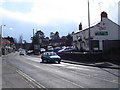
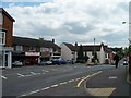
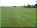


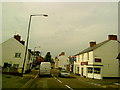
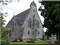
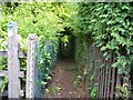
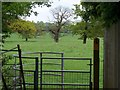
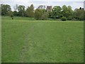
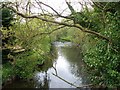
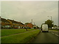
55 photos from this area
Area Information
Key information about the B80 7NP including its size, population, and administrative classification.
- Area Type
- Postcode
- Area Size
- 1.2 hectares
- Population
- 1655
- Population Density
- 249 people/km²
House Prices in B80 7NP
41
Properties
£179,391
Average Sold Price
£25,500
Lowest Price
£445,500
Highest Price
Showing 41 properties
| Address | Type | Beds | Baths | Last Sale Price | Last Sale Date | |
|---|---|---|---|---|---|---|
| 80 Alcester Road, Studley, B80 7NP | Terraced | 2 | 1 | £207,250 | Aug 2025 | |
| 84 Alcester Road, Studley, B80 7NP | Terraced | 2 | 1 | £205,000 | Jan 2025 | |
| 90B Alcester Road, Studley, B80 7NP | Flat | - | - | £125,000 | Oct 2024 | |
| 90A Alcester Road, Studley, B80 7NP | Flat | - | - | £125,000 | Oct 2024 | |
| 70 Alcester Road, Studley, B80 7NP | Terraced | 2 | 1 | £222,500 | Sep 2024 | |
| 64 Alcester Road, Studley, B80 7NP | Terraced | 4 | 2 | £305,000 | Jan 2022 | |
| 104 Alcester Road, Studley, B80 7NP | Terraced | 2 | 1 | £165,000 | Sep 2021 | |
| 92 Alcester Road, Studley, B80 7NP | house | - | - | £445,500 | Sep 2021 | |
| Sharm Cottage, 62 Alcester Road, Studley, B80 7NP | house | 3 | 2 | £277,500 | May 2019 | |
| 76 Alcester Road, Studley, B80 7NP | house | - | - | £210,000 | Sep 2017 |
Page 1 of 5
Energy Efficiency in B80 7NP
Amenities
Schools
| Rank | School | Type | Entry gender | Ages |
|---|
Explore more schools in this area
Go to Schools tabDemographics
Household Size
Two person
most common
Accommodation Type
Houses
most common
Tenure
75
majority
Ethnic Group
White
most common
Religion
N/A
most common
Household Composition
N/A
most common
Age
47
median
Adults (30-64 years)
most common
Household Deprivation
N/A
with no deprivation
NS-SEC
38
in Lower managerial occupations
Explore more demographic insights in this area
Go to Demographics tabPlanning
Planning Constraints
- Flood RiskPremium
- Ramsar Wetland SitesPremium
- Area of Outstanding Natural BeautyPremium
- Protected Nature ReservePremium
- Protected WoodlandPremium