Area Overview for B74 3NT
Photos of B74 3NT
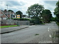
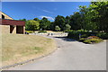
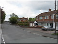

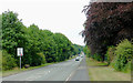
16 photos from this area
Area Information
Key information about the B74 3NT including its size, population, and administrative classification.
- Area Type
- Postcode
- Area Size
- 12.1 hectares
- Population
- 1431
- Population Density
- 532 people/km²
House Prices in B74 3NT
16
Properties
£273,859
Average Sold Price
£104,500
Lowest Price
£520,000
Highest Price
Showing 16 properties
| Address | Type | Beds | Baths | Last Sale Price | Last Sale Date | |
|---|---|---|---|---|---|---|
| 152 Foley Road West, Streetly, B74 3NT | Bungalow | 4 | 1 | £520,000 | Jul 2023 | |
| 162 Foley Road West, Streetly, B74 3NT | house | - | - | £500,000 | Sep 2021 | |
| 168 Foley Road West, Streetly, B74 3NT | Semi-detached | 4 | - | £332,500 | May 2016 | |
| 166 Foley Road West, Streetly, B74 3NT | house | 4 | - | £255,110 | Sep 2012 | |
| 164 Foley Road West, Streetly, B74 3NT | house | - | - | £345,000 | Oct 2006 | |
| 150 Foley Road West, Streetly, B74 3NT | Semi-detached | - | - | £149,950 | May 2002 | |
| 158 Foley Road West, Streetly, B74 3NT | Detached | - | - | £145,000 | Sep 1999 | |
| 160 Foley Road West, Streetly, B74 3NT | Detached | - | - | £104,500 | Jan 1997 | |
| 146 Foley Road West, Streetly, B74 3NT | Detached | - | - | £112,675 | Sep 1995 | |
| 154 Foley Road West, Streetly, B74 3NT | Cottage | 5 | 4 | - | - |
Page 1 of 2
Energy Efficiency in B74 3NT
Amenities
Schools
| Rank | School | Type | Entry gender | Ages |
|---|
Explore more schools in this area
Go to Schools tabDemographics
Household Size
Family (3-5 people)
most common
Accommodation Type
Houses
most common
Tenure
94
majority
Ethnic Group
White
most common
Religion
N/A
most common
Household Composition
N/A
most common
Age
47
median
Adults (30-64 years)
most common
Household Deprivation
N/A
with no deprivation
NS-SEC
46
in Lower managerial occupations
Explore more demographic insights in this area
Go to Demographics tabPlanning
Planning Constraints
- Flood RiskPremium
- Ramsar Wetland SitesPremium
- Area of Outstanding Natural BeautyPremium
- Protected Nature ReservePremium
- Protected WoodlandPremium