Area Overview for B74 3LS
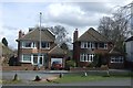
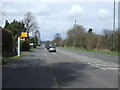
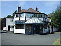
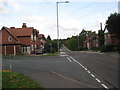
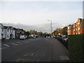
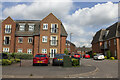
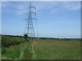
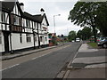
Photos of B74 3LS
Area Information
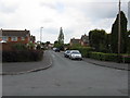
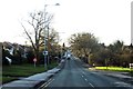
Living in B74 3LS means residing in a specific residential cluster that occupies just 5.7 hectares. This postcode covers a small area within the broader Streetly district, which functions as a semi-rural to suburban district in the northern part of the Birmingham metropolitan area. The local population stands at 1,431 people, creating a very tight-knit community where neighbours likely know each other. Despite its small footprint, the area feels distinct due to its proximity to New Oscott, Great Barr, Four Oaks, and Aldridge, while remaining separated from Walsall by open fields and the North Birmingham green belt. Daily life here blends suburban convenience with the character of a district that retains much open space and lies close to many farms. Residents enjoy access to Sutton Park, which has its own dedicated gate near the area. The residential nature of B74 3LS means you are surrounded by a quiet environment rather than a bustling urban centre. This specific postcode represents a slice of a larger neighbourhood that transformed from a sparsely populated rural area into a residential suburb. You are living in a place where history meets modernity, with Roman Ryknield Street lines still traceable in nearby Sutton Park and lists of local amenities nearby for practical needs. The area offers a concentrated living experience within a district that has served as a response to urbanisation since the mid-20th century.
- Area Type
- Postcode
- Area Size
- 5.7 hectares
- Population
- 1431
- Population Density
- 532 people/km²
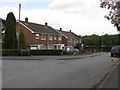
The property market in B74 3LS is overwhelmingly characterised by owner-occupancy. Data indicates that 94% of the stock consists of homes owned by their current residents. This creates an environment where houses typically change hands gradually rather than through high rates of short-term tenancy agreements. The accommodation type is predominantly houses, which aligns with the character of the wider Streetly district that transformed from a rural area into a residential suburb. You are looking largely at privately owned homes, much of which dates from the 1960s onwards. This housing stock reflects the mass construction that occurred in response to Birmingham's urbanisation. The small size of the B74 3LS postcode, covering only 5.7 hectares, means the available properties represent a specific cluster within this larger suburban district. There is a distinct lack of private renting activity in the immediate vicinity, suggesting that the cost of entering the market or the cultural norm favours purchasing over renting. If you are considering buying in this area, you are entering a market where sellers are likely to be motivated by life changes rather than the need to generate rental income. The high concentration of owner-occupied homes often correlates with better maintenance standards as owners look to maximise their property value before selling. This stability can also mean that the area benefits from consistent investment in local upkeep.
House Prices in B74 3LS
Showing 20 properties
| Address | Type | Beds | Baths | Last Sale Price | Last Sale Date | |
|---|---|---|---|---|---|---|
| 67 Wood Lane, Streetly, B74 3LS | Detached | 5 | 4 | £965,000 | Dec 2024 | |
| 89 Wood Lane, Streetly, B74 3LS | house | 4 | 4 | £800,000 | Aug 2023 | |
| 85 Wood Lane, Streetly, B74 3LS | house | - | - | £600,000 | Mar 2023 | |
| 93 Wood Lane, Streetly, B74 3LS | Detached | 4 | 2 | £655,000 | Jul 2022 | |
| 91 Wood Lane, Streetly, B74 3LS | house | - | - | £550,000 | Apr 2021 | |
| 109 Wood Lane, Streetly, B74 3LS | Bungalow | 4 | 2 | £433,000 | Apr 2018 | |
| 63 Wood Lane, Streetly, B74 3LS | Bungalow | 4 | 1 | £308,000 | Mar 2012 | |
| 75 Wood Lane, Streetly, B74 3LS | house | 5 | - | £472,500 | Jun 2011 | |
| 59A Wood Lane, Streetly, B74 3LS | Detached | - | - | £280,000 | Oct 2008 | |
| 73 Wood Lane, Streetly, B74 3LS | Detached | - | - | £455,000 | May 2007 |
Energy Efficiency in B74 3LS
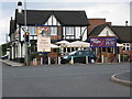
Your daily lifestyle in B74 3LS is supported by a practical network of amenities within easy reach. For retail needs, you have access to five notable venues including M&S Foley BP, Tesco Streetly, and Co-op Streetly. These locations provide essential goods and fresh provisions without requiring a journey into the city centre. Public transport options reinforce this convenience, with five notable rail stations and five metro stops nearby, including Butlers Lane and Blake Street Railway Stations. These stops ease your travel to Wednesbury, Handsworth, and surrounding communities. The character of the area is further enriched by its connection to nature, specifically Sutton Park which has a dedicated gate for Streetly residents. You can step out from your home in B74 3LS and enter a historic space containing the starting point of the Roman Ryknield Street at the Parson & Clerk Inn. Historical landmarks such as a church built in Foley Road in 1908 and Methodist Chapel in Blackwood Road add to the local atmosphere. Community facilities include a clinic and a library located in Blackwood Road, serving both medical and informational needs. This blend of retail, transport, and green space creates a balanced environment where you can shop, travel, and enjoy outdoor recreation without excessive driving.
Amenities
Schools
Families living in B74 3LS have access to specific educational institutions within walking distance or a short drive. The nearest school is Blackwood School, which operates as a primary school catering to younger children. For older students, the data lists Blackwood School as an academy, indicating the presence of secondary education options within the immediate vicinity of the postcode. While detailed Ofsted ratings are not provided for these specific names in the current dataset, the presence of both primary and academy statuses suggests a complete local educational catchment. You do not need to travel far to ensure your children are located at Blackwood School, whether for their early years or secondary education. The proximity of these facilities supports families who prefer the convenience of having education options nearby alongside their homes. The mix of school types, including an academy and a primary institution, reflects the established nature of the residential area. Parents in B74 3LS can rely on being close to established educational infrastructure. This arrangement supports daily life by reducing commute times for drop-offs and collections. The availability of Blackwood School in different capacities ensures that the local education network is robust enough to serve the 1,431 residents within the area.
| Rank | School | Type | Entry gender | Ages |
|---|
Explore more schools in this area
Go to Schools tabDemographics
The community in B74 3LS is defined by stability and a mature age profile. The median age is 47 years, indicating that the most common age range is adults between 30 and 64 years old. You are likely dealing with a household where children have either grown and left or are no longer the primary focus of the living space. This demographic structure reflects a region that has seen significant development since the 1960s, attracting families and professionals over several decades. Home ownership is extremely high, with 94% of houses in this postcode area owned by their residents. This figure suggests very little private renting activity and a community invested in long-term stability. The dominant accommodation type is houses, fitting the suburban character of the wider Streetly district which lies close to many farms and green belt land. Regarding diversity, the predominant ethnic group is White, which aligns with the historical development of the area as a response to Birmingham's urbanisation trends. The low population density of 532 people per square kilometre contributes to the quiet and spacious feel of living here. There is no indication of significant deprivation or high turnover of residents, supporting the idea that this is a settled neighbourhood where people build roots. The high rate of home ownership also implies that any maintenance issues or adaptations to the housing stock are typically handled by owner-occupiers rather than landlords.
Household Size
Accommodation Type
Tenure
Ethnic Group
Religion
Household Composition
Age
Household Deprivation
NS-SEC
Explore more demographic insights in this area
Go to Demographics tabPlanning
Planning Constraints
- Flood RiskPremium
- Ramsar Wetland SitesPremium
- Area of Outstanding Natural BeautyPremium
- Protected Nature ReservePremium
- Protected WoodlandPremium