Area Overview for B74 2DT
Photos of B74 2DT
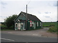
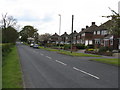
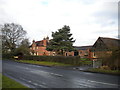
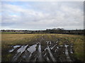
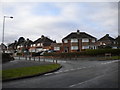
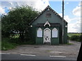
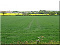
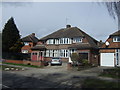
14 photos from this area
Area Information
Key information about the B74 2DT including its size, population, and administrative classification.
- Area Type
- Postcode
- Area Size
- 9248 m²
- Population
- 1863
- Population Density
- 5697 people/km²
House Prices in B74 2DT
18
Properties
£174,542
Average Sold Price
£53,000
Lowest Price
£265,000
Highest Price
Showing 18 properties
| Address | Type | Beds | Baths | Last Sale Price | Last Sale Date | |
|---|---|---|---|---|---|---|
| 312 Aldridge Road, Streetly, B74 2DT | Terraced | 2 | 1 | £140,000 | Apr 2023 | |
| 326 Aldridge Road, Streetly, B74 2DT | house | 3 | - | £245,000 | Aug 2021 | |
| 350 Aldridge Road, Streetly, B74 2DT | Detached | 3 | 1 | £265,000 | Mar 2021 | |
| 346 Aldridge Road, Streetly, B74 2DT | Semi-detached | 3 | 1 | £235,000 | Oct 2019 | |
| 328 Aldridge Road, Streetly, B74 2DT | Terraced | 2 | 1 | £245,000 | Dec 2018 | |
| 318 Aldridge Road, Streetly, B74 2DT | house | 2 | - | £191,000 | Dec 2016 | |
| 342 Aldridge Road, Streetly, B74 2DT | Semi-detached | 4 | - | £215,000 | Apr 2015 | |
| 314 Aldridge Road, Streetly, B74 2DT | house | - | - | £145,000 | Aug 2009 | |
| 308 Aldridge Road, Streetly, B74 2DT | Terraced | - | - | £146,500 | Mar 2006 | |
| 310 Aldridge Road, Streetly, B74 2DT | Terraced | 2 | - | £155,000 | Nov 2004 |
Page 1 of 2
Energy Efficiency in B74 2DT
Amenities
Schools
| Rank | School | Type | Entry gender | Ages |
|---|
Explore more schools in this area
Go to Schools tabDemographics
Household Size
Family (3-5 people)
most common
Accommodation Type
Houses
most common
Tenure
89
majority
Ethnic Group
White
most common
Religion
N/A
most common
Household Composition
N/A
most common
Age
47
median
Adults (30-64 years)
most common
Household Deprivation
N/A
with no deprivation
NS-SEC
37
in Lower managerial occupations
Explore more demographic insights in this area
Go to Demographics tabPlanning
Planning Constraints
- Flood RiskPremium
- Ramsar Wetland SitesPremium
- Area of Outstanding Natural BeautyPremium
- Protected Nature ReservePremium
- Protected WoodlandPremium