Area Overview for B74 2DU
Photos of B74 2DU
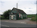
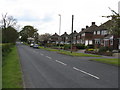
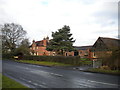
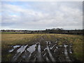
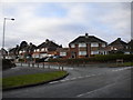
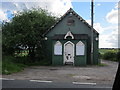
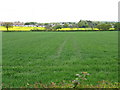
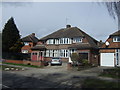
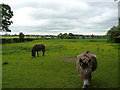
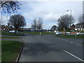
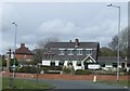
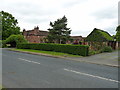
14 photos from this area
Area Information
Key information about the B74 2DU including its size, population, and administrative classification.
- Area Type
- Postcode
- Area Size
- 21.1 hectares
- Population
- 1476
- Population Density
- 1541 people/km²
House Prices in B74 2DU
15
Properties
£254,199
Average Sold Price
£69,000
Lowest Price
£437,000
Highest Price
Showing 15 properties
| Address | Type | Beds | Baths | Last Sale Price | Last Sale Date | |
|---|---|---|---|---|---|---|
| 286 Aldridge Road, Streetly, B74 2DU | Semi-detached | 3 | 1 | £287,600 | Sep 2024 | |
| 278 Aldridge Road, Streetly, B74 2DU | Semi-detached | 3 | 3 | £410,000 | Jul 2022 | |
| 276 Aldridge Road, Streetly, B74 2DU | Semi-detached | 4 | 1 | £437,000 | Sep 2021 | |
| 268 Aldridge Road, Streetly, B74 2DU | Semi-detached | 4 | 1 | £280,000 | Jan 2021 | |
| 292 Aldridge Road, Streetly, B74 2DU | house | - | - | £325,000 | Jun 2017 | |
| 290 Aldridge Road, Streetly, B74 2DU | house | - | - | £214,000 | Oct 2015 | |
| 282A Aldridge Road, Streetly, B74 2DU | Semi-detached | 4 | - | £210,000 | Jan 2014 | |
| 280 Aldridge Road, Streetly, B74 2DU | Semi-detached | - | - | £200,000 | May 2008 | |
| 274 Aldridge Road, Streetly, B74 2DU | Semi-detached | 3 | 2 | £171,590 | Jul 2007 | |
| 288 Aldridge Road, Streetly, B74 2DU | Semi-detached | - | - | £192,000 | Apr 2004 |
Page 1 of 2
Energy Efficiency in B74 2DU
Amenities
Schools
| Rank | School | Type | Entry gender | Ages |
|---|
Explore more schools in this area
Go to Schools tabDemographics
Household Size
Two person
most common
Accommodation Type
Houses
most common
Tenure
84
majority
Ethnic Group
White
most common
Religion
N/A
most common
Household Composition
N/A
most common
Age
47
median
Adults (30-64 years)
most common
Household Deprivation
N/A
with no deprivation
NS-SEC
43
in Lower managerial occupations
Explore more demographic insights in this area
Go to Demographics tabPlanning
Planning Constraints
- Flood RiskPremium
- Ramsar Wetland SitesPremium
- Area of Outstanding Natural BeautyPremium
- Protected Nature ReservePremium
- Protected WoodlandPremium