Area Overview for B74 2AF
Photos of B74 2AF
Area Information
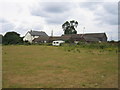
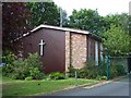
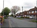
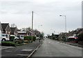
Living in B74 2AF offers a distinct experience within the northern part of the Birmingham metropolitan area. This specific postcode covers a small residential cluster spanning 4,653 square metres. You will find 1,863 residents calling this compact area home. The location is deeply rooted in history, deriving its name from Ryknield Street, an ancient Roman road that still runs through the adjoining Sutton Park. Archaeological evidence suggests Stone Age people inhabited the area long before written records exist. The earliest written record appears in an Anglo-Saxon Charter dated 959, when an estate here was granted to thegn Wulfhelm. Originally a rural district spanning Staffordshire, the area transformed into a suburban district during the mid-20th century following mass housing construction. You are close to neighbouring areas including New Oscott, Great Barr, Four Oaks, Little Aston, and Aldridge. Roughly 21,000 inhabitants now live in the wider Streetly district. Today, the area remains semi-rural in character, lying close to farms and green belt land, yet it functions as a modern residential suburb. The transformation from a sparsely populated rural zone to today's community occurred significantly between 1918 and the 1960s. You gain access to Sutton Park, which features a dedicated gate specifically for Streetly. The Parson & Clerk Inn marks the starting point of the Roman Ryknield Street within its grounds. A church built in Foley Road in 1908 serves as a chapel of ease to Great Barr Parish Church. This neighbourhood balances historical heritage with the convenience of modern suburban living.
- Area Type
- Postcode
- Area Size
- 4653 m²
- Population
- 1863
- Population Density
- 5697 people/km²
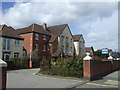
The property market in B74 2AF is dominated by homeownership and family housing. You will find that 89% of residents are homeowners, creating a community where houses are seldom rented out. The predominant accommodation type is houses, meaning alleyways of flats are absent from the core character of this residential cluster. This high rate of ownership indicates that many families originally moved to Streetly when large housing estates were constructed from the 1960s onwards. These properties were built to replace the rural farmland that characterised the area prior to the 1950s. Because the area is a small residential cluster within the wider Streetly district, specific sale prices for the postcode itself are not provided in this dataset. However, the character of the area remains consistent with the broader 21,000-strong population of the Streetly district. Buyers looking at this area today are likely evaluating properties that have been lived in for decades. The high home ownership rate suggests that while there will be occasional sales, the market is primarily driven by existing residents moving between properties rather than investors buying to rent. The absence of flats and the prevalence of houses point to a market catering to families and couples who value private gardens and street-level privacy. Given the demographic median age of 47, you are likely to see transfers between generations, such as adults moving to larger homes or downsizing to the bungalows common in established estates. The area's classification as a small residential cluster implies limited volume, so competition will focus on specific property deeds rather than broad market trends.
House Prices in B74 2AF
Showing 8 properties
| Address | Type | Beds | Baths | Last Sale Price | Last Sale Date | |
|---|---|---|---|---|---|---|
| 10 Catalpa Grove, Streetly, B74 2AF | house | - | - | £390,000 | Jun 2021 | |
| 15 Catalpa Grove, Streetly, B74 2AF | house | - | - | £325,000 | Nov 2015 | |
| 11 Catalpa Grove, Streetly, B74 2AF | Detached | - | - | £270,000 | Sep 2014 | |
| 4 Catalpa Grove, Streetly, B74 2AF | Detached | - | - | £275,950 | Jun 2006 | |
| 2 Catalpa Grove, Streetly, B74 2AF | Detached | - | - | £244,950 | Apr 2006 | |
| 6 Catalpa Grove, Streetly, B74 2AF | Detached | - | - | £299,950 | Feb 2006 | |
| 9 Catalpa Grove, Streetly, B74 2AF | Detached | - | - | £264,950 | Feb 2006 | |
| 8 Catalpa Grove, Streetly, B74 2AF | Detached | - | - | £264,950 | Feb 2006 |
Energy Efficiency in B74 2AF
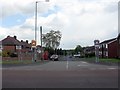
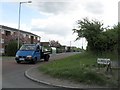
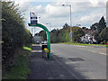
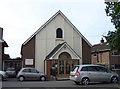
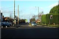
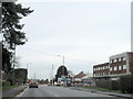
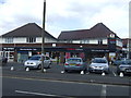
Your daily lifestyle in B74 2AF benefits from immediate access to high-quality essential services and green spaces. You can shop at five notable retail venues, including Waitrose Little, Tesco Streetly, and Morrisons Daily Great Barr 921. These supermarkets provide comprehensive grocery needs without the need for lengthy car journeys. The area features five notable railway stations, offering connectivity to Butlers Lane, Four Oaks, and Sutton Coldfield for business or leisure trips. Beyond transport, you enjoy the natural assets of Sutton Park, accessed via a dedicated gate from the neighbourhood. Historical landmarks add character to your daily walks, such as the church built in Foley Road in 1908 and the Parson & Clerk Inn, which marks the start of the ancient Roman Ryknield Street. Several key services were established in the 1960s and 70s, including St. Anne's Roman Catholic Church, a Clinic, and a Library located in Blackwood Road. The Parson & Clerk Inn also marks the start of Roman Ryknield Street within Sutton Park grounds. This mix of modern retail and historical amenities creates a straightforward yet varied environment for your weekend activities. You do not need to travel far for groceries, medical consultations, or religious services. The proximity to Sutton Park provides immediate recreational space for exercise or family outings, separating this cluster from the urban sprawl while maintaining convenience.
Amenities
Schools
| Rank | School | Type | Entry gender | Ages |
|---|
Explore more schools in this area
Go to Schools tabDemographics
The community in B74 2AF is defined by stability and maturity. The median age stands at 47 years, placing the most common age range firmly in adulthood between 30 and 64 years. This demographic profile suggests a settlement established by families and individuals in their working lives, rather than a university town or student hub. You will find that 89% of residents are homeowners, indicating a strong sense of local investment and tenure. The predominant accommodation type is houses, which aligns with the historical shift from open fields to suburban estates in the 1960s and beyond. The >90% home ownership rate also contrasts sharply with the rental-heavy centres of the city. Predominant ethnicity is White, reflecting the traditional migration patterns into the West Midlands suburbs during the post-war housing boom. While specific immigration data for this exact postcode is not included in this snapshot, the overall West Midlands context shows significant diversity from the 1960s onwards. The population density reaches 400,377 people per square kilometre. This high figure in the raw data reflects the way small physical areas are measured in the system, but the total population of 1,863 for this small cluster means the area feels uncrowded. Residents enjoy quiet streets and mature gardens typical of developments from the mid-20th century. The high home ownership percentage suggests residents often purchase their first home as a ladder to this desirable area before later moving to larger properties or downsizing.
Household Size
Accommodation Type
Tenure
Ethnic Group
Religion
Household Composition
Age
Household Deprivation
NS-SEC
Explore more demographic insights in this area
Go to Demographics tabPlanning
Planning Constraints
- Flood RiskPremium
- Ramsar Wetland SitesPremium
- Area of Outstanding Natural BeautyPremium
- Protected Nature ReservePremium
- Protected WoodlandPremium