Area Overview for B74 2BH
Photos of B74 2BH
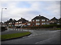
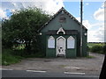
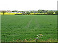
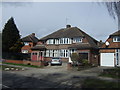
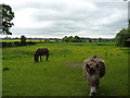
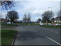
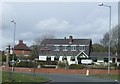
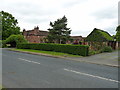
14 photos from this area
Area Information
Key information about the B74 2BH including its size, population, and administrative classification.
- Area Type
- Postcode
- Area Size
- 9038 m²
- Population
- 1863
- Population Density
- 5697 people/km²
House Prices in B74 2BH
28
Properties
£193,207
Average Sold Price
£62,000
Lowest Price
£315,000
Highest Price
Showing 28 properties
| Address | Type | Beds | Baths | Last Sale Price | Last Sale Date | |
|---|---|---|---|---|---|---|
| 161 Hundred Acre Road, Streetly, B74 2BH | Retail | 3 | 1 | £315,000 | Mar 2022 | |
| 157 Hundred Acre Road, Streetly, B74 2BH | house | - | - | £292,000 | Jun 2021 | |
| 128 Hundred Acre Road, Streetly, B74 2BH | Semi-detached | 3 | 1 | £260,000 | Feb 2021 | |
| 159 Hundred Acre Road, Streetly, B74 2BH | Semi-detached | 3 | 1 | £266,000 | Aug 2020 | |
| 169 Hundred Acre Road, Streetly, B74 2BH | Semi-detached | 3 | 1 | £270,000 | May 2020 | |
| 163 Hundred Acre Road, Streetly, B74 2BH | Semi-detached | 3 | 2 | £228,000 | Feb 2020 | |
| 148 Hundred Acre Road, Streetly, B74 2BH | Semi-detached | 4 | 1 | £310,000 | Jan 2020 | |
| 140 Hundred Acre Road, Streetly, B74 2BH | Semi-detached | 3 | 1 | £249,950 | Feb 2019 | |
| 147 Hundred Acre Road, Streetly, B74 2BH | Semi-detached | 3 | 2 | £239,500 | Aug 2017 | |
| 150 Hundred Acre Road, Streetly, B74 2BH | Semi-detached | 3 | 1 | £240,000 | Jul 2017 |
Page 1 of 3
Energy Efficiency in B74 2BH
Amenities
Schools
| Rank | School | Type | Entry gender | Ages |
|---|
Explore more schools in this area
Go to Schools tabDemographics
Household Size
Family (3-5 people)
most common
Accommodation Type
Houses
most common
Tenure
89
majority
Ethnic Group
White
most common
Religion
N/A
most common
Household Composition
N/A
most common
Age
47
median
Adults (30-64 years)
most common
Household Deprivation
N/A
with no deprivation
NS-SEC
37
in Lower managerial occupations
Explore more demographic insights in this area
Go to Demographics tabPlanning
Planning Constraints
- Flood RiskPremium
- Ramsar Wetland SitesPremium
- Area of Outstanding Natural BeautyPremium
- Protected Nature ReservePremium
- Protected WoodlandPremium