Area Overview for B44 8RG
Photos of B44 8RG
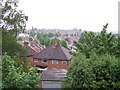
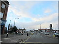
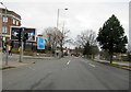


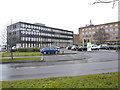

24 photos from this area
Area Information
Key information about the B44 8RG including its size, population, and administrative classification.
- Area Type
- Postcode
- Area Size
- 6176 m²
- Population
- 1590
- Population Density
- 6404 people/km²
House Prices in B44 8RG
20
Properties
£130,282
Average Sold Price
£45,950
Lowest Price
£250,000
Highest Price
Showing 20 properties
| Address | Type | Beds | Baths | Last Sale Price | Last Sale Date | |
|---|---|---|---|---|---|---|
| 96 Goodway Road, Birmingham, B44 8RG | Detached | 3 | 1 | £210,000 | May 2025 | |
| 122 Goodway Road, Birmingham, B44 8RG | Terraced | 3 | 1 | £250,000 | Feb 2025 | |
| 104 Goodway Road, Birmingham, B44 8RG | Semi-detached | 2 | 1 | £171,500 | Aug 2024 | |
| 90 Goodway Road, Birmingham, B44 8RG | house | - | - | £206,000 | Aug 2022 | |
| 94 Goodway Road, Birmingham, B44 8RG | house | - | - | £122,000 | Dec 2019 | |
| 86 Goodway Road, Birmingham, B44 8RG | Semi-detached | 2 | 1 | £133,000 | Oct 2018 | |
| 88 Goodway Road, Birmingham, B44 8RG | Semi-detached | 3 | 1 | £160,000 | Mar 2018 | |
| 98 Goodway Road, Birmingham, B44 8RG | house | - | - | £162,000 | Jul 2017 | |
| 92 Goodway Road, Birmingham, B44 8RG | house | - | - | £107,000 | May 2015 | |
| 108 Goodway Road, Birmingham, B44 8RG | Semi-detached | 2 | 1 | £102,500 | Feb 2014 |
Page 1 of 2
Energy Efficiency in B44 8RG
Amenities
Schools
| Rank | School | Type | Entry gender | Ages |
|---|
Explore more schools in this area
Go to Schools tabDemographics
Household Size
Family (3-5 people)
most common
Accommodation Type
Houses
most common
Tenure
78
majority
Ethnic Group
White
most common
Religion
N/A
most common
Household Composition
N/A
most common
Age
47
median
Adults (30-64 years)
most common
Household Deprivation
N/A
with no deprivation
NS-SEC
24
in Lower managerial occupations
Explore more demographic insights in this area
Go to Demographics tabPlanning
Planning Constraints
- Flood RiskPremium
- Ramsar Wetland SitesPremium
- Area of Outstanding Natural BeautyPremium
- Protected Nature ReservePremium
- Protected WoodlandPremium