Area Overview for B44 8JA
Photos of B44 8JA
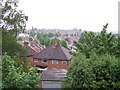
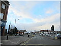
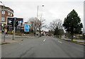


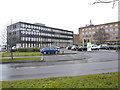
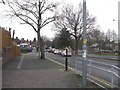
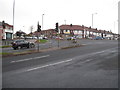
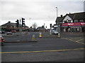
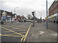
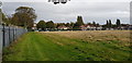

24 photos from this area
Area Information
Key information about the B44 8JA including its size, population, and administrative classification.
- Area Type
- Postcode
- Area Size
- 1.2 hectares
- Population
- 1590
- Population Density
- 6404 people/km²
House Prices in B44 8JA
37
Properties
£129,034
Average Sold Price
£37,000
Lowest Price
£225,000
Highest Price
Showing 37 properties
| Address | Type | Beds | Baths | Last Sale Price | Last Sale Date | |
|---|---|---|---|---|---|---|
| 116 Courtenay Road, Birmingham, B44 8JA | Semi-detached | 2 | 1 | £225,000 | Dec 2025 | |
| 114 Courtenay Road, Birmingham, B44 8JA | Semi-detached | 2 | 1 | £180,000 | Nov 2025 | |
| 72 Courtenay Road, Birmingham, B44 8JA | Detached | 2 | 1 | £207,000 | Jun 2025 | |
| 56 Courtenay Road, Birmingham, B44 8JA | Semi-detached | 2 | 1 | £170,000 | Jan 2025 | |
| 86 Courtenay Road, Birmingham, B44 8JA | Semi-detached | 3 | 1 | £210,000 | Oct 2024 | |
| 106 Courtenay Road, Birmingham, B44 8JA | house | - | - | £125,000 | Dec 2022 | |
| 80 Courtenay Road, Birmingham, B44 8JA | Semi-detached | 2 | - | £150,000 | Feb 2021 | |
| 76 Courtenay Road, Birmingham, B44 8JA | house | - | - | £148,500 | Nov 2018 | |
| 112 Courtenay Road, Birmingham, B44 8JA | house | - | - | £140,450 | Nov 2018 | |
| 54 Courtenay Road, Birmingham, B44 8JA | Semi-detached | 2 | 1 | £125,000 | Jun 2018 |
Page 1 of 4
Energy Efficiency in B44 8JA
Amenities
Schools
| Rank | School | Type | Entry gender | Ages |
|---|
Explore more schools in this area
Go to Schools tabDemographics
Household Size
Family (3-5 people)
most common
Accommodation Type
Houses
most common
Tenure
78
majority
Ethnic Group
White
most common
Religion
N/A
most common
Household Composition
N/A
most common
Age
47
median
Adults (30-64 years)
most common
Household Deprivation
N/A
with no deprivation
NS-SEC
24
in Lower managerial occupations
Explore more demographic insights in this area
Go to Demographics tabPlanning
Planning Constraints
- Flood RiskPremium
- Ramsar Wetland SitesPremium
- Area of Outstanding Natural BeautyPremium
- Protected Nature ReservePremium
- Protected WoodlandPremium