Area Overview for B31 3BP
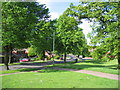
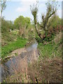
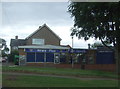
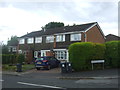
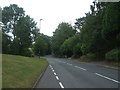
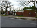
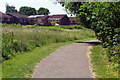
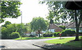
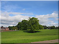
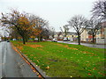
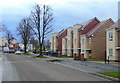
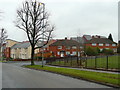
Photos of B31 3BP
Area Information
Living in B31 3BP means inhabiting a tightly packed residential cluster in the southern suburbs of Birmingham, historically part of Worcestershire. The area covers just 3,491 square metres, housing 2,073 people in a population density of 593,894 per square kilometre. This compact postcode is part of King’s Norton North Ward, a historically significant area shaped by its Royalist past and 19th-century industrial growth. The Worcester and Birmingham Canal runs nearby, a legacy of the area’s role as a trading hub for wool and pottery. Daily life here is defined by proximity to transport links, with railway stations like Northfield and Kings Norton within reach. While the area lacks large-scale amenities, its small footprint ensures a tightly knit community, though the high population density may feel restrictive. For those prioritising convenience over space, B31 3BP offers a blend of historical character and modern connectivity, though its limited size means every decision about living here is shaped by proximity and availability.
- Area Type
- Postcode
- Area Size
- 3491 m²
- Population
- 2073
- Population Density
- 7317 people/km²
B31 3BP’s property market is characterised by a low home ownership rate of 23%, suggesting that most residents are renters rather than homeowners. The area’s housing stock is dominated by houses, which is notable given its small size and high density. This mix implies limited availability of larger properties, potentially making the area more suited to smaller households or those prioritising rental flexibility. The compact nature of the postcode means the housing market is tightly constrained, with little scope for expansion. Buyers considering the area should note that the limited land area and high population density may restrict property choices, particularly for those seeking larger homes or gardens. The predominance of houses may also indicate a focus on traditional housing types, though the small scale of the area limits the variety of options available.
House Prices in B31 3BP
Showing 21 properties
| Address | Type | Beds | Baths | Last Sale Price | Last Sale Date | |
|---|---|---|---|---|---|---|
| Apartment 5, 52 Oddingley Road, Birmingham, B31 3BP | Flat | 2 | 1 | - | - | |
| 70 Oddingley Road, Birmingham, B31 3BP | Flat | 2 | 1 | - | - | |
| 50 Oddingley Road, Birmingham, B31 3BP | Terraced | - | - | - | - | |
| 54 Oddingley Road, Birmingham, B31 3BP | Terraced | - | - | - | - | |
| Apartment 3, 52 Oddingley Road, Birmingham, B31 3BP | Flat | - | - | - | - | |
| Apartment 4, 52 Oddingley Road, Birmingham, B31 3BP | Flat | - | - | - | - | |
| Apartment 1, 52 Oddingley Road, Birmingham, B31 3BP | Flat | - | - | - | - | |
| 76 Oddingley Road, Birmingham, B31 3BP | house | - | - | - | - | |
| 80 Oddingley Road, Birmingham, B31 3BP | Semi-detached | - | - | - | - | |
| 78 Oddingley Road, Birmingham, B31 3BP | house | - | - | - | - |
Energy Efficiency in B31 3BP
Daily life in B31 3BP is shaped by its proximity to retail, transport, and historical sites. Local shops include Spar, Tesco West, and Aldi Tunnel, providing essential shopping within walking distance. Rail and metro stations like Northfield, Kings Norton, and Edgbaston Village offer easy access to Birmingham’s urban centres. The Worcester and Birmingham Canal, a legacy of the area’s industrial past, adds a recreational element. While the area lacks large parks or leisure facilities, its compact size ensures amenities are closely clustered. The mix of retail, transport, and historical features creates a practical, if small-scale, lifestyle. Residents may find the convenience of nearby services offset by the limited space for expansive outdoor activities.
Amenities
Schools
Residents of B31 3BP have access to several primary schools, including Wychall Farm Junior School, Wychall Farm Infant School, St Thomas Aquinas Catholic School, and Wychall Primary School. St Thomas Aquinas Catholic School is an academy with a ‘good’ Ofsted rating, offering a notable educational option for families. The concentration of primary schools suggests a strong focus on early education, though no secondary schools are listed in the data. For parents prioritising primary education, the proximity of multiple schools reduces the need for long commutes. However, the absence of secondary schools may require families to look beyond the immediate area for comprehensive schooling. The mix of state and Catholic schools provides some choice, but the lack of data on secondary education is a key consideration for prospective residents.
| Rank | School | Type | Entry gender | Ages |
|---|
Explore more schools in this area
Go to Schools tabDemographics
The population of B31 3BP skews towards adults aged 30–64, with a median age of 47. Only 23% of residents own their homes, indicating a rental-dominated market, and the area is predominantly occupied by White residents. The accommodation type is largely houses, which is unusual for a high-density postcode. This combination of home ownership rates and housing stock suggests a community where renters may outnumber owners, potentially affecting property values and long-term stability. The high population density—over 593,000 people per square kilometre—means living spaces are closely packed, which could influence both social dynamics and access to private outdoor space. While no specific data on deprivation is provided, the low home ownership rate and high density might correlate with economic pressures, though this remains unconfirmed.
Household Size
Accommodation Type
Tenure
Ethnic Group
Religion
Household Composition
Age
Household Deprivation
NS-SEC
Explore more demographic insights in this area
Go to Demographics tabPlanning
Planning Constraints
- Flood RiskPremium
- Ramsar Wetland SitesPremium
- Area of Outstanding Natural BeautyPremium
- Protected Nature ReservePremium
- Protected WoodlandPremium