Area Overview for B31 3BL
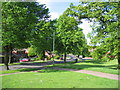
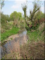
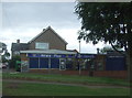
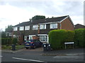
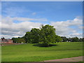
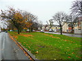
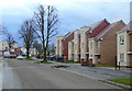
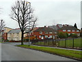
Photos of B31 3BL
Area Information
B31 3BL is a compact residential postcode in Birmingham’s southern suburbs, encompassing parts of the former King’s Norton and Northfield Urban District. With a population of 2073 spread over 6373 m², it is one of the most densely populated areas in England, at 325,256 people per square kilometre. Historically part of Worcestershire, it has evolved from a 16th-century market town into a modern suburban enclave. Daily life here is shaped by its proximity to transport networks, including the Worcester and Birmingham Canal and nearby railway stations. The area’s small size means residents often interact with the same local amenities, fostering a tight-knit community feel. While the postcode’s high density suggests a focus on residential living, its historical roots as a trading hub for wool and pottery remain evident in its local character. For homebuyers, B31 3BL offers a blend of compact living with access to Birmingham’s broader infrastructure, though its limited size means property choices are constrained to a small cluster of homes.
- Area Type
- Postcode
- Area Size
- 6373 m²
- Population
- 2073
- Population Density
- 7317 people/km²
The property market in B31 3BL is characterised by a low home ownership rate of 23%, suggesting that most residents rent rather than own their homes. The accommodation type is predominantly houses, which are less common in high-density urban areas. This combination implies a limited housing stock, with few flats or apartments available to buyers. The area’s small size means property choices are restricted to a narrow cluster of homes, often requiring buyers to look beyond the immediate postcode for more options. For those seeking to purchase, the market may be competitive, with prices potentially influenced by the area’s proximity to Birmingham’s transport links. However, the predominance of houses could appeal to buyers prioritising space over density, though the high population density may limit the availability of larger properties.
House Prices in B31 3BL
Showing 33 properties
| Address | Type | Beds | Baths | Last Sale Price | Last Sale Date | |
|---|---|---|---|---|---|---|
| 15 Kinver Road, Birmingham, B31 3BL | Semi-detached | - | - | £61,975 | Aug 2006 | |
| 17 Kinver Road, Birmingham, B31 3BL | Semi-detached | - | - | £61,975 | Aug 2006 | |
| 19 Kinver Road, Birmingham, B31 3BL | Terraced | 3 | 2 | - | - | |
| Former 14, Kinver Road, Birmingham, B31 3BL | Semi-detached | - | - | - | - | |
| Former 7, Kinver Road, Birmingham, B31 3BL | Terraced | - | - | - | - | |
| Former 3, Kinver Road, Birmingham, B31 3BL | Semi-detached | - | - | - | - | |
| Former 12, Kinver Road, Birmingham, B31 3BL | Semi-detached | - | - | - | - | |
| Former 10, Kinver Road, Birmingham, B31 3BL | Semi-detached | - | - | - | - | |
| Former 15, Kinver Road, Birmingham, B31 3BL | Semi-detached | - | - | - | - | |
| Former 5, Kinver Road, Birmingham, B31 3BL | Terraced | - | - | - | - |
Energy Efficiency in B31 3BL
Residents of B31 3BL have access to a range of amenities within practical reach, including five retail outlets such as Spar, Co-op Longbridge, and Tesco West, ensuring daily shopping needs are met. The area’s rail network connects to Northfield, Kings Norton, and Longbridge stations, offering direct links to Birmingham’s business districts and cultural hubs. Nearby metro stops, including Edgbaston Village, Centenary Square, and Town Hall, provide easy access to Birmingham’s urban amenities. While the area’s small size limits the variety of leisure options, its proximity to Birmingham’s broader infrastructure means residents can enjoy the city’s parks, museums, and entertainment venues. The presence of multiple retail and transport hubs contributes to a convenient, if compact, lifestyle, balancing local convenience with the opportunities of a larger city.
Amenities
Schools
| Rank | School | Type | Entry gender | Ages |
|---|
Explore more schools in this area
Go to Schools tabDemographics
The community in B31 3BL is predominantly middle-aged, with a median age of 47 and the most common age range being adults aged 30–64. Only 23% of residents own their homes, indicating a rental-dominated market, while the majority of properties are houses rather than flats or apartments. The predominant ethnic group is White, reflecting the area’s historical ties to Worcestershire’s rural past. With a population density of 325,256 people per square kilometre, the area is exceptionally crowded, which can impact living space and community dynamics. This high density, combined with a low proportion of owner-occupied homes, suggests a transient population with limited long-term investment in the area. For buyers, this means competition for available properties and a need to consider proximity to amenities, as the area’s small size offers few alternatives for housing.
Household Size
Accommodation Type
Tenure
Ethnic Group
Religion
Household Composition
Age
Household Deprivation
NS-SEC
Explore more demographic insights in this area
Go to Demographics tabPlanning
Planning Constraints
- Flood RiskPremium
- Ramsar Wetland SitesPremium
- Area of Outstanding Natural BeautyPremium
- Protected Nature ReservePremium
- Protected WoodlandPremium