Area Overview for B31 3BT
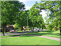
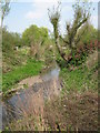
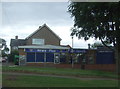
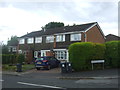
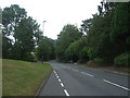
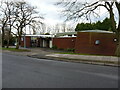
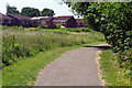
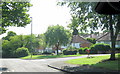
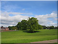
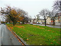
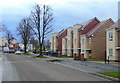
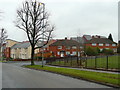
Photos of B31 3BT
Area Information
B31 3BT is a small, densely populated residential postcode in England, covering 3,713 square metres and home to 2,073 residents. Situated in Birmingham’s southern suburbs, it lies within the historical boundaries of Worcestershire, now fully integrated into the city’s urban fabric. The area reflects a blend of historical settlement and modern suburban development, with roots tracing back to the 11th century as a Royalist stronghold during the Civil War. Today, it is a compact cluster of homes, closely packed with a population density of 558,275 people per square kilometre. Daily life here is shaped by its proximity to transport networks, including the Worcester and Birmingham Canal, and nearby rail links. The community is predominantly middle-aged, with a median age of 47, and a strong presence of households in the 30-64 age bracket. While the area lacks large-scale amenities, its proximity to Birmingham’s core offers access to broader urban opportunities. For those seeking a quiet, established residential environment with a touch of historical character, B31 3BT presents a distinctive blend of compact living and strategic connectivity.
- Area Type
- Postcode
- Area Size
- 3713 m²
- Population
- 2073
- Population Density
- 7317 people/km²
The property market in B31 3BT is defined by a low home ownership rate of 23%, indicating that the majority of residents rent their homes. This suggests a rental-focused market rather than a strong owner-occupied presence, which could influence property values and investment potential. The area is predominantly composed of houses, reflecting a traditional housing stock that contrasts with the higher-density flats typical of urban centres. Given the postcode’s small size and high population density, the housing stock is limited, meaning buyers may need to consider nearby areas for more options. The combination of low ownership and house-centric development points to a market where rental yields could be attractive, though property availability might be constrained. For buyers, this small area offers a compact, established residential environment, but competition for properties could be fierce, necessitating a strategic approach to location and timing.
House Prices in B31 3BT
Showing 12 properties
| Address | Type | Beds | Baths | Last Sale Price | Last Sale Date | |
|---|---|---|---|---|---|---|
| 9 Elsworth Road, Birmingham, B31 3BT | house | - | - | - | - | |
| 10 Elsworth Road, Birmingham, B31 3BT | house | - | - | - | - | |
| 3 Elsworth Road, Birmingham, B31 3BT | house | - | - | - | - | |
| 4 Elsworth Road, Birmingham, B31 3BT | house | - | - | - | - | |
| 6 Elsworth Road, Birmingham, B31 3BT | house | - | - | - | - | |
| 15 Elsworth Road, Birmingham, B31 3BT | Semi-detached | - | - | - | - | |
| 11 Elsworth Road, Birmingham, B31 3BT | house | - | - | - | - | |
| 12 Elsworth Road, Birmingham, B31 3BT | house | - | - | - | - | |
| 14 Elsworth Road, Birmingham, B31 3BT | house | - | - | - | - | |
| 8 Elsworth Road, Birmingham, B31 3BT | house | - | - | - | - |
Energy Efficiency in B31 3BT
Residents of B31 3BT enjoy a range of nearby amenities, including retail outlets such as Spar, Aldi Tunnel, and Tesco West, which cater to daily shopping needs. The area’s proximity to rail stations and metro stops like Edgbaston Village and Centenary Square provides access to Birmingham’s cultural and commercial hubs. While the data does not mention parks or leisure facilities directly, the historical presence of the Worcester and Birmingham Canal suggests opportunities for recreational activities along its banks. The compact nature of the area means that essential services are within walking or short driving distance, contributing to a convenient lifestyle. The mix of retail and transport options supports both practicality and connectivity, allowing residents to balance local convenience with urban access. However, the absence of detailed information on green spaces or leisure venues leaves some aspects of the lifestyle experience unexplored.
Amenities
Schools
Residents of B31 3BT have access to several primary schools, including Wychall Farm Junior School, Wychall Farm Infant School, Wychall Primary School, and St Thomas Aquinas Catholic School, which operates as an academy with a ‘good’ Ofsted rating. The presence of multiple primary schools suggests a well-established educational infrastructure for young families, though no secondary schools are listed in the data. The inclusion of a Catholic school indicates a mix of faith-based and secular educational options. For parents, the variety of primary schools provides flexibility in choosing a school that aligns with their child’s needs and the family’s values. The ‘good’ rating at St Thomas Aquinas Catholic School adds a layer of quality assurance for those prioritising academic standards. However, families requiring secondary education may need to look beyond the immediate area, as the data does not mention nearby secondary schools.
| Rank | School | Type | Entry gender | Ages |
|---|
Explore more schools in this area
Go to Schools tabDemographics
The community in B31 3BT is predominantly middle-aged, with a median age of 47 and the largest demographic group being adults aged 30-64. Home ownership is low at 23%, suggesting a higher reliance on rental properties, which may influence the local property market’s dynamics. The area is characterised by a predominance of houses rather than flats, reflecting a traditional housing stock. The predominant ethnic group is White, though specific data on diversity is not provided. The population density of 558,275 per square kilometre indicates a tightly packed residential area, which may impact the availability of private outdoor space. This density also implies a strong sense of community, though it could contribute to higher demand for local amenities. The age profile suggests a mature population, potentially with established careers and family structures, which may shape local services and social dynamics.
Household Size
Accommodation Type
Tenure
Ethnic Group
Religion
Household Composition
Age
Household Deprivation
NS-SEC
Explore more demographic insights in this area
Go to Demographics tabPlanning
Planning Constraints
- Flood RiskPremium
- Ramsar Wetland SitesPremium
- Area of Outstanding Natural BeautyPremium
- Protected Nature ReservePremium
- Protected WoodlandPremium