Area Overview for B31 3BS
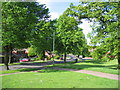
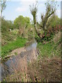
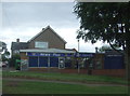
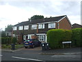
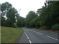
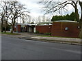
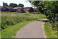
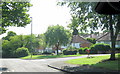
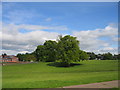
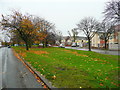
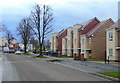
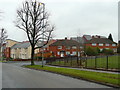
Photos of B31 3BS
Area Information
Living in B31 3BS means inhabiting a small, densely populated residential cluster in the southern suburbs of Birmingham. The area covers 6,262 square metres and is home to 2,073 people, creating a compact, tightly knit community. Historically part of Worcestershire, it now falls under Birmingham City Council and retains echoes of its past as a trading hub for wool and pottery. Daily life here is shaped by proximity to transport networks and a mix of traditional and modern amenities. The area’s compact size means residents are close to essential services, while its integration into Birmingham’s suburban sprawl offers access to urban opportunities. With a median age of 47, the community is predominantly composed of middle-aged adults, suggesting a stable, established population. This postcode is ideal for those seeking a balance between suburban tranquillity and urban connectivity, though its small size means choices are limited to immediate surroundings.
- Area Type
- Postcode
- Area Size
- 6262 m²
- Population
- 2073
- Population Density
- 7317 people/km²
The property market in B31 3BS is characterised by a low home ownership rate of 23%, indicating that most residents rent rather than own their homes. The area is primarily composed of houses, though the exact number or proportion of detached versus semi-detached properties is not specified. This suggests a housing stock that may be older or more traditional, with limited new developments given the postcode’s small size. For buyers, the market is likely constrained by the area’s compact nature, offering fewer options than larger suburbs. The high population density and focus on houses may mean properties are in demand, particularly for families seeking space. However, the rental market dominates, which could make purchasing a home competitive. Prospective buyers should consider the area’s limited size and the prevalence of rental properties when evaluating long-term investment potential.
House Prices in B31 3BS
Showing 21 properties
| Address | Type | Beds | Baths | Last Sale Price | Last Sale Date | |
|---|---|---|---|---|---|---|
| 2 Oddingley Road, Birmingham, B31 3BS | Semi-detached | 3 | - | £115,000 | Aug 2016 | |
| 10 Oddingley Road, Birmingham, B31 3BS | Semi-detached | 3 | - | £110,000 | Aug 2013 | |
| 44 Oddingley Road, Birmingham, B31 3BS | Terraced | - | - | - | - | |
| 42 Oddingley Road, Birmingham, B31 3BS | Terraced | - | - | - | - | |
| 20 Oddingley Road, Birmingham, B31 3BS | Terraced | - | - | - | - | |
| 16 Oddingley Road, Birmingham, B31 3BS | Semi-detached | - | - | - | - | |
| 12 Oddingley Road, Birmingham, B31 3BS | house | - | - | - | - | |
| 36 Oddingley Road, Birmingham, B31 3BS | Terraced | - | - | - | - | |
| 34 Oddingley Road, Birmingham, B31 3BS | house | - | - | - | - | |
| 22 Oddingley Road, Birmingham, B31 3BS | Terraced | - | - | - | - |
Energy Efficiency in B31 3BS
The lifestyle in B31 3BS is shaped by its proximity to a range of amenities within practical reach. Retail options include Tesco West, Co-op Longbridge, and Spar, providing everyday shopping convenience. The area’s rail and metro connections, such as Northfield Railway Station and Edgbaston Village, link residents to Birmingham’s broader network, enabling easy access to urban centres. The Worcester and Birmingham Canal adds a historical element, offering leisure opportunities for residents. While the area lacks large-scale leisure facilities, its compact size ensures that essential services are nearby. The mix of retail, transport, and historical features creates a functional yet characterful environment, ideal for those prioritising accessibility over expansive recreational spaces.
Amenities
Schools
Residents of B31 3BS have access to several primary schools, including Wychall Farm Junior School, Wychall Farm Infant School, St Thomas Aquinas Catholic School, and Wychall Primary School. St Thomas Aquinas Catholic School is an academy with a ‘good’ Ofsted rating, offering a notable option for families. The presence of multiple primary schools suggests a strong focus on education, though no secondary schools are listed in the data. The mix of state and Catholic schools provides choice for parents, though the absence of secondary education options may require students to commute. For families prioritising primary education, the proximity of these schools is a significant advantage, though the lack of secondary provision should be considered when planning long-term schooling needs.
| Rank | School | Type | Entry gender | Ages |
|---|
Explore more schools in this area
Go to Schools tabDemographics
The population of B31 3BS is 2,073, with a median age of 47, indicating a mature demographic. The most common age group is adults aged 30–64, suggesting a community of established professionals and families. Home ownership is low, with only 23% of residents owning their homes, pointing to a rental-heavy market. The area is predominantly composed of houses, though the exact number of properties is unspecified. The predominant ethnic group is White, reflecting the broader demographic trends of the West Midlands. While no data on deprivation is provided, the high population density of 331,066 people per square kilometre implies limited space per household, which could influence quality of life. The age profile and ownership rates suggest a community focused on stability, with many residents likely renting in a market where property ownership is less common.
Household Size
Accommodation Type
Tenure
Ethnic Group
Religion
Household Composition
Age
Household Deprivation
NS-SEC
Explore more demographic insights in this area
Go to Demographics tabPlanning
Planning Constraints
- Flood RiskPremium
- Ramsar Wetland SitesPremium
- Area of Outstanding Natural BeautyPremium
- Protected Nature ReservePremium
- Protected WoodlandPremium