Area Overview for B20 2DJ
Photos of B20 2DJ
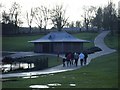
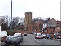
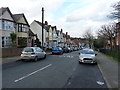
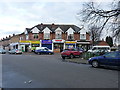
63 photos from this area
Area Information
Key information about the B20 2DJ including its size, population, and administrative classification.
- Area Type
- Postcode
- Area Size
- 6425 m²
- Population
- 1631
- Population Density
- 5157 people/km²
House Prices in B20 2DJ
22
Properties
£101,912
Average Sold Price
£40,000
Lowest Price
£156,500
Highest Price
Showing 22 properties
| Address | Type | Beds | Baths | Last Sale Price | Last Sale Date | |
|---|---|---|---|---|---|---|
| 20 Packwood Close, Birmingham, B20 2DJ | Terraced | 1 | 1 | £150,000 | Aug 2024 | |
| 34 Packwood Close, Birmingham, B20 2DJ | house | - | - | £156,500 | Sep 2021 | |
| 26 Packwood Close, Birmingham, B20 2DJ | Terraced | 1 | 1 | £120,000 | Jan 2020 | |
| 16 Packwood Close, Birmingham, B20 2DJ | house | - | - | £155,500 | May 2019 | |
| 32 Packwood Close, Birmingham, B20 2DJ | Terraced | 1 | 1 | £112,000 | Nov 2017 | |
| 30 Packwood Close, Birmingham, B20 2DJ | Terraced | 1 | 1 | £110,000 | Jun 2017 | |
| 18 Packwood Close, Birmingham, B20 2DJ | Terraced | 2 | 1 | £103,000 | Mar 2014 | |
| 17 Packwood Close, Birmingham, B20 2DJ | house | 2 | - | £119,000 | Aug 2013 | |
| 24 Packwood Close, Birmingham, B20 2DJ | house | - | - | £108,000 | Jul 2010 | |
| 28 Packwood Close, Birmingham, B20 2DJ | house | - | - | £81,000 | Oct 2009 |
Page 1 of 3
Energy Efficiency in B20 2DJ
Amenities
Schools
| Rank | School | Type | Entry gender | Ages |
|---|
Explore more schools in this area
Go to Schools tabDemographics
Household Size
One person
most common
Accommodation Type
Houses
most common
Tenure
46
majority
Ethnic Group
asian_total
most common
Religion
N/A
most common
Household Composition
N/A
most common
Age
47
median
Adults (30-64 years)
most common
Household Deprivation
N/A
with no deprivation
NS-SEC
24
in Lower managerial occupations
Explore more demographic insights in this area
Go to Demographics tabPlanning
Planning Constraints
- Flood RiskPremium
- Ramsar Wetland SitesPremium
- Area of Outstanding Natural BeautyPremium
- Protected Nature ReservePremium
- Protected WoodlandPremium