Area Overview for B20 2DT
Photos of B20 2DT
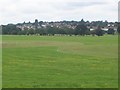
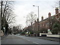
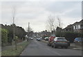
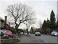
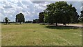
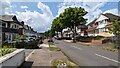
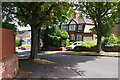
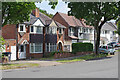
17 photos from this area
Area Information
Key information about the B20 2DT including its size, population, and administrative classification.
- Area Type
- Postcode
- Area Size
- 2.3 hectares
- Population
- 1631
- Population Density
- 5157 people/km²
House Prices in B20 2DT
35
Properties
£380,077
Average Sold Price
£116,000
Lowest Price
£735,000
Highest Price
Showing 35 properties
| Address | Type | Beds | Baths | Last Sale Price | Last Sale Date | |
|---|---|---|---|---|---|---|
| Maple Cottage, 64A Handsworth Wood Road, Birmingham, B20 2DT | Semi-detached | 4 | 2 | £330,000 | Apr 2024 | |
| 78 Handsworth Wood Road, Birmingham, B20 2DT | Semi-detached | 7 | 4 | £735,000 | Dec 2022 | |
| 74 Handsworth Wood Road, Birmingham, B20 2DT | house | - | - | £660,000 | Mar 2022 | |
| 64 Handsworth Wood Road, Birmingham, B20 2DT | Semi-detached | 4 | 1 | £430,000 | Jan 2020 | |
| 80 Handsworth Wood Road, Birmingham, B20 2DT | Semi-detached | 6 | 2 | £485,000 | Nov 2017 | |
| 66 Handsworth Wood Road, Birmingham, B20 2DT | Semi-detached | 7 | 2 | £450,000 | Jan 2015 | |
| 68 Handsworth Wood Road, Birmingham, B20 2DT | house | 5 | - | £290,000 | Jun 2011 | |
| 76 Handsworth Wood Road, Birmingham, B20 2DT | Semi-detached | 7 | 2 | £435,000 | Jul 2006 | |
| 52 Handsworth Wood Road, Birmingham, B20 2DT | house | - | - | £375,000 | Nov 2003 | |
| Flat Above, 70-72 Handsworth Wood Road, Birmingham, B20 2DT | Flat | - | - | £350,000 | Nov 1999 |
Page 1 of 4
Energy Efficiency in B20 2DT
Amenities
Schools
| Rank | School | Type | Entry gender | Ages |
|---|
Explore more schools in this area
Go to Schools tabDemographics
Household Size
One person
most common
Accommodation Type
Houses
most common
Tenure
46
majority
Ethnic Group
asian_total
most common
Religion
N/A
most common
Household Composition
N/A
most common
Age
47
median
Adults (30-64 years)
most common
Household Deprivation
N/A
with no deprivation
NS-SEC
24
in Lower managerial occupations
Explore more demographic insights in this area
Go to Demographics tabPlanning
Planning Constraints
- Flood RiskPremium
- Ramsar Wetland SitesPremium
- Area of Outstanding Natural BeautyPremium
- Protected Nature ReservePremium
- Protected WoodlandPremium