Area Overview for SN10 3NN
Photos of SN10 3NN
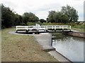

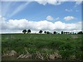
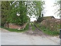
![Bridleway crosses the canal [1] in SN10 3NN](https://images.propbar.co.uk/images/geograph/57/53/5753228_120.jpg)
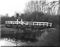
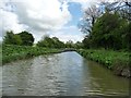
![The canal from the swing bridge [1] in SN10 3NN](https://images.propbar.co.uk/images/geograph/57/53/5753234_120.jpg)
34 photos from this area
Area Information
Key information about the SN10 3NN including its size, population, and administrative classification.
- Area Type
- Postcode
- Area Size
- 1.1 km²
- Population
- 1902
- Population Density
- 43 people/km²
House Prices in SN10 3NN
13
Properties
£878,750
Average Sold Price
£60,000
Lowest Price
£1,950,000
Highest Price
Showing 13 properties
| Address | Type | Beds | Baths | Last Sale Price | Last Sale Date | |
|---|---|---|---|---|---|---|
| The Little House, Allington, Allington, SN10 3NN | house | - | - | £1,325,000 | Nov 2022 | |
| Allington House, Allington, Allington, SN10 3NN | Detached | 5 | - | £1,950,000 | Jan 2021 | |
| Willow Cottage, Allington, Allington, SN10 3NN | Detached | 4 | 2 | £605,000 | Oct 2020 | |
| Chestnuts, Allington, Allington, SN10 3NN | house | 4 | - | £620,000 | Jan 2016 | |
| Allington Cottage, Western Road To Allington East C 8 Towards Cannings Cross, Allington, SN10 3NN | Detached | 5 | - | £712,500 | Sep 2014 | |
| Hamblains, Allington, Allington, SN10 3NN | Detached | - | - | £60,000 | Jul 1995 | |
| Tennis 50M From The Little House 63M From Unnamed Road, Allington, Allington, SN10 3NN | Leisure | - | - | - | - | |
| The Old Barn, Allington, Allington, SN10 3NN | Detached | - | - | - | - | |
| Park View, Allington, Allington, SN10 3NN | Detached | - | - | - | - | |
| Manor Farm, Allington, Allington, SN10 3NN | Detached | - | - | - | - |
Page 1 of 2
Energy Efficiency in SN10 3NN
Amenities
Schools
| Rank | School | Type | Entry gender | Ages |
|---|
Explore more schools in this area
Go to Schools tabDemographics
Household Size
Two person
most common
Accommodation Type
Houses
most common
Tenure
77
majority
Ethnic Group
White
most common
Religion
N/A
most common
Household Composition
N/A
most common
Age
47
median
Adults (30-64 years)
most common
Household Deprivation
N/A
with no deprivation
NS-SEC
43
in Lower managerial occupations
Explore more demographic insights in this area
Go to Demographics tabPlanning
Planning Constraints
- Flood RiskPremium
- Ramsar Wetland SitesPremium
- Area of Outstanding Natural BeautyPremium
- Protected Nature ReservePremium
- Protected WoodlandPremium