Area Overview for SN10 3NJ
Photos of SN10 3NJ
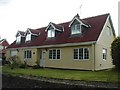
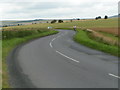

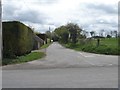
![Wansdyke Cottage [2] in SN10 3NJ](https://images.propbar.co.uk/images/geograph/57/75/5775184_120.jpg)
44 photos from this area
Area Information
Key information about the SN10 3NJ including its size, population, and administrative classification.
- Area Type
- Postcode
- Area Size
- 4291 m²
- Population
- 1902
- Population Density
- 43 people/km²
House Prices in SN10 3NJ
2
Properties
£280,000
Average Sold Price
£210,000
Lowest Price
£350,000
Highest Price
Showing 2 properties
| Address | Type | Beds | Baths | Last Sale Price | Last Sale Date | |
|---|---|---|---|---|---|---|
| Hillview, 2 Allington, Allington, SN10 3NJ | Semi-detached | 3 | - | £350,000 | Mar 2025 | |
| Sunnyside, 1 Allington, Allington, SN10 3NJ | Semi-detached | - | - | £210,000 | Apr 2011 |
Energy Efficiency in SN10 3NJ
Amenities
Schools
| Rank | School | Type | Entry gender | Ages |
|---|
Explore more schools in this area
Go to Schools tabDemographics
Household Size
Two person
most common
Accommodation Type
Houses
most common
Tenure
77
majority
Ethnic Group
White
most common
Religion
N/A
most common
Household Composition
N/A
most common
Age
47
median
Adults (30-64 years)
most common
Household Deprivation
N/A
with no deprivation
NS-SEC
43
in Lower managerial occupations
Explore more demographic insights in this area
Go to Demographics tabPlanning
Planning Constraints
- Flood RiskPremium
- Ramsar Wetland SitesPremium
- Area of Outstanding Natural BeautyPremium
- Protected Nature ReservePremium
- Protected WoodlandPremium