Area Overview for SN10 3NX
Photos of SN10 3NX
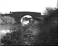
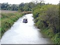
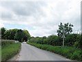
![Woodway Bridge [No 128], from the east in SN10 3NX](https://images.propbar.co.uk/images/geograph/44/94/4494763_120.jpg)
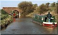
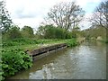
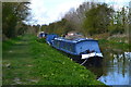
![Kennet and Avon Canal [1] in SN10 3NX](https://images.propbar.co.uk/images/geograph/44/96/4496059_120.jpg)
37 photos from this area
Area Information
Key information about the SN10 3NX including its size, population, and administrative classification.
- Area Type
- Postcode
- Area Size
- 34.0 hectares
- Population
- 1902
- Population Density
- 43 people/km²
House Prices in SN10 3NX
29
Properties
£390,972
Average Sold Price
£108,000
Lowest Price
£710,000
Highest Price
Showing 29 properties
| Address | Type | Beds | Baths | Last Sale Price | Last Sale Date | |
|---|---|---|---|---|---|---|
| 1 Townsend, All Cannings, SN10 3NX | Terraced | 3 | 1 | £465,000 | May 2025 | |
| 52 Townsend, All Cannings, SN10 3NX | house | - | - | £475,000 | Jul 2020 | |
| Penning House, Townsend, All Cannings, SN10 3NX | house | - | - | £513,000 | Jan 2006 | |
| 71 Townsend, All Cannings, SN10 3NX | Detached | - | - | £710,000 | Dec 2005 | |
| 4 Townsend, All Cannings, SN10 3NX | Detached | - | - | £291,000 | Jul 2003 | |
| 81 Townsend, All Cannings, SN10 3NX | Detached | 3 | 2 | £340,000 | Sep 2002 | |
| 67 Townsend, All Cannings, SN10 3NX | Detached | - | - | £474,000 | Apr 2002 | |
| 54 Townsend, All Cannings, SN10 3NX | Semi-detached | - | - | £142,750 | Sep 1998 | |
| Rybury, Townsend, All Cannings, SN10 3NX | Detached | - | - | £108,000 | Jul 1995 | |
| 3, Walnut Cottages, Townsend, All Cannings, SN10 3NX | Terraced | 3 | 1 | - | - |
Page 1 of 3
Energy Efficiency in SN10 3NX
Amenities
Schools
| Rank | School | Type | Entry gender | Ages |
|---|
Explore more schools in this area
Go to Schools tabDemographics
Household Size
Two person
most common
Accommodation Type
Houses
most common
Tenure
77
majority
Ethnic Group
White
most common
Religion
N/A
most common
Household Composition
N/A
most common
Age
47
median
Adults (30-64 years)
most common
Household Deprivation
N/A
with no deprivation
NS-SEC
43
in Lower managerial occupations
Explore more demographic insights in this area
Go to Demographics tabPlanning
Planning Constraints
- Flood RiskPremium
- Ramsar Wetland SitesPremium
- Area of Outstanding Natural BeautyPremium
- Protected Nature ReservePremium
- Protected WoodlandPremium