Area Overview for SN10 3NL
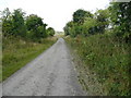
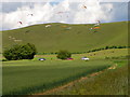
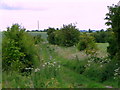
Photos of SN10 3NL
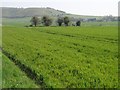
![Concrete and chalk [1] in SN10 3NL](https://images.propbar.co.uk/images/geograph/57/54/5754508_120.jpg)
![Concrete and chalk [2] in SN10 3NL](https://images.propbar.co.uk/images/geograph/57/54/5754509_120.jpg)


22 photos from this area
Area Information
Key information about the SN10 3NL including its size, population, and administrative classification.
- Area Type
- Postcode
- Area Size
- 34.7 hectares
- Population
- 1902
- Population Density
- 43 people/km²
House Prices in SN10 3NL
7
Properties
£690,000
Average Sold Price
£270,000
Lowest Price
£1,300,000
Highest Price
Showing 7 properties
| Address | Type | Beds | Baths | Last Sale Price | Last Sale Date | |
|---|---|---|---|---|---|---|
| Manor Farm Cottages, 7 Western Road To Allington East C 8 Towards Cannings Cross, Allington, SN10 3NL | Detached | 4 | 2 | £1,300,000 | Jan 2023 | |
| 5, Manor Farm Cottages, Allington, Allington, SN10 3NL | Detached | 4 | 3 | £500,000 | Aug 2008 | |
| Wansdyke Cottage, Western Road To Allington East C 8 Towards Cannings Cross, Allington, SN10 3NL | Detached | - | - | £270,000 | Jul 1997 | |
| 2, Manor Farm Cottages, Allington, Allington, SN10 3NL | house | - | - | - | - | |
| 1, Manor Farm Cottages, Allington, Allington, SN10 3NL | house | - | - | - | - | |
| Annexe, Wansdyke Cottage, Western Road To Allington East C 8 Towards Cannings Cross, Allington, SN10 3NL | Flat | - | - | - | - | |
| 5, Annexe, Manor Farm Cottages, Allington, Allington, SN10 3NL | Flat | - | - | - | - |
Energy Efficiency in SN10 3NL
Amenities
Schools
| Rank | School | Type | Entry gender | Ages |
|---|
Explore more schools in this area
Go to Schools tabDemographics
Household Size
Two person
most common
Accommodation Type
Houses
most common
Tenure
77
majority
Ethnic Group
White
most common
Religion
N/A
most common
Household Composition
N/A
most common
Age
47
median
Adults (30-64 years)
most common
Household Deprivation
N/A
with no deprivation
NS-SEC
43
in Lower managerial occupations
Explore more demographic insights in this area
Go to Demographics tabPlanning
Planning Constraints
- Flood RiskPremium
- Ramsar Wetland SitesPremium
- Area of Outstanding Natural BeautyPremium
- Protected Nature ReservePremium
- Protected WoodlandPremium