Area Overview for SN10 3LQ
Photos of SN10 3LQ
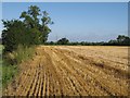
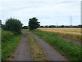
![The end of the track [1] in SN10 3LQ](https://images.propbar.co.uk/images/geograph/50/58/5058941_120.jpg)
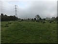
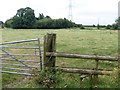
![Water channels [1] in SN10 3LQ](https://images.propbar.co.uk/images/geograph/50/58/5058958_120.jpg)
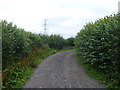
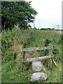
![Water channels [2] in SN10 3LQ](https://images.propbar.co.uk/images/geograph/50/58/5058960_120.jpg)
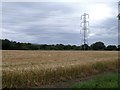
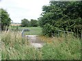
![Field edge way [1] in SN10 3LQ](https://images.propbar.co.uk/images/geograph/50/58/5058961_120.jpg)
14 photos from this area
Area Information
Key information about the SN10 3LQ including its size, population, and administrative classification.
- Area Type
- Postcode
- Area Size
- 1.6 km²
- Population
- 1296
- Population Density
- 33 people/km²
House Prices in SN10 3LQ
9
Properties
£241,333
Average Sold Price
£105,000
Lowest Price
£317,000
Highest Price
Showing 9 properties
| Address | Type | Beds | Baths | Last Sale Price | Last Sale Date | |
|---|---|---|---|---|---|---|
| Jacmin, Puddles Lane South East To Lowerfields Farm, Coate, SN10 3LQ | Bungalow | 3 | 1 | £302,000 | Jan 2024 | |
| Littlecross, Puddles Lane South East To Lowerfields Farm, Coate, SN10 3LQ | Bungalow | 3 | 2 | £317,000 | Oct 2014 | |
| Cross House, Puddles Lane South East To Lowerfields Farm, Coate, SN10 3LQ | Detached | - | - | £105,000 | Jan 2002 | |
| Lowerfields Farm, Puddles Lane South East To Lowerfields Farm, Coate, SN10 3LQ | Detached | - | - | - | - | |
| Annexe, Lodge Farm, Puddles Lane South East To Lowerfields Farm, Coate, SN10 3LQ | Flat | - | - | - | - | |
| Lodge Farm, Puddles Lane South East To Lowerfields Farm, Coate, SN10 3LQ | Semi-detached | - | - | - | - | |
| Hollans, Puddles Lane South East To Lowerfields Farm, Coate, SN10 3LQ | Detached | - | - | - | - | |
| 1, Bystone Cottages, Puddles Lane South East To Lowerfields Farm, Coate, SN10 3LQ | Semi-detached | - | - | - | - | |
| 2, Bystone Cottages, Puddles Lane South East To Lowerfields Farm, Coate, SN10 3LQ | Semi-detached | - | - | - | - |
Energy Efficiency in SN10 3LQ
Amenities
Schools
| Rank | School | Type | Entry gender | Ages |
|---|
Explore more schools in this area
Go to Schools tabDemographics
Household Size
Two person
most common
Accommodation Type
Houses
most common
Tenure
69
majority
Ethnic Group
White
most common
Religion
N/A
most common
Household Composition
N/A
most common
Age
47
median
Adults (30-64 years)
most common
Household Deprivation
N/A
with no deprivation
NS-SEC
40
in Lower managerial occupations
Explore more demographic insights in this area
Go to Demographics tabPlanning
Planning Constraints
- Flood RiskPremium
- Ramsar Wetland SitesPremium
- Area of Outstanding Natural BeautyPremium
- Protected Nature ReservePremium
- Protected WoodlandPremium