Area Overview for BS23 2ED
Photos of BS23 2ED


Area Information
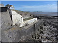
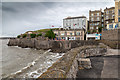
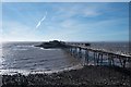
BS23 2ED is a compact residential postcode in North Somerset, nestled within the historic town of Weston-super-Mare. Covering just 3.9 hectares, it is home to 1,758 residents, giving it a high population density of 1,564 people per square kilometre. This small cluster is part of a larger seaside town with a rich Victorian heritage, known for its sandy beaches and tidal range. Daily life here is shaped by proximity to coastal amenities, with the area’s proximity to Weston-super-Mare’s historic seafront offering easy access to leisure and transport. The community is largely composed of adults aged 30–64, reflecting a mature demographic. While the area is small, it benefits from nearby rail links, retail hubs, and a ferry service, blending residential tranquillity with the vibrancy of a coastal town. Living in BS23 2ED means being part of a tightly knit community with a distinct character, where historical architecture coexists with modern convenience.
- Area Type
- Postcode
- Area Size
- 3.9 hectares
- Population
- 1758
- Population Density
- 1564 people/km²
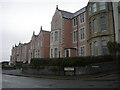
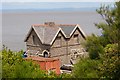
The property market in BS23 2ED is characterised by a high proportion of flats, with 48% of homes owned by residents. This suggests a focus on medium-density housing, typical of urban or semi-urban settings. The area’s small size means the housing stock is limited, which may create competition among buyers and renters. With a population density of 1,564 people per square kilometre, the demand for housing is likely to be steady, though the availability of new builds or conversions is unclear. For buyers, the predominance of flats may mean fewer detached or semi-detached properties, which could be a consideration for those seeking larger homes. The area’s proximity to Weston-super-Mare’s amenities may offset the limitations of its size, offering value in terms of location. However, the small footprint of BS23 2ED means that property searches should extend to nearby postcode areas for broader options.
House Prices in BS23 2ED
Showing 71 properties
| Address | Type | Beds | Baths | Last Sale Price | Last Sale Date | |
|---|---|---|---|---|---|---|
| Flat 4, 1 Claremont Crescent, Weston Super Mare, BS23 2ED | Flat | - | - | £122,000 | Jan 2020 | |
| 5 Claremont Crescent, Weston Super Mare, BS23 2ED | house | 18 | 10 | - | - | |
| Wyndham, 15 Claremont Crescent, Weston Super Mare, BS23 2ED | Terraced | - | - | - | - | |
| Garden Flat, 4 Claremont Crescent, Weston Super Mare, BS23 2ED | Flat | 2 | - | - | - | |
| Flat 2, 1 Claremont Crescent, Weston Super Mare, BS23 2ED | Flat | - | - | - | - | |
| Hall Flat 9, 1 Claremont Crescent, Weston Super Mare, BS23 2ED | Flat | - | - | - | - | |
| Third Floor Flat, 3 Claremont Crescent, Weston Super Mare, BS23 2ED | Flat | - | - | - | - | |
| Flat 5, 2 Claremont Crescent, Weston Super Mare, BS23 2ED | Flat | - | - | - | - | |
| Flat 3, 4 Claremont Crescent, Weston Super Mare, BS23 2ED | Flat | - | - | - | - | |
| Flat 1, Wyndham, 15 Claremont Crescent, Weston Super Mare, BS23 2ED | Flat | - | - | - | - |
Energy Efficiency in BS23 2ED
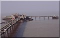
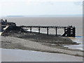
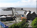
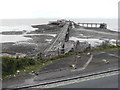
Living in BS23 2ED offers access to a variety of amenities within easy reach. The area is served by five retail outlets, including Spar, Morrisons Daily Weston Super, and Tesco Weston, ensuring everyday shopping needs are met without long journeys. The nearby ferry service at Weston provides direct access to maritime travel, while the three railway stations—Weston, Weston Milton, and Worle—connect residents to regional hubs. The proximity to Weston-super-Mare’s historic seafront and Victorian architecture adds to the area’s charm, offering opportunities for leisure, dining, and cultural activities. For residents, the combination of retail convenience, transport links, and coastal proximity creates a lifestyle that balances practicality with the appeal of a seaside town.
Amenities
Schools
| Rank | School | Type | Entry gender | Ages |
|---|
Explore more schools in this area
Go to Schools tabDemographics
The population of BS23 2ED has a median age of 47, with the majority of residents falling within the 30–64 age range. This suggests a community skewed towards middle-aged adults, likely with established careers and family ties. Home ownership accounts for 48% of properties, indicating a mix of owner-occupied and rental housing. The predominant accommodation type is flats, reflecting a higher density of residential units in this small area. The predominant ethnic group is White, though specific data on diversity is not provided. With a population density of 1,564 people per square kilometre, the area is relatively compact, which may influence social dynamics and access to shared resources. The demographic profile suggests a stable, long-term resident base, though the lack of detailed diversity statistics means broader cultural or socioeconomic nuances remain unexplored.
Household Size
Accommodation Type
Tenure
Ethnic Group
Religion
Household Composition
Age
Household Deprivation
NS-SEC
Explore more demographic insights in this area
Go to Demographics tabPlanning
Planning Constraints
- Flood RiskPremium
- Ramsar Wetland SitesPremium
- Area of Outstanding Natural BeautyPremium
- Protected Nature ReservePremium
- Protected WoodlandPremium