Area Overview for BS23 2EE
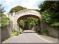
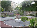
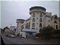
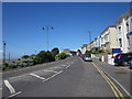
Photos of BS23 2EE


Area Information
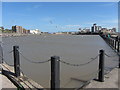
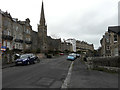
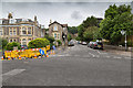
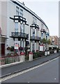
Living in BS23 2EE means being part of a compact, densely populated residential cluster in North Somerset. The area covers 7,042 square metres and hosts 1,758 residents, translating to a population density of 1,564 people per square kilometre. This postcode is nestled in Weston-super-Mare, a Victorian seaside resort known for its sandy beaches and high tidal range. The town’s history as a holiday destination remains evident in its architecture and infrastructure, though the area itself is more residential than tourist-focused. Daily life here is shaped by proximity to the coast, with the nearby Grand Pier and Victorian seafront offering leisure options. The community is defined by its compact size and high density, creating a mix of shared spaces and private living. With a median age of 47, the area is predominantly inhabited by adults aged 30–64, suggesting a stable, mature population. The presence of 3 rail stations, including Weston and Worle, and a ferry service at Weston ensures connectivity to nearby towns. While the area is small, its proximity to retail hubs like Tesco and Morrisons, along with its historical heritage, makes it a practical choice for those seeking a balance between coastal living and urban convenience.
- Area Type
- Postcode
- Area Size
- 7042 m²
- Population
- 1758
- Population Density
- 1564 people/km²
The property market in BS23 2EE is defined by a 48% home ownership rate, meaning nearly half of residents rent their homes. This suggests a rental market that may cater to professionals or those seeking short-term housing. The predominant accommodation type is flats, which are well-suited to the area’s high population density of 1,564 people per square kilometre. Flats in this postcode likely benefit from shared infrastructure and proximity to amenities, but their smaller size and shared walls may limit personal space. Given the area’s small size, property choices are limited to a specific cluster of residences, reducing competition but also restricting diversity in housing options. Buyers should consider the area’s compact nature and the prevalence of flats when evaluating long-term suitability. The market may appeal to those prioritising convenience over expansive living space, though the lack of larger properties could be a drawback for growing families.
House Prices in BS23 2EE
Showing 18 properties
Energy Efficiency in BS23 2EE
Residents of BS23 2EE have access to essential amenities within practical reach. Five retail outlets, including Spar, Morrisons Daily Weston, and Tesco Weston, provide everyday shopping convenience. Three rail stations—Weston, Weston Milton, and Worle—offer direct links to nearby towns and cities, while the Weston ferry service connects to the Bristol Channel. The area’s proximity to Weston-super-Mare’s historic seafront, Grand Pier, and Victorian architecture adds cultural and recreational value. Though the postcode itself is small, its integration with the broader town ensures a mix of modern retail and coastal leisure. The compact layout means amenities are clustered, reducing travel time for essentials. However, the limited size of the area may mean residents rely on nearby parts of Weston for more specialised services. Overall, daily life here balances practical convenience with the charm of a historic seaside town.
Amenities
Schools
| Rank | School | Type | Entry gender | Ages |
|---|
Explore more schools in this area
Go to Schools tabDemographics
BS23 2EE has a median age of 47, with the majority of residents falling within the 30–64 age range. This suggests a community of established professionals and families, reflecting the area’s stability. Home ownership rates are 48%, slightly below the national average, indicating a rental market that accommodates a significant portion of the population. The primary accommodation type is flats, which aligns with the high population density of 1,564 people per square kilometre. This density implies shared walls and communal spaces, typical of urban or semi-urban living. The predominant ethnic group is White, with no specific data on other demographics provided. While the area’s compact size fosters a close-knit environment, the lack of detailed diversity statistics means the community’s composition remains largely uncharacterised beyond this. The age profile and housing stock suggest a practical, functional living environment tailored to middle-aged residents, with limited scope for younger or older demographics.
Household Size
Accommodation Type
Tenure
Ethnic Group
Religion
Household Composition
Age
Household Deprivation
NS-SEC
Explore more demographic insights in this area
Go to Demographics tabPlanning
Planning Constraints
- Flood RiskPremium
- Ramsar Wetland SitesPremium
- Area of Outstanding Natural BeautyPremium
- Protected Nature ReservePremium
- Protected WoodlandPremium