Area Overview for BS23 2EY
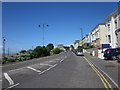
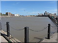
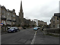
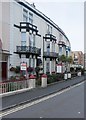
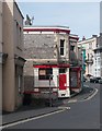
Photos of BS23 2EY


Area Information
BS23 2EY is a small, densely populated postcode area in England, covering just 1890 m² with a population of 1758 residents. This compact cluster sits within the historic seaside town of Weston-super-Mare, a Victorian-era resort town renowned for its sandy beaches and high tidal range. Daily life here is shaped by its coastal heritage, with the Grand Pier and Victorian architecture standing as enduring landmarks. The area’s proximity to the Bristol Channel offers easy access to maritime activities, while its rail connections to Weston, Weston Milton, and Worle stations provide links to nearby towns. The community is characterised by a mature demographic, with a median age of 47 and a majority of residents aged 30–64. Though small, the area blends practical living with coastal charm, offering a mix of retail, transport, and recreational options within reach. Its compact size and high population density mean residents are close to amenities, though the housing stock is predominantly flats, reflecting a mix of owner-occupied and rental properties. For those seeking a balance between seaside living and everyday convenience, BS23 2EY presents a focused, accessible option.
- Area Type
- Postcode
- Area Size
- 1890 m²
- Population
- 1758
- Population Density
- 1564 people/km²
The property market in BS23 2EY is characterised by a high proportion of rental homes, with only 48% of properties owner-occupied. The accommodation type is predominantly flats, which is typical for smaller, densely populated areas. This suggests a housing stock that may be older, with limited scope for large family homes or detached properties. The compact size of the postcode area means the local market is likely influenced by nearby towns, such as Weston-super-Mare, which offers more extensive housing options. For buyers, the challenge lies in the limited availability of owner-occupied properties, with flats forming the bulk of the stock. This dynamic may appeal to those seeking manageable, centrally located homes but could limit options for those prioritising larger spaces or long-term ownership. The area’s proximity to transport links and amenities may offset its smaller scale, making it attractive for those valuing convenience over expansive property choices.
House Prices in BS23 2EY
Showing 13 properties
| Address | Type | Beds | Baths | Last Sale Price | Last Sale Date | |
|---|---|---|---|---|---|---|
| 8, Addington Court, Madeira Road, Weston Super Mare, BS23 2EY | Flat | 2 | 1 | £120,000 | Sep 2025 | |
| 5, Addington Court, Madeira Road, Weston Super Mare, BS23 2EY | Flat | 1 | 1 | £85,000 | Aug 2020 | |
| 11, Addington Court, Madeira Road, Weston Super Mare, BS23 2EY | Flat | - | - | £115,500 | Feb 2020 | |
| 3, Addington Court, Madeira Road, Weston Super Mare, BS23 2EY | Flat | - | - | £190,000 | Nov 2017 | |
| 7, Addington Court, Madeira Road, Weston Super Mare, BS23 2EY | Flat | - | - | £168,000 | Aug 2017 | |
| 12, Addington Court, Madeira Road, Weston Super Mare, BS23 2EY | Flat | 2 | 1 | £124,250 | Feb 2016 | |
| 10, Addington Court, Madeira Road, Weston Super Mare, BS23 2EY | Flat | - | - | £135,000 | Jan 2016 | |
| 6, Addington Court, Madeira Road, Weston Super Mare, BS23 2EY | Flat | - | - | £93,000 | Jan 2009 | |
| 4, Addington Court, Madeira Road, Weston Super Mare, BS23 2EY | Flat | - | - | £40,000 | Feb 1999 | |
| 2, Addington Court, Madeira Road, Weston Super Mare, BS23 2EY | Flat | - | - | £29,500 | Mar 1997 |
Energy Efficiency in BS23 2EY
Living in BS23 2EY offers access to a range of practical amenities within close reach. Retail options include Spar, Morrisons Daily Weston Super, and Tesco Weston, providing everyday shopping convenience. The area’s rail stations connect residents to Weston, Weston Milton, and Worle, facilitating travel to nearby towns and attractions. A ferry service to Weston adds to the transport diversity, useful for both commuting and leisure. The coastal location means proximity to the seaside, with the historic Grand Pier and Victorian architecture of Weston-super-Mare within reach. While the area itself is small, its integration with the larger town ensures residents can enjoy a mix of seaside leisure, cultural landmarks, and retail without long commutes. The compact nature of BS23 2EY means amenities are tightly clustered, supporting a lifestyle that prioritises ease of access over expansive spaces.
Amenities
Schools
| Rank | School | Type | Entry gender | Ages |
|---|
Explore more schools in this area
Go to Schools tabDemographics
The population of BS23 2EY is 1758, with a median age of 47 and the majority of residents falling within the 30–64 age range. This suggests a community of established adults, likely with families or long-term careers. Home ownership in the area is relatively low, at 48%, indicating that more than half of residents rent their homes. The predominant accommodation type is flats, which aligns with the area’s compact size and high population density of 1564 people per km². The predominant ethnic group is White, though specific data on diversity or deprivation is not provided. The age profile and housing mix imply a stable, mature population, possibly with a mix of long-term residents and those drawn to the area’s coastal amenities. The absence of detailed diversity statistics means the community’s cultural composition remains less defined in the data.
Household Size
Accommodation Type
Tenure
Ethnic Group
Religion
Household Composition
Age
Household Deprivation
NS-SEC
Explore more demographic insights in this area
Go to Demographics tabPlanning
Planning Constraints
- Flood RiskPremium
- Ramsar Wetland SitesPremium
- Area of Outstanding Natural BeautyPremium
- Protected Nature ReservePremium
- Protected WoodlandPremium