Area Overview for BS23 2EF
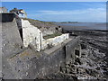
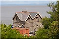
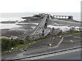
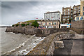
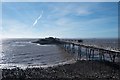
Photos of BS23 2EF


Area Information
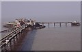
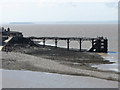
BS23 2EF is a small, densely populated residential postcode in North Somerset, covering just 7.6 hectares and home to 1,758 residents. Its compact size means it is likely integrated into the broader fabric of Weston-super-Mare, a historic seaside town known for its Victorian architecture, sandy beaches, and high tidal range. The area’s population density of 1,564 people per square kilometre reflects a tightly knit community, with a median age of 47 and a majority of residents aged 30–64. This suggests a mature, stable demographic, possibly with long-term residents and families. Daily life here is likely shaped by proximity to Weston-super-Mare’s amenities, including its rail links, retail hubs, and coastal attractions. The area’s small footprint means it is probably a quiet, residential cluster, with limited commercial activity but strong connectivity to nearby services. Living here offers a blend of coastal charm and urban convenience, though the high density may influence the pace of life and availability of private space.
- Area Type
- Postcode
- Area Size
- 7.6 hectares
- Population
- 1758
- Population Density
- 1564 people/km²
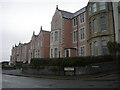
The property market in BS23 2EF is characterised by a high proportion of rented accommodation, with 52% of residents in rental homes and 48% owning their properties. The predominant housing type is flats, which is typical of densely populated urban or semi-urban areas. This suggests a housing stock that prioritises efficiency over spaciousness, likely catering to families or individuals seeking affordability in a compact setting. Given the area’s small size (7.6 hectares), the immediate surroundings may offer limited scope for property expansion, making existing homes highly sought after. Buyers should consider the proximity to Weston-super-Mare’s amenities, including rail links and retail, which may enhance the area’s appeal. However, the high population density and limited land availability could mean that property prices are influenced more by location and proximity to transport than by size or condition.
House Prices in BS23 2EF
Showing 37 properties
Energy Efficiency in BS23 2EF
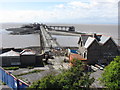
Residents of BS23 2EF have access to a mix of retail, dining, and transport amenities within practical reach. The area includes five notable retail outlets, such as Spar, Morrisons Daily Weston Super, and Tesco Weston, providing everyday shopping convenience. Nearby rail stations—Weston, Weston Milton, and Worle—offer regular services to and from Weston-super-Mare, a town with a rich seaside heritage, including the Grand Pier and Victorian architecture. The ferry to Weston further connects residents to coastal activities and local attractions. While the area itself is small, its integration with Weston-super-Mare means residents can enjoy a blend of urban amenities and coastal lifestyle. The presence of multiple retail options and transport links suggests a lifestyle that balances practicality with access to a larger town’s offerings.
Amenities
Schools
| Rank | School | Type | Entry gender | Ages |
|---|
Explore more schools in this area
Go to Schools tabDemographics
BS23 2EF has a median age of 47, with the majority of residents falling within the 30–64 age range. This indicates a community dominated by working-age adults and older professionals, suggesting stability and a focus on established households. Home ownership rates are 48%, meaning just over half of residents own their homes, with the remaining 52% likely renting. The accommodation type is predominantly flats, reflecting a compact, possibly multi-unit housing stock. The predominant ethnic group is White, though no specific data on diversity or deprivation is provided. The high population density of 1,564 people per square kilometre implies a closely packed residential environment, which may influence social dynamics and access to shared spaces. For buyers, this suggests a market where rental demand could be strong, but the limited housing stock may create competition for available properties.
Household Size
Accommodation Type
Tenure
Ethnic Group
Religion
Household Composition
Age
Household Deprivation
NS-SEC
Explore more demographic insights in this area
Go to Demographics tabPlanning
Planning Constraints
- Flood RiskPremium
- Ramsar Wetland SitesPremium
- Area of Outstanding Natural BeautyPremium
- Protected Nature ReservePremium
- Protected WoodlandPremium