Area Overview for RG2 9GA
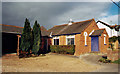
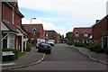
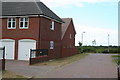
Photos of RG2 9GA
Area Information
Living in RG2 9GA means inhabiting a specific residential cluster covering just 3.3 hectares. The postcode commands a population of 1709 people across a very small footprint, resulting in a population density of 51317 people per square kilometre. This scale creates a compact environment where daily necessities are close at hand for the inhabitants. The area is firmly rooted in Berkshire, offering a distinct sense of locality within the wider Reading and Bradfield context. Residents here experience a neighbourhood defined by its density and intimate size, distinguishing it from sprawling suburban developments. The community is established, with long-term residents forming the backbone of the local social fabric. For anyone considering homes in RG2 9GA, the decision involves accepting a high-density living arrangement in exchange for proximity to essential services. The character of the area is shaped by its limited land area, ensuring that movement between properties and local hubs is brief. Whether you choose a flat or a house, the setting remains consistent with the constraints of a small urban patch. This locality serves as a practical example of high-density residential planning in England.
- Area Type
- Postcode
- Area Size
- 3.3 hectares
- Population
- 1709
- Population Density
- 3688 people/km²
The property market in RG2 9GA is heavily skewed towards owner-occupation, with a home ownership rate of 72 per cent. This statistic indicates that the housing stock is primarily held by residents who have purchased their properties rather than landlords renting to tenants. Consequently, the area functions less like a transient rental market and more like a settled community of homeowners. The accommodation type is listed as houses, meaning the physical structures are detached, semi-detached, or terraced homes rather than flats or apartments. This specific configuration supports the high population density of 51317 people per square kilometre, as the limited 3.3 hectare area maximises the number of residential units. Buyers looking at homes in RG2 9GA will find a traditional market where transactions often involve moving between owners within the same cluster. The prevalence of owner-occupiers suggests that demand is driven by local purchase activity rather than investment lettings. This stability is appealing for those seeking a predictable property environment. The lack of flat-type accommodation further narrows the property search to single-family dwellings. Understanding this market dynamic helps prospective buyers avoid assuming a high supply of rentals. The 72 per cent ownership figure is a concrete indicator of the area's long-term residential character.
House Prices in RG2 9GA
Showing 76 properties
| Address | Type | Beds | Baths | Last Sale Price | Last Sale Date | |
|---|---|---|---|---|---|---|
| 70 Gloucester Avenue, Shinfield, RG2 9GA | Semi-detached | 3 | 3 | £510,000 | Jul 2025 | |
| 21 Gloucester Avenue, Shinfield, RG2 9GA | Semi-detached | 2 | 1 | £374,000 | Aug 2024 | |
| 36 Gloucester Avenue, Shinfield, RG2 9GA | Maisonette | 1 | 1 | £222,000 | Jun 2023 | |
| 25 Gloucester Avenue, Shinfield, RG2 9GA | Retail | 2 | 1 | £365,810 | Jun 2022 | |
| 55 Gloucester Avenue, Shinfield, RG2 9GA | Terraced | 4 | 2 | £444,000 | May 2022 | |
| 5 Gloucester Avenue, Shinfield, RG2 9GA | Flat | 2 | 2 | £117,000 | Feb 2022 | |
| 43 Gloucester Avenue, Shinfield, RG2 9GA | house | - | - | £940,000 | Feb 2022 | |
| 41 Gloucester Avenue, Shinfield, RG2 9GA | Semi-detached | 6 | 4 | £635,000 | Jan 2022 | |
| 69 Gloucester Avenue, Shinfield, RG2 9GA | house | - | - | £720,000 | Apr 2021 | |
| 51 Gloucester Avenue, Shinfield, RG2 9GA | house | - | - | £840,000 | Apr 2021 |
Energy Efficiency in RG2 9GA
Residents of RG2 9GA have practical access to retail and transport hubs within their immediate reach. The nearest retail options include Lidl Beke, Asda Shinfield, and a Co-op Former store, providing five major shopping points for daily necessities. For rail travel, Earley Railway Station, Winnersh Triangle Railway Station, and Winnersh Railway Station serve the area, totaling five rail connections for commuting needs. This distribution of amenities ensures that groceries, general goods, and public transport are never far away. The presence of Asda and Lidl suggests a focus on affordable, high-volume fresh food and household goods. Commuters can access the rail network efficiently, reducing reliance on cars for daily journeys. Living in RG2 9GA offers convenience because these facilities are located within a practical walking or short driving distance. The specific naming of these stations and supermarkets grounds the lifestyle description in reality. Residents do not need to plan extensive trips to London or Reading town centre for basic goods. The combination of five retail outlets and five rail stations creates a robust support network for the 1709 local population. Daily errands become straightforward tasks rather than burdensome journeys. The layout of amenities complements the compact nature of the residential cluster.
Amenities
Schools
Families moving to RG2 9GA will find Shinfield Infant and Nursery School offering primary education options. This institution operates as both a primary school and an academy, providing flexibility in the educational structure for young children. Additionally, Shinfield St Mary's CofE Junior School serves as a nearby primary option and holds a 'good' Ofsted rating. This official assessment confirms the quality of education provided within the cluster. The presence of two distinct primary institutions means parents have choices for early years schooling without needing to travel far outside the immediate vicinity. The mix of academy and Church of England faith schools reflects a diverse educational approach available to residents. Neither school is listed here as secondary, indicating that older children may need to travel further for high school education. The proximity of these rated schools supports the decision of many families to live in this area. The 'good' rating for St Mary's provides a verified benchmark for quality. Prospective buyers can assess the transition from infant to junior stages within walking distance of their RG2 9GA homes. Schools near RG2 9GA form a critical part of the local amenity profile for households with children.
| Rank | School | Type | Entry gender | Ages |
|---|
Explore more schools in this area
Go to Schools tabDemographics
The community in RG2 9GA is defined by a clear age profile where adults aged 30 to 64 years constitute the most common demographic. This age grouping aligns with the area's median age of 47, indicating a population that has settled and built lives rather than transient younger renters. Seventy-two per cent of households in this cluster are owner-occupied, suggesting a stable community with residents invested in theiraddresses. The accommodation type is predominantly houses, which contrasts with the high density figures caused by the small 3.3 hectare size. Ideally, this mix implies families or retired couples rather than single occupancy flats. The predominant ethnic group is White, reflecting the broader demographics of the local region. These figures paint a picture of a mature neighbourhood where stability is the norm. The high home ownership rate reduces the prevalence of short-term tenancies, creating a tighter-knit social environment. For those moving to RG2 9GA, understanding this demographic shift is key. The area attracts those seeking a semi-senior lifestyle or starting a family, rather than young professionals in their late teens or early twenties. This consistency ensures that local services cater to the needs of working-age adults and their dependents.
Household Size
Accommodation Type
Tenure
Ethnic Group
Religion
Household Composition
Age
Household Deprivation
NS-SEC
Explore more demographic insights in this area
Go to Demographics tabPlanning
Planning Constraints
- Flood RiskPremium
- Ramsar Wetland SitesPremium
- Area of Outstanding Natural BeautyPremium
- Protected Nature ReservePremium
- Protected WoodlandPremium