Area Overview for RG2 9DD
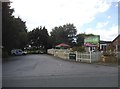
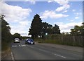
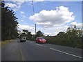
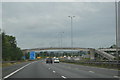
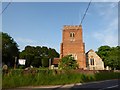
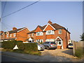
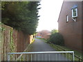
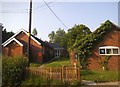
Photos of RG2 9DD
Area Information
RG2 9DD is a small, tightly packed residential area in England, spanning just 1894 square metres and home to 1709 residents. Its high population density—over 900,000 people per square kilometre—reflects its compact nature, where homes are clustered closely together. This postcode area is defined by its proximity to essential services, including multiple schools, retail outlets, and rail links. Daily life here is shaped by its mix of domestic and commuter-focused infrastructure. The area’s appeal lies in its accessibility: rail stations such as Earley and Winnersh Triangle provide direct connections to Reading and beyond, while nearby shops like Lidl and Asda cater to everyday needs. The community is predominantly middle-aged, with a median age of 47, and 72% of residents owning their homes. This suggests a stable, long-term population with a focus on family living. While the area lacks natural amenities like woodlands or protected landscapes, its practicality and connectivity make it a viable option for those prioritising convenience over rural scenery.
- Area Type
- Postcode
- Area Size
- 1894 m²
- Population
- 1709
- Population Density
- 3688 people/km²
The property market in RG2 9DD is characterised by a strong emphasis on home ownership, with 72% of residents living in houses rather than flats or rented properties. This indicates a market skewed towards owner-occupied homes, which may appeal to families seeking stability. The area’s small size means housing stock is limited, and buyers should consider the proximity to nearby amenities as a key factor. The dominance of houses suggests a focus on larger properties, potentially offering more space than the average urban dwelling. However, the high population density—over 900,000 people per square kilometre—means properties are closely spaced, which could affect privacy or outdoor space. For buyers, the compact nature of RG2 9DD means competition for available homes may be fierce, and proximity to rail links and schools could be decisive factors in property value.
House Prices in RG2 9DD
Showing 2 properties
| Address | Type | Beds | Baths | Last Sale Price | Last Sale Date | |
|---|---|---|---|---|---|---|
| 2, Church Cottages, Church Lane, Shinfield, RG2 9DD | Detached | 3 | 1 | - | - | |
| 1, Church Cottages, Church Lane, Shinfield, RG2 9DD | house | 3 | 1 | - | - |
Energy Efficiency in RG2 9DD
The lifestyle in RG2 9DD is shaped by its proximity to essential amenities. Retail options include Lidl Beke, Asda Shinfield, and Co-op Former, offering everyday shopping needs within walking or short driving distance. The rail stations—Earley, Winnersh Triangle, and Reading West—enhance mobility, connecting residents to broader networks for work, leisure, or travel. While the area lacks detailed information on parks or leisure facilities, its compact design ensures convenience, with amenities clustered closely. The presence of multiple schools and shops suggests a community-oriented environment where daily errands and social interactions are easily accessible. However, the absence of specific data on green spaces or recreational areas means residents may need to look beyond RG2 9DD for outdoor activities. Overall, the area’s practicality and accessibility make it appealing for those prioritising convenience over expansive natural amenities.
Amenities
Schools
Residents of RG2 9DD have access to a range of primary education options. Shinfield Infant and Nursery School serves as a primary school, while Shinfield St Mary’s CofE Junior School, rated ‘good’ by Ofsted, provides a second primary option. A third school, also named Shinfield Infant and Nursery School, is listed as an academy, though its specific focus is unclear. The presence of two primary schools and an academy offers families flexibility in choosing educational paths. The ‘good’ Ofsted rating at St Mary’s CofE suggests a reliable standard of teaching, which may be a draw for parents prioritising quality education. However, the absence of secondary schools in the data means families may need to look beyond the immediate area for high school options. The concentration of schools reflects the area’s family-oriented character, with education being a central concern for residents.
| Rank | School | Type | Entry gender | Ages |
|---|
Explore more schools in this area
Go to Schools tabDemographics
RG2 9DD’s population is predominantly composed of adults aged 30–64, with a median age of 47. This suggests a mature, settled community with strong family ties. Home ownership is high at 72%, indicating a preference for long-term residency over renting. The area is largely composed of houses, which aligns with the demographic profile of established families. The predominant ethnic group is White, though specific data on diversity is not provided. The high population density—over 900,000 people per square kilometre—means the area is intensely populated, which can influence local amenities and social dynamics. While no deprivation data is available, the high home ownership rate and presence of schools suggest a relatively stable quality of life. However, the compact size of the area may limit green spaces or recreational facilities, which could impact lifestyle options for residents.
Household Size
Accommodation Type
Tenure
Ethnic Group
Religion
Household Composition
Age
Household Deprivation
NS-SEC
Explore more demographic insights in this area
Go to Demographics tabPlanning
Planning Constraints
- Flood RiskPremium
- Ramsar Wetland SitesPremium
- Area of Outstanding Natural BeautyPremium
- Protected Nature ReservePremium
- Protected WoodlandPremium