Area Overview for RG2 0NE
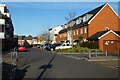
Photos of RG2 0NE

Area Information
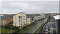
RG2 0NE is a small, compact postcode area in England, spanning 9,934 square metres and home to 1,700 residents. Its population density of 708 people per square kilometre suggests a tightly knit community, where proximity to services and amenities is a key feature. The area is characterised by a mature demographic, with a median age of 47 and a majority of residents aged between 30 and 64. This suggests a stable, established population, likely drawn from professionals and families seeking a quiet, residential environment. The area’s small size means it is likely integrated into a larger town or city, with nearby infrastructure such as rail links and retail hubs. While the data does not specify the broader town, the presence of multiple rail stations within practical reach indicates connectivity to urban centres. For those considering RG2 0NE, the balance of residential tranquillity and access to essential services makes it a viable option for buyers prioritising convenience and community.
- Area Type
- Postcode
- Area Size
- 9934 m²
- Population
- 1700
- Population Density
- 708 people/km²
The property market in RG2 0NE is dominated by owner-occupied homes, with 48% of residents owning their properties. The accommodation type is exclusively houses, which implies a market focused on family homes rather than rental properties or flats. This suggests a limited supply of properties, given the small area size and the likely concentration of housing stock. For buyers, this means competition may be fierce, particularly for those seeking a home in this specific postcode. The predominance of houses also indicates that the area is more suited to those requiring larger living spaces, rather than investors targeting rental yields. Given the small size of RG2 0NE, buyers should consider the surrounding areas for additional options, though proximity to rail links and retail amenities may offset the need for a larger footprint.
House Prices in RG2 0NE
No properties found in this postcode.
Energy Efficiency in RG2 0NE
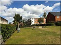
Residents of RG2 0NE have access to a range of nearby amenities, including five retail outlets such as Aldi Whitley, Morrisons Whitley, and Lidl Whitley. These stores provide convenience for everyday shopping, reducing the need for long trips to larger centres. The proximity to multiple rail stations also enhances lifestyle flexibility, enabling easy access to cultural, recreational, and professional opportunities in nearby towns. While the data does not specify parks or leisure facilities, the presence of retail and transport hubs suggests a practical, service-oriented lifestyle. The small area size means amenities are likely concentrated, offering a balance of convenience and community cohesion.
Amenities
Schools
The nearest school to RG2 0NE is Green Park Village Primary Academy, a primary school with an Ofsted rating of ‘good’. This provides families with a local option for early education, though the data does not list secondary schools in the immediate vicinity. The presence of a primary school with a positive rating is a significant advantage for parents, ensuring access to quality education for younger children. However, families requiring secondary schooling may need to look further afield, potentially increasing travel time. The single school listed highlights the need for careful planning when considering RG2 0NE as a family home, particularly for those with older children.
| Rank | School | Type | Entry gender | Ages |
|---|
Explore more schools in this area
Go to Schools tabDemographics
The community in RG2 0NE is predominantly composed of adults aged 30 to 64, with a median age of 47. This suggests a population that is largely in their prime working years, likely with established careers and family commitments. Home ownership rates stand at 48%, indicating that nearly half of residents own their homes, while the remaining 52% are likely renters. The accommodation type is primarily houses, reflecting a preference for single-family dwellings over flats or apartments. The predominant ethnic group is White, which aligns with broader demographic trends in similar postcodes. The data does not provide specific information on deprivation levels, but the high proportion of owner-occupied homes and the presence of retail amenities suggest a moderate quality of life. The absence of significant diversity data means the community’s social composition remains largely unexplored in this context.
Household Size
Accommodation Type
Tenure
Ethnic Group
Religion
Household Composition
Age
Household Deprivation
NS-SEC
Explore more demographic insights in this area
Go to Demographics tabPlanning
Planning Constraints
- Flood RiskPremium
- Ramsar Wetland SitesPremium
- Area of Outstanding Natural BeautyPremium
- Protected Nature ReservePremium
- Protected WoodlandPremium