Area Overview for RG2 0GH
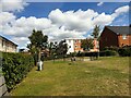
Photos of RG2 0GH


Area Information
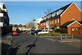
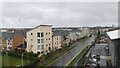
RG2 0GH is a compact residential postcode in England, covering just 8 hectares and home to 1700 people. Its population density of 708 people per square kilometre suggests a tightly knit community, with homes clustered closely together. This small area is part of a larger network of nearby towns and villages, offering residents access to a range of local services. The area’s proximity to retail hubs like Morrisons Whitley and Costco Reading, as well as multiple railway stations including Reading West and Earley, positions it as a convenient base for commuters. Daily life here is shaped by its modest size and the balance between residential tranquillity and practical connectivity. While the area lacks large-scale amenities, its compact nature ensures that essential services are within walking or short driving distance. For those seeking a blend of accessibility and a smaller, manageable community, RG2 0GH provides a distinct character, though its challenges—such as flood risk and crime—require careful consideration.
- Area Type
- Postcode
- Area Size
- 8.0 hectares
- Population
- 1700
- Population Density
- 708 people/km²
The property market in RG2 0GH is characterised by a 48% home ownership rate, with houses being the predominant accommodation type. This suggests a market skewed towards owner-occupied homes rather than a rental-heavy area. Given the small size of the postcode—just 8 hectares—the housing stock is likely limited, with properties concentrated in a compact cluster. Buyers should consider the immediate surrounding areas for more options, as the small footprint of RG2 0GH may restrict availability. The presence of houses rather than flats or apartments indicates a preference for private, standalone living spaces. However, the 48% home ownership rate also implies that nearly half of properties are rented, which could influence pricing dynamics and competition for available homes. Prospective buyers should assess whether the area’s size and property types align with their long-term needs.
House Prices in RG2 0GH
No properties found in this postcode.
Energy Efficiency in RG2 0GH
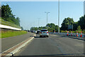
Residents of RG2 0GH have access to practical amenities within reach, including five retail outlets such as Morrisons Whitley, Aldi Whitley, and Costco Reading. These stores provide everyday shopping options, from groceries to larger retail needs. The area’s rail connections, with stations like Reading West and Earley, facilitate easy travel to nearby towns and cities, supporting both commuters and those seeking leisure opportunities elsewhere. While the data does not mention parks or leisure facilities, the presence of multiple retail and transport options suggests a functional lifestyle focused on convenience. The compact nature of the area means that amenities are closely clustered, reducing travel time for daily errands. However, those seeking extensive green spaces or recreational facilities may need to look beyond the immediate postcode for such amenities.
Amenities
Schools
The nearest school to RG2 0GH is Green Park Village Primary Academy, a primary school with a good Ofsted rating. This provides families with a locally rated institution for early education, though no secondary schools are listed in the data. The presence of a primary school with a good rating is a positive factor for families with young children, but those requiring secondary education may need to look beyond the immediate area. The absence of additional schools suggests that parents should investigate nearby towns for secondary options. For buyers prioritising schools, the availability of a high-quality primary institution is a key advantage, though the lack of secondary schools could necessitate a broader search for educational facilities.
| Rank | School | Type | Entry gender | Ages |
|---|
Explore more schools in this area
Go to Schools tabDemographics
The residents of RG2 0GH are predominantly adults aged 30–64, with a median age of 47. This suggests a mature, stable population, likely with established careers and families. Home ownership stands at 48%, indicating a mixed market where nearly half of properties are owner-occupied, while the remaining 52% are likely rented. The accommodation type is primarily houses, which may reflect a preference for single-family living. The predominant ethnic group is White, though no specific data on diversity or deprivation is provided. The age profile implies a community focused on long-term residency rather than transient populations. For buyers, this demographic profile suggests a market where properties may appeal to those seeking a settled lifestyle, though the relatively low home ownership rate could indicate a higher proportion of rental properties available.
Household Size
Accommodation Type
Tenure
Ethnic Group
Religion
Household Composition
Age
Household Deprivation
NS-SEC
Explore more demographic insights in this area
Go to Demographics tabPlanning
Planning Constraints
- Flood RiskPremium
- Ramsar Wetland SitesPremium
- Area of Outstanding Natural BeautyPremium
- Protected Nature ReservePremium
- Protected WoodlandPremium