Area Overview for RG2 0GZ
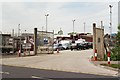
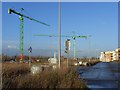
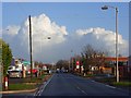
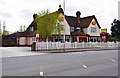
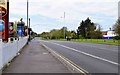
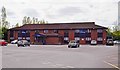
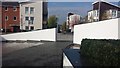
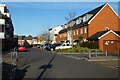
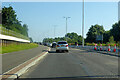
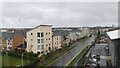
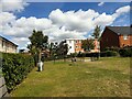
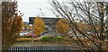
Photos of RG2 0GZ
Area Information
RG2 0GZ is a compact residential postcode in England, covering 5,673 square metres and home to around 1,700 people. Its high population density of 708 people per square kilometre suggests a tightly knit community, where daily life is shaped by proximity to local amenities and transport links. The area’s small size means residents have easy access to essential services, though it remains a quiet, low-rise neighbourhood with a focus on housing rather than commercial development. Living in RG2 0GZ offers a balance of convenience and tranquillity, with no major natural or planning constraints affecting the area. The demographic profile—predominantly adults aged 30–64—hints at a mature, stable population, many of whom own their homes. While the area lacks large-scale attractions, its practical layout and proximity to rail networks make it appealing for commuters or those seeking a simpler, less congested lifestyle.
- Area Type
- Postcode
- Area Size
- 5673 m²
- Population
- 1700
- Population Density
- 708 people/km²
The property market in RG2 0GZ is defined by a 48% home ownership rate, with houses making up the majority of accommodation types. This suggests a focus on owner-occupied homes rather than a rental market, though the exact proportion of rental properties is not specified. The small area size and limited data on property types mean the housing stock is likely uniform, with few high-end or luxury developments. For buyers, this presents a straightforward market: properties are likely to be family homes with limited scope for redevelopment. The compact nature of the postcode means the immediate surroundings are key to assessing potential, with nearby amenities and transport links playing a significant role in property value. The absence of planning constraints or environmental restrictions may also make the area attractive for those seeking a stable, low-risk investment.
House Prices in RG2 0GZ
Showing 56 properties
| Address | Type | Beds | Baths | Last Sale Price | Last Sale Date | |
|---|---|---|---|---|---|---|
| Flat 45, Thorney House, Drake Way, Reading, RG2 0GZ | Flat | 2 | 2 | - | - | |
| Flat 56, Thorney House, Drake Way, Reading, RG2 0GZ | Flat | 1 | 1 | - | - | |
| Flat 6, Thorney House, Drake Way, Reading, RG2 0GZ | Flat | 1 | 1 | - | - | |
| Flat 42, Thorney House, Drake Way, Reading, RG2 0GZ | Flat | 2 | 2 | - | - | |
| Flat 4, Thorney House, Drake Way, Reading, RG2 0GZ | Flat | 2 | - | - | - | |
| Flat 57, Thorney House, Drake Way, Reading, RG2 0GZ | Flat | 1 | 1 | - | - | |
| Flat 52, Thorney House, Drake Way, Reading, RG2 0GZ | Flat | 2 | 1 | - | - | |
| Flat 27, Thorney House, Drake Way, Reading, RG2 0GZ | Flat | 1 | 1 | - | - | |
| Flat 21, Thorney House, Drake Way, Reading, RG2 0GZ | Flat | 2 | 2 | - | - | |
| Flat 30, Thorney House, Drake Way, Reading, RG2 0GZ | Retail | 1 | 1 | - | - |
Energy Efficiency in RG2 0GZ
The lifestyle in RG2 0GZ is shaped by its proximity to essential amenities. Within reach are five retail outlets, including Aldi Whitley, Morrisons Whitley, and Lidl Whitley, offering everyday shopping needs. These stores provide convenience for residents, reducing the need to travel further for groceries or household items. The area’s rail stations—Reading West, Reading, and Earley—also contribute to a dynamic lifestyle, enabling quick access to urban centres for work, leisure, or social activities. While the postcode lacks large parks or recreational facilities, the compact layout ensures that daily errands and transport are efficient. The combination of retail options and rail connectivity supports a practical, low-maintenance lifestyle, ideal for those prioritising accessibility over expansive leisure spaces.
Amenities
Schools
The nearest school to RG2 0GZ is Green Park Village Primary Academy, a primary school with a ‘good’ Ofsted rating. This institution serves the local community, providing education for younger children in the area. The presence of a single primary school suggests that families with young dependents may need to consider secondary education options elsewhere, though the quality of the primary school is a positive factor. The absence of secondary schools or other educational institutions in the immediate vicinity means parents should plan for commuting to nearby towns for higher education. However, the ‘good’ rating indicates a reliable standard of teaching and facilities, which is a key consideration for families prioritising school quality.
| Rank | School | Type | Entry gender | Ages |
|---|
Explore more schools in this area
Go to Schools tabDemographics
The community in RG2 0GZ is predominantly composed of adults aged 30–64, with a median age of 47. This suggests a mature population, likely with established careers and families. Home ownership rates stand at 48%, indicating a mix of owner-occupied properties and rental homes. The area is characterised by houses rather than flats, reflecting a preference for single-family dwellings. The predominant ethnic group is White, with no specific data on other demographics provided. The population density of 708 people per square kilometre implies a close-knit, possibly family-oriented environment. While no deprivation data is available, the high proportion of middle-aged residents may suggest a stable economy, though the lack of diverse age groups could impact local amenities catering to younger or older populations.
Household Size
Accommodation Type
Tenure
Ethnic Group
Religion
Household Composition
Age
Household Deprivation
NS-SEC
Explore more demographic insights in this area
Go to Demographics tabPlanning
Planning Constraints
- Flood RiskPremium
- Ramsar Wetland SitesPremium
- Area of Outstanding Natural BeautyPremium
- Protected Nature ReservePremium
- Protected WoodlandPremium