Area Overview for RG2 0GS
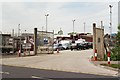
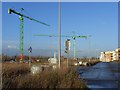
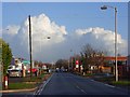
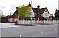
Photos of RG2 0GS
Area Information
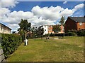
Living in RG2 0GS means inhabiting a tightly packed residential cluster in England, where 1,389 people reside across 2,426 square metres. This makes it one of the most densely populated areas in the country, with 572,449 people per square kilometre. The area is small but functional, serving as a microcosm of suburban living with a focus on proximity to transport links. Daily life here is shaped by its compact size and the surrounding infrastructure. Residents benefit from nearby rail stations, including Reading West and Earley, which connect to major urban centres. The area’s character is defined by its mix of retail and transport hubs, with supermarkets like Morrisons and Aldi within practical reach. While the population is relatively small, the density means community interactions are frequent. The area is not a typical commuter town but rather a niche postcode where convenience and connectivity outweigh space. For those seeking a compact, well-served environment, RG2 0GS offers a unique blend of proximity to amenities and a tightly knit residential fabric.
- Area Type
- Postcode
- Area Size
- 2426 m²
- Population
- 1389
- Population Density
- 8166 people/km²
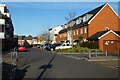
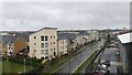
The property market in RG2 0GS is characterised by a low home ownership rate of 26%, indicating that the majority of housing is rented. Flats dominate the accommodation type, a logical outcome of the area’s high population density. This suggests a limited supply of larger homes, with the housing stock tailored to smaller, shared living spaces. As a small postcode area, RG2 0GS has minimal room for expansion, meaning buyers must consider properties within its immediate surroundings. The focus on rental properties may reflect the area’s role as a secondary residence or its appeal to commuters. For buyers, this means competition for available flats and a need to prioritise proximity to transport links. The compact size of the area also means that property values are likely influenced by location within the postcode, with homes closer to rail stations or amenities commanding higher prices.
House Prices in RG2 0GS
Showing 17 properties
| Address | Type | Beds | Baths | Last Sale Price | Last Sale Date | |
|---|---|---|---|---|---|---|
| 7 Lindisfarne Way, Reading, RG2 0GS | Terraced | 2 | 2 | £337,500 | Nov 2024 | |
| 3 Lindisfarne Way, Reading, RG2 0GS | Terraced | 4 | 2 | £460,000 | Jun 2024 | |
| 9 Lindisfarne Way, Reading, RG2 0GS | Terraced | 2 | 3 | £345,000 | Jul 2023 | |
| 5 Lindisfarne Way, Reading, RG2 0GS | house | 2 | 2 | £347,500 | Jan 2023 | |
| 4 Lindisfarne Way, Reading, RG2 0GS | Terraced | 4 | 3 | £440,000 | Sep 2022 | |
| 12 Lindisfarne Way, Reading, RG2 0GS | Terraced | 2 | 1 | £303,000 | Jun 2021 | |
| 1 Lindisfarne Way, Reading, RG2 0GS | house | - | - | £405,000 | Jun 2018 | |
| 10 Lindisfarne Way, Reading, RG2 0GS | Terraced | 2 | 2 | £302,500 | Nov 2016 | |
| 2 Lindisfarne Way, Reading, RG2 0GS | Terraced | 2 | 2 | £290,000 | Apr 2014 | |
| 6 Lindisfarne Way, Reading, RG2 0GS | Terraced | 3 | - | £270,000 | Jun 2013 |
Energy Efficiency in RG2 0GS
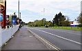
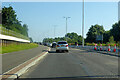
RG2 0GS offers a range of amenities within easy reach, enhancing daily life for residents. The area is served by five retail outlets, including Morrisons Whitley, Aldi Whitley, and Makro Reading, providing access to groceries, household goods, and other essentials. These stores cater to both everyday needs and occasional shopping trips. The rail network is a key feature, with five stations nearby, including Reading West and Earley, facilitating swift travel to urban centres. While the area lacks extensive parks or leisure facilities, its compact size ensures that essential services are within walking or short driving distance. The presence of major supermarkets and transport links contributes to a convenient, efficient lifestyle, ideal for those prioritising accessibility over expansive recreational spaces.
Amenities
Schools
| Rank | School | Type | Entry gender | Ages |
|---|
Explore more schools in this area
Go to Schools tabDemographics
RG2 0GS has a median age of 47, with the majority of residents aged between 30 and 64. This suggests a mature, settled population, likely with established careers and families. Home ownership is low at 26%, indicating that most residents are renters, which could reflect the area’s limited housing stock or its role as a secondary residence. Flats are the predominant accommodation type, a common feature in high-density urban settings. The population is predominantly White, with no specific data provided on other ethnic groups. The high population density of 572,449 people per square kilometre implies shared living spaces and a tightly packed community. While this density can foster a sense of neighbourliness, it also means limited private outdoor space. The age profile and ownership rates suggest a community focused on stability, with residents likely prioritising accessibility to transport and services over expansive living areas.
Household Size
Accommodation Type
Tenure
Ethnic Group
Religion
Household Composition
Age
Household Deprivation
NS-SEC
Explore more demographic insights in this area
Go to Demographics tabPlanning
Planning Constraints
- Flood RiskPremium
- Ramsar Wetland SitesPremium
- Area of Outstanding Natural BeautyPremium
- Protected Nature ReservePremium
- Protected WoodlandPremium