Area Overview for RG2 0FS
Photos of RG2 0FS


Area Information
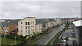
RG2 0FS is a small, tightly knit residential cluster in England, covering just 1.2 hectares with a population of 1700 people. The area’s compact size means it is densely populated, with 708 people per square kilometre, creating a community feel that is both intimate and efficient. This postcode is characterised by its mature demographic, with a median age of 47 and a strong presence of adults aged 30–64. The area is predominantly home-owning, with 48% of properties owned outright, and houses are the primary accommodation type. Daily life here is shaped by proximity to essential services: within practical reach are five retail outlets, including Aldi Whitley and Morrisons Whitley, and five railway stations, such as Reading West and Earley. The area’s digital connectivity is robust, with a broadband score of 97 and mobile coverage of 85, supporting both remote work and everyday internet needs. While the community is small, it is well-connected to nearby towns via rail, and the low flood risk adds to its appeal. However, residents should be aware of the area’s high crime risk, which is above average. For those seeking a compact, service-rich environment with a strong sense of local identity, RG2 0FS offers a distinct blend of practicality and accessibility.
- Area Type
- Postcode
- Area Size
- 1.2 hectares
- Population
- 1700
- Population Density
- 708 people/km²
The property market in RG2 0FS is dominated by owner-occupied homes, with 48% of properties owned outright. This suggests a market where long-term residency is common, though the exact proportion of rental properties is not specified. The area’s housing stock is primarily composed of houses, which may indicate a suburban or semi-rural layout with larger, more private dwellings. Given the small size of the postcode (1.2 hectares) and its high population density, the housing stock is likely limited, with little scope for new development. This could make the area competitive for buyers, particularly those seeking established homes in a compact, well-serviced environment. However, the lack of detailed data on property prices or average sizes means buyers should consider the surrounding areas for broader options. For those prioritising stability and proximity to essential services, RG2 0FS offers a focused, if limited, housing market.
House Prices in RG2 0FS
Showing 39 properties
| Address | Type | Beds | Baths | Last Sale Price | Last Sale Date | |
|---|---|---|---|---|---|---|
| 3 St Agnes Way, Reading, RG2 0FS | Terraced | 4 | 3 | £373,000 | Feb 2025 | |
| 40 St Agnes Way, Reading, RG2 0FS | Terraced | 3 | 2 | £460,000 | Mar 2022 | |
| 42 St Agnes Way, Reading, RG2 0FS | Semi-detached | 4 | 3 | £400,000 | Aug 2021 | |
| 34 St Agnes Way, Reading, RG2 0FS | Semi-detached | 4 | 2 | £420,000 | Jun 2021 | |
| 22 St Agnes Way, Reading, RG2 0FS | Terraced | 2 | 2 | £282,500 | May 2021 | |
| 5 St Agnes Way, Reading, RG2 0FS | Terraced | 2 | - | £290,000 | May 2021 | |
| 20 St Agnes Way, Reading, RG2 0FS | Terraced | 2 | 2 | £295,000 | Sep 2020 | |
| 16 St Agnes Way, Reading, RG2 0FS | Terraced | 3 | 2 | £375,000 | Nov 2019 | |
| 31 St Agnes Way, Reading, RG2 0FS | Terraced | 3 | 1 | £350,000 | Oct 2019 | |
| 1 St Agnes Way, Reading, RG2 0FS | Terraced | 4 | 2 | £420,000 | Aug 2019 |
Energy Efficiency in RG2 0FS
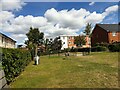
The lifestyle in RG2 0FS is shaped by its proximity to essential retail and transport hubs. Within walking or short driving distance are five retail outlets, including Aldi Whitley, Morrisons Whitley, and Makro Reading, offering a range of shopping options for daily needs. These stores provide convenience for groceries, household items, and general supplies, reducing the need for long trips to larger centres. The area’s rail network, with stations such as Reading West and Earley, connects residents to broader networks, facilitating access to cultural, leisure, and professional opportunities beyond the immediate postcode. While the data does not mention parks or leisure facilities, the compact nature of the area suggests that residents may rely on nearby towns for recreational activities. The combination of retail accessibility and transport links supports a practical, efficient lifestyle, though the absence of detailed information on green spaces or community amenities means buyers should explore surrounding areas for a fuller picture of recreational options.
Amenities
Schools
The nearest school to RG2 0FS is Green Park Village Primary Academy, a primary school with a ‘good’ Ofsted rating. This provides a reliable option for younger children, though no secondary schools are listed in the data. The presence of a primary school with a strong rating is a key consideration for families, as it ensures quality early education within the area. However, parents seeking secondary schooling may need to look beyond RG2 0FS, potentially increasing commuting times. The absence of additional schools in the data suggests that the area is best suited for families with younger children or those willing to access broader educational networks nearby. For those prioritising immediate access to primary education, Green Park Village Primary Academy offers a solid foundation, but the lack of secondary options should be factored into long-term planning.
| Rank | School | Type | Entry gender | Ages |
|---|
Explore more schools in this area
Go to Schools tabDemographics
The community in RG2 0FS is predominantly composed of adults aged 30–64, with a median age of 47. This suggests a stable, established population, likely with long-term ties to the area. Home ownership rates are 48%, indicating a mix of owner-occupied and rental properties, though the latter is not explicitly quantified. The area’s accommodation is almost entirely houses, which may reflect its suburban or semi-rural character. The predominant ethnic group is White, though no specific figures are provided for other groups. The population density of 708 people per square kilometre implies a compact, closely packed living environment, which may foster a strong sense of community but could also contribute to higher demand for local amenities. While no data on deprivation or income levels is available, the high home ownership and mature age profile suggest a relatively stable economic environment. For families or individuals seeking a settled, low-traffic residential area with minimal environmental constraints, RG2 0FS aligns with a demographic that values security and established infrastructure.
Household Size
Accommodation Type
Tenure
Ethnic Group
Religion
Household Composition
Age
Household Deprivation
NS-SEC
Explore more demographic insights in this area
Go to Demographics tabPlanning
Planning Constraints
- Flood RiskPremium
- Ramsar Wetland SitesPremium
- Area of Outstanding Natural BeautyPremium
- Protected Nature ReservePremium
- Protected WoodlandPremium