Area Overview for RG2 0FY
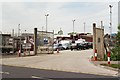
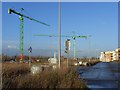
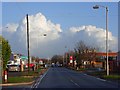
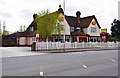
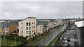
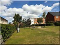
Photos of RG2 0FY
Area Information
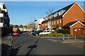
RG2 0FY is a compact residential postcode in England, covering just 447 square metres and home to 1,389 residents. Despite its small size, the area is densely populated, with 3.1 million people per square kilometre — a reflection of its urban character. This is a mature community, with a median age of 47 and a majority of residents aged 30–64. The area’s layout suggests a focus on practical living, with a mix of flats and nearby infrastructure. Daily life here is shaped by proximity to retail and transport hubs, including Aldi, Morrisons, and Lidl in Whitley, as well as multiple railway stations. While the population density is high, the area’s small footprint means it is likely a tightly knit neighbourhood, where amenities are within easy reach. For those considering living in RG2 0FY, the blend of convenience, connectivity, and a stable demographic profile could appeal to those seeking a settled, accessible urban environment.
- Area Type
- Postcode
- Area Size
- 447 m²
- Population
- 1389
- Population Density
- 8166 people/km²
The property market in RG2 0FY is characterised by a low rate of home ownership — just 26% of residents own their homes. This suggests that the area is more of a rental market than an owner-occupied one, with flats being the predominant accommodation type. The small size of the postcode, covering only 447 square metres, means that the housing stock is limited, likely concentrated in a few blocks or developments. For buyers, this could imply a competitive market with limited options, particularly for those seeking to purchase rather than rent. The high population density also suggests that properties here are likely to be smaller, with a focus on efficiency rather than space. Those considering the area should note that while the housing stock is practical and accessible, the low home ownership rate may indicate a preference for rental living among residents.
House Prices in RG2 0FY
Showing 6 properties
| Address | Type | Beds | Baths | Last Sale Price | Last Sale Date | |
|---|---|---|---|---|---|---|
| Flat 3, 47 Havergate Way, Reading, RG2 0FY | Flat | 1 | 1 | - | - | |
| Flat 1, 47 Havergate Way, Reading, RG2 0FY | Flat | - | - | - | - | |
| Flat 2, 47 Havergate Way, Reading, RG2 0FY | Flat | - | - | - | - | |
| Flat 6, 47 Havergate Way, Reading, RG2 0FY | Flat | - | - | - | - | |
| Flat 5, 47 Havergate Way, Reading, RG2 0FY | Flat | - | - | - | - | |
| Flat 4, 47 Havergate Way, Reading, RG2 0FY | Flat | - | - | - | - |
Energy Efficiency in RG2 0FY
Living in RG2 0FY offers access to a range of practical amenities within walking or short driving distance. The area is served by five retail outlets, including Aldi, Morrisons, and Lidl in Whitley, providing everyday shopping convenience. For commuters, five nearby railway stations — such as Reading West and Earley — offer direct links to major routes, facilitating travel to work or leisure. While the area does not include large parks or recreational spaces in its immediate vicinity, the presence of retail and transport hubs suggests a lifestyle focused on accessibility and efficiency. The compact nature of RG2 0FY means that essential services are close at hand, reducing the need for long commutes. This makes it appealing to those who prioritise convenience and connectivity over expansive green spaces, though residents may need to travel slightly further for more extensive leisure facilities.
Amenities
Schools
| Rank | School | Type | Entry gender | Ages |
|---|
Explore more schools in this area
Go to Schools tabDemographics
The community in RG2 0FY is predominantly composed of adults aged 30–64, with a median age of 47. This suggests a mature population, likely with established careers and families. Home ownership is relatively low at 26%, indicating that a significant proportion of residents are renters. The accommodation type is primarily flats, reflecting a housing stock suited to urban living. The predominant ethnic group is White, though the data does not specify further diversity metrics. The high population density — 3.1 million people per square kilometre — implies a compact, possibly mixed-use area where residential and commercial spaces coexist. While the data does not provide direct indicators of deprivation, the combination of low home ownership and a high proportion of middle-aged residents may suggest a community with stable employment but limited property investment opportunities.
Household Size
Accommodation Type
Tenure
Ethnic Group
Religion
Household Composition
Age
Household Deprivation
NS-SEC
Explore more demographic insights in this area
Go to Demographics tabPlanning
Planning Constraints
- Flood RiskPremium
- Ramsar Wetland SitesPremium
- Area of Outstanding Natural BeautyPremium
- Protected Nature ReservePremium
- Protected WoodlandPremium