Area Overview for RG2 0GE
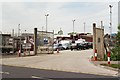
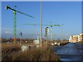
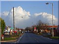
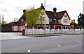
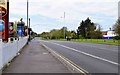
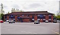
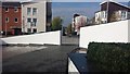
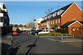
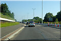
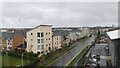
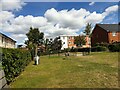
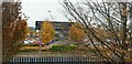
Photos of RG2 0GE
Area Information
RG2 0GE is a small, compact postcode area in England, covering just over 5,000 square metres and home to around 1,700 residents. Its population density of 708 people per square kilometre suggests a tightly knit community, where daily life is likely shaped by close proximity to local amenities and services. The area’s small size means it is likely to feel intimate, with residents frequently interacting in shared spaces. While no major landmarks or natural features are listed, the area benefits from proximity to nearby towns and transport links, which may contribute to its appeal. The demographic profile—skewing towards adults aged 30–64—suggests a stable population, possibly with families and professionals seeking a quieter, residential environment. Living here may involve a balance between local convenience and access to broader regional networks, making it a practical choice for those prioritising community over urban sprawl.
- Area Type
- Postcode
- Area Size
- 5070 m²
- Population
- 1700
- Population Density
- 708 people/km²
The property market in RG2 0GE is characterised by a 48% home ownership rate, with houses forming the predominant accommodation type. This suggests a market skewed towards owner-occupied properties rather than rental demand, which may indicate a more settled population. The small area size—just over 5,000 square metres—means the housing stock is limited, potentially leading to competition among buyers. The focus on houses rather than flats could appeal to those seeking traditional family homes or larger living spaces. However, the limited size of the area may also mean that property availability is constrained, requiring buyers to consider nearby neighbourhoods for additional options. The market’s stability may be influenced by the area’s demographic profile, with a mature population less likely to move frequently.
House Prices in RG2 0GE
Showing 14 properties
| Address | Type | Beds | Baths | Last Sale Price | Last Sale Date | |
|---|---|---|---|---|---|---|
| 2 Rushley Way, Reading, RG2 0GE | Maisonette | 2 | 2 | £200,000 | Sep 2011 | |
| 3 Rushley Way, Reading, RG2 0GE | Maisonette | 2 | 2 | £88,000 | May 2010 | |
| 11 Rushley Way, Reading, RG2 0GE | house | - | - | - | - | |
| 17 Rushley Way, Reading, RG2 0GE | house | - | - | - | - | |
| 23 Rushley Way, Reading, RG2 0GE | house | - | - | - | - | |
| 9 Rushley Way, Reading, RG2 0GE | house | - | - | - | - | |
| 21 Rushley Way, Reading, RG2 0GE | house | - | - | - | - | |
| 27 Rushley Way, Reading, RG2 0GE | house | - | - | - | - | |
| 5 Rushley Way, Reading, RG2 0GE | house | - | - | - | - | |
| 7 Rushley Way, Reading, RG2 0GE | house | - | - | - | - |
Energy Efficiency in RG2 0GE
The lifestyle in RG2 0GE is shaped by its proximity to retail and transport hubs. Within practical reach are five retail outlets, including Aldi, Morrisons, and Lidl in Whitley, offering everyday shopping convenience. The area also has five railway stations, such as Reading West and Earley, which provide access to broader regional networks. While no parks or leisure facilities are listed, the retail and transport options suggest a focus on practicality over expansive recreational spaces. The compact nature of the area may encourage walking or cycling to nearby amenities, fostering a sense of community. The availability of essential services within a short distance supports a lifestyle that balances convenience with the need for local interaction.
Amenities
Schools
The nearest school to RG2 0GE is Green Park Village Primary Academy, a primary school with a good Ofsted rating. This provides families with a locally available option for early education, though no secondary schools are listed in the data. The presence of a primary school with a good rating may be a key consideration for parents, as it suggests a reliable foundation for children’s education. However, the absence of secondary schools nearby could mean that students would need to travel to other areas for further schooling. The single school listed reflects the small scale of the area, where educational facilities are likely to be integrated with local community services.
| Rank | School | Type | Entry gender | Ages |
|---|
Explore more schools in this area
Go to Schools tabDemographics
The population of RG2 0GE is predominantly adults aged 30–64, with a median age of 47. This suggests a mature, established community, likely with a mix of long-term residents and families. Home ownership in the area stands at 48%, slightly below the national average, indicating a mix of owner-occupied and rental properties. The accommodation type is primarily houses, which may reflect a preference for more spacious or traditional living compared to flats. The predominant ethnic group is White, with no specific data on other ethnicities provided. The population density of 708 people per square kilometre implies a moderately sized community where social interactions are likely to be frequent. While no deprivation data is explicitly stated, the relatively high proportion of adult residents may suggest a focus on stability over transient populations.
Household Size
Accommodation Type
Tenure
Ethnic Group
Religion
Household Composition
Age
Household Deprivation
NS-SEC
Explore more demographic insights in this area
Go to Demographics tabPlanning
Planning Constraints
- Flood RiskPremium
- Ramsar Wetland SitesPremium
- Area of Outstanding Natural BeautyPremium
- Protected Nature ReservePremium
- Protected WoodlandPremium