Area Overview for RG2 0BL
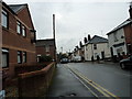
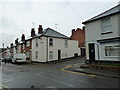
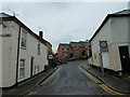
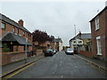
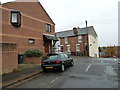
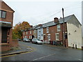
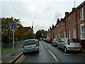
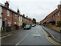
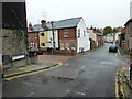
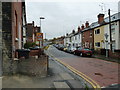
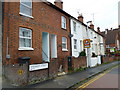
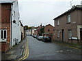
Photos of RG2 0BL
Area Information
RG2 0BL is a compact residential postcode in England, covering just 6,747 square metres and home to 1,779 residents. Its high population density of 263,670 people per square kilometre reflects a tightly knit community, where proximity to amenities and transport is a defining feature. This area is characterised by its small-scale residential cluster, offering a mix of convenience and intimacy. Daily life here is shaped by the surrounding infrastructure, with easy access to retail, rail networks, and schools. The median age of 47 suggests a mature population, predominantly adults aged 30–64, many of whom may be established professionals or families seeking stability. While the area’s size is modest, its strategic location near Reading’s transport hubs and retail centres makes it appealing for those prioritising connectivity over expansive living spaces. However, the high density also means limited green space, a trade-off for those valuing urban convenience. For buyers, RG2 0BL represents a blend of practicality and accessibility, though its small footprint means every decision about living here is influenced by proximity to essential services.
- Area Type
- Postcode
- Area Size
- 6747 m²
- Population
- 1779
- Population Density
- 13580 people/km²
The property market in RG2 0BL is shaped by its small size and high population density. With 43% of residents owning their homes, the area leans more towards a rental market than outright ownership, suggesting a demand for short-term or flexible housing solutions. The accommodation type is predominantly houses, which, in such a compact postcode, may mean smaller properties or terraced homes rather than large standalone houses. This configuration is typical of areas prioritising proximity to services over expansive living spaces. For buyers, the limited area means competition for available properties, and the focus on houses may appeal to those seeking family-friendly layouts. However, the high density also implies limited scope for development or expansion, which could affect long-term investment potential. The immediate surroundings likely offer similar housing stock, reinforcing the area’s character as a practical, service-oriented residential zone rather than a high-end or luxury market.
House Prices in RG2 0BL
Showing 34 properties
| Address | Type | Beds | Baths | Last Sale Price | Last Sale Date | |
|---|---|---|---|---|---|---|
| 50 Elgar Road, Reading, RG2 0BL | Terraced | 3 | 1 | £385,000 | Oct 2023 | |
| 70 Elgar Road, Reading, RG2 0BL | Terraced | 3 | 1 | £402,000 | Sep 2023 | |
| 62 Elgar Road, Reading, RG2 0BL | Terraced | 3 | 1 | £412,000 | Jun 2023 | |
| 76 Elgar Road, Reading, RG2 0BL | Terraced | 3 | 1 | £410,000 | Oct 2022 | |
| 90 Elgar Road, Reading, RG2 0BL | Terraced | 3 | 1 | £330,000 | Oct 2022 | |
| 60 Elgar Road, Reading, RG2 0BL | Retail | 3 | 1 | £418,000 | Jul 2022 | |
| 46 Elgar Road, Reading, RG2 0BL | house | 3 | - | £432,000 | Dec 2021 | |
| 72 Elgar Road, Reading, RG2 0BL | Terraced | 3 | 2 | £352,500 | Mar 2021 | |
| 40 Elgar Road, Reading, RG2 0BL | Terraced | 3 | 1 | £372,000 | Feb 2018 | |
| 98 Elgar Road, Reading, RG2 0BL | house | 3 | 1 | £310,000 | Feb 2017 |
Energy Efficiency in RG2 0BL
Living in RG2 0BL offers access to a range of nearby amenities, including five retail outlets such as Iceland Reading, Asda Berkeley, and Tesco Crown. These stores provide convenience for shopping, groceries, and everyday needs, reducing the need for long trips to larger centres. The area’s rail connectivity further enhances its appeal, with five stations offering links to Reading’s broader transport network. While the data does not specify parks or leisure facilities, the proximity to retail and transport hubs suggests a lifestyle focused on practicality and accessibility. The presence of multiple supermarkets and shops indicates a well-served community, though those prioritising green spaces or recreational areas may need to look further afield. Overall, the lifestyle in RG2 0BL is defined by ease of access to essentials, making it suitable for those who value convenience over expansive amenities.
Amenities
Schools
The nearest school to RG2 0BL is Katesgrove Primary School, which holds a ‘good’ Ofsted rating. This institution serves the primary education needs of local children, offering a foundation for families with young dependents. The absence of secondary schools in the immediate vicinity means students may need to commute to nearby areas for further education, a consideration for parents evaluating long-term schooling options. The presence of a well-rated primary school is a positive factor, but the lack of higher-tier educational institutions within the area could influence decisions about where to settle. For families prioritising a comprehensive school system, the proximity to Katesgrove Primary is a benefit, though additional research into secondary school catchment areas would be necessary. The school’s rating suggests a standard of education that meets or exceeds national benchmarks, providing reassurance for prospective residents.
| Rank | School | Type | Entry gender | Ages |
|---|
Explore more schools in this area
Go to Schools tabDemographics
The community in RG2 0BL is predominantly composed of adults aged 30–64, with a median age of 47. This suggests a population of largely middle-aged individuals, many of whom may be in their peak earning years or raising children. Home ownership rates stand at 43%, meaning over half of residents rent, indicating a rental market that caters to both transient and long-term occupants. The accommodation type is primarily houses, which, given the area’s size, implies a focus on single-family homes rather than apartments or high-density housing. The predominant ethnic group is White, reflecting a homogenous demographic profile. The high population density of 263,670 people per square kilometre means living spaces are closely packed, which can influence the character of the neighbourhood—likely more urban than rural. For buyers, this density may translate to a vibrant, active community but also potential challenges in finding private outdoor space. The data does not indicate significant deprivation, but the lack of diversity in ethnic composition and the age range could affect the social dynamics and services available.
Household Size
Accommodation Type
Tenure
Ethnic Group
Religion
Household Composition
Age
Household Deprivation
NS-SEC
Explore more demographic insights in this area
Go to Demographics tabPlanning
Planning Constraints
- Flood RiskPremium
- Ramsar Wetland SitesPremium
- Area of Outstanding Natural BeautyPremium
- Protected Nature ReservePremium
- Protected WoodlandPremium