Area Overview for RG2 0JZ
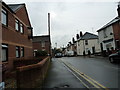
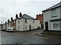
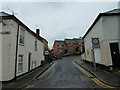
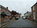
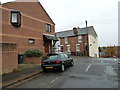
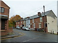
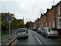
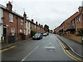
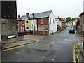
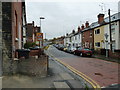
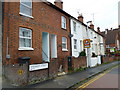
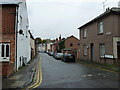
Photos of RG2 0JZ
Area Information
RG2 0JZ is a compact residential postcode in England, covering just 6.9 hectares and home to 1,473 people. Its high population density of 1,466 people per square kilometre reflects a tightly knit community, though the area’s small size means it is best suited for those prioritising proximity to Reading’s broader amenities. The postcode sits within a cluster of homes, predominantly owner-occupied, with a median age of 47. This suggests a stable, mature demographic, with adults aged 30–64 forming the largest age group. Daily life here is shaped by the area’s limited footprint, requiring residents to venture slightly beyond the postcode for major services. However, its closeness to Reading’s rail network and retail hubs offers a balance between residential tranquillity and urban convenience. The area’s distinctiveness lies in its blend of compact living and accessibility, though buyers should note the critical flood risk assessment, which could influence long-term considerations for property investment.
- Area Type
- Postcode
- Area Size
- 6.9 hectares
- Population
- 1473
- Population Density
- 1466 people/km²
RG2 0JZ is a predominantly owner-occupied area, with 65% of properties owned by their residents. The accommodation type is largely houses, which suggests a focus on single-family homes rather than apartments or flats. This housing stock is typical of smaller, residential postcode clusters, where property values may reflect the limited supply and demand from local buyers. The small area size means the housing market is likely constrained, with few new developments or speculative investment opportunities. For buyers, this could mean a competitive market for existing homes, particularly those seeking a traditional family home. The high home ownership rate also indicates that rental properties are less common, which may limit options for those preferring to rent. Proximity to Reading’s rail network and retail amenities adds value, but the area’s compact nature means buyers should consider the broader surrounding region for more extensive property choices.
House Prices in RG2 0JZ
Showing 2 properties
| Address | Type | Beds | Baths | Last Sale Price | Last Sale Date | |
|---|---|---|---|---|---|---|
| 17-19 Rose Kiln Lane, Reading, RG2 0JZ | shop | - | - | - | - | |
| Goodman Steel Services, Unit 4B, Rose Kiln Lane, Reading, RG2 0JZ | Industrial | - | - | - | - |
Energy Efficiency in RG2 0JZ
Residents of RG2 0JZ have access to a range of nearby amenities, including five retail outlets such as Iceland Reading, Makro Reading, and Asda Berkeley. These stores offer a mix of grocery and general retail options, ensuring daily needs are met without long journeys. The area’s proximity to multiple railway stations, including Reading and Earley, enhances mobility, making it easier to reach larger urban centres or regional hubs. While the postcode itself is small, its connection to Reading’s broader infrastructure means residents can access cultural, leisure, and professional opportunities in the city. The presence of major supermarkets and transport links contributes to a practical lifestyle, balancing local convenience with urban accessibility. This combination of retail and transport options supports a lifestyle that prioritises efficiency and connectivity.
Amenities
Schools
| Rank | School | Type | Entry gender | Ages |
|---|
Explore more schools in this area
Go to Schools tabDemographics
The community in RG2 0JZ is predominantly composed of adults aged 30–64, with a median age of 47. This indicates a population skewed towards middle-aged individuals, likely with established careers and families. Home ownership is high at 65%, suggesting a strong presence of long-term residents rather than transient renters. The accommodation type is primarily houses, which aligns with the area’s residential character. The predominant ethnic group is White, though no specific data on diversity or deprivation levels is provided. The absence of detailed diversity statistics means the community’s cultural composition remains unquantified. The age profile and ownership figures imply a stable, low-turnover environment, where residents may prioritise security and familiarity over rapid change. This demographic profile could appeal to buyers seeking a settled, family-oriented neighbourhood.
Household Size
Accommodation Type
Tenure
Ethnic Group
Religion
Household Composition
Age
Household Deprivation
NS-SEC
Explore more demographic insights in this area
Go to Demographics tabPlanning
Planning Constraints
- Flood RiskPremium
- Ramsar Wetland SitesPremium
- Area of Outstanding Natural BeautyPremium
- Protected Nature ReservePremium
- Protected WoodlandPremium