Area Overview for RG2 0ST
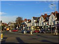
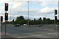
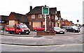
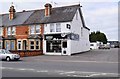
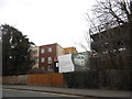
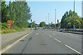
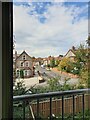
Photos of RG2 0ST


Area Information
RG2 0ST is a compact residential postcode in England, covering just 7 hectares with a population of 1473 people. Its high population density of 1466 people per square kilometre reflects a tightly knit community, where homes are predominantly owner-occupied. The area is characterised by a mature demographic, with a median age of 47 and the majority of residents falling within the 30-64 age range. This suggests a stable population of professionals and families, many of whom likely commute via the nearby rail network. The small size of the area means it is a focused, localised cluster, with residents living close to essential services and transport links. While the area is not large, its proximity to Reading’s retail and rail hubs adds to its practicality. Living here offers a balance of residential tranquillity and access to urban amenities, though the high density may mean limited space for expansion or new development. The presence of multiple rail stations and major supermarkets within reach ensures daily life is convenient, though the area’s small footprint means it is best suited for those prioritising proximity to key services over sprawling suburban landscapes.
- Area Type
- Postcode
- Area Size
- 7.0 hectares
- Population
- 1473
- Population Density
- 1466 people/km²
The property market in RG2 0ST is dominated by owner-occupied homes, with 65% of residents owning their properties. This contrasts with areas where rental demand is higher, indicating a community that values long-term residency and stability. The accommodation type is primarily houses, which is notable given the area’s small size. This suggests that properties are likely to be family homes or semi-detached units, rather than apartments or flats. The high home ownership rate implies limited availability of rental properties, which could make the area less attractive to tenants or first-time buyers seeking flexibility. Given the compact nature of the postcode, the housing stock is likely to be limited in volume, with little scope for new developments. Buyers should consider the proximity to amenities and transport links as key selling points, as the area’s value may be tied to its convenience rather than expansive living space. The market is best suited for those prioritising proximity to services over large properties.
House Prices in RG2 0ST
Showing 1 properties
| Address | Type | Beds | Baths | Last Sale Price | Last Sale Date | |
|---|---|---|---|---|---|---|
| Evans Halshaw, Rose Kiln Lane, Reading, RG2 0ST | retail_financial | - | - | - | - |
Energy Efficiency in RG2 0ST
Residents of RG2 0ST have access to a range of nearby amenities, including five retail outlets such as Makro Reading, Iceland Reading, and Morrisons Whitley. These supermarkets provide convenient shopping options for daily essentials, reducing the need for long commutes. The area’s rail network is particularly well-developed, with five stations—including Reading West and Earley—offering frequent services to central Reading and beyond. This connectivity ensures easy access to employment, leisure, and cultural opportunities in the city. While the area itself is small, its proximity to larger urban hubs means residents can enjoy a blend of local convenience and city amenities. The presence of multiple rail stations also supports a lifestyle that balances suburban comfort with urban accessibility. The retail options and transport links contribute to a practical, efficient daily life, though the compact nature of the area means it is best suited for those prioritising proximity to services over expansive green spaces or recreational facilities.
Amenities
Schools
| Rank | School | Type | Entry gender | Ages |
|---|
Explore more schools in this area
Go to Schools tabDemographics
The community in RG2 0ST is predominantly composed of adults aged 30-64, with a median age of 47. This suggests a population skewed towards middle-aged individuals, likely including professionals, families, and retirees. Home ownership is high at 65%, indicating a strong presence of long-term residents and a stable housing market. The area is largely made up of houses rather than flats, which aligns with the demographic profile of older, more established households. The predominant ethnic group is White, though no further breakdown of diversity is provided. The high population density of 1466 people per square kilometre means the area is intensely populated for its size, which could influence the availability of communal spaces or green areas. While no data on deprivation is available, the high home ownership rate and mature age profile suggest a community with relatively stable economic conditions. This profile may appeal to those seeking a settled, low-turnover environment with established local connections.
Household Size
Accommodation Type
Tenure
Ethnic Group
Religion
Household Composition
Age
Household Deprivation
NS-SEC
Explore more demographic insights in this area
Go to Demographics tabPlanning
Planning Constraints
- Flood RiskPremium
- Ramsar Wetland SitesPremium
- Area of Outstanding Natural BeautyPremium
- Protected Nature ReservePremium
- Protected WoodlandPremium