Area Overview for RG2 0BH
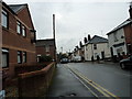
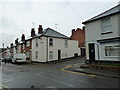
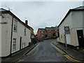
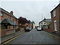
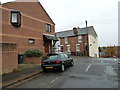
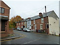
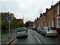
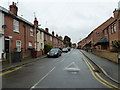
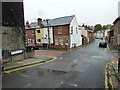
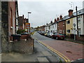
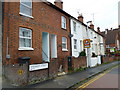
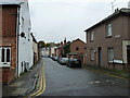
Photos of RG2 0BH
Area Information
RG2 0BH is a compact residential postcode in England, spanning 1,580 square metres and home to 1,779 residents. Its high population density of 1,126,114 people per square kilometre reflects a tightly knit community, though the area remains small enough to foster a sense of familiarity. The postcode is part of a residential cluster, with homes primarily in the form of houses, suggesting a mix of established properties and family-oriented living. Daily life here is shaped by proximity to amenities: five retail outlets, including major stores like Tesco and Asda, and five rail stations, such as Reading Railway Station, provide easy access to shopping, transport, and commuting. The area’s broadband score of 100 ensures seamless digital connectivity, while mobile coverage of 85 is reliable for most needs. With a median age of 47 and a population skewed toward adults aged 30–64, the community is stable and mature, with a strong emphasis on home ownership. For those considering living in RG2 0BH, the blend of practicality, connectivity, and a low crime risk makes it an attractive option for buyers seeking a balanced lifestyle.
- Area Type
- Postcode
- Area Size
- 1580 m²
- Population
- 1779
- Population Density
- 13580 people/km²
The property market in RG2 0BH is characterised by a 43% home ownership rate, indicating that just over a third of properties are owner-occupied, with the rest likely rented out. The area’s accommodation type is primarily houses, which suggests a focus on larger, family-friendly homes rather than smaller units. This mix implies a balance between long-term residents and renters, though the relatively low home ownership rate may reflect a reliance on rental markets or a preference for tenancy. Given the area’s small size and high population density, property availability is likely limited, making it a competitive market for buyers. The presence of rail stations and retail hubs nearby may enhance the appeal of homes here, particularly for those prioritising convenience. However, the lack of data on property prices or recent sales trends means buyers should conduct further local research to gauge current market conditions.
House Prices in RG2 0BH
Showing 12 properties
| Address | Type | Beds | Baths | Last Sale Price | Last Sale Date | |
|---|---|---|---|---|---|---|
| 15 Elgar Road, Reading, RG2 0BH | Terraced | 3 | 1 | £340,000 | Mar 2025 | |
| 19 Elgar Road, Reading, RG2 0BH | Terraced | 3 | 2 | £350,000 | Feb 2023 | |
| 23 Elgar Road, Reading, RG2 0BH | house | 3 | - | £294,000 | Feb 2021 | |
| 3A Elgar Road, Reading, RG2 0BH | Flat | 1 | - | £102,500 | Nov 2018 | |
| 5 Elgar Road, Reading, RG2 0BH | Terraced | 2 | - | £260,000 | Jan 2017 | |
| 17 Elgar Road, Reading, RG2 0BH | Terraced | 3 | 1 | £185,000 | Mar 2013 | |
| 11 Elgar Road, Reading, RG2 0BH | house | 3 | - | £187,000 | Oct 2011 | |
| 21 Elgar Road, Reading, RG2 0BH | house | 3 | - | £210,000 | Feb 2011 | |
| 9 Elgar Road, Reading, RG2 0BH | Terraced | 3 | 1 | £168,000 | Dec 2009 | |
| 3 Elgar Road, Reading, RG2 0BH | Flat | 3 | 1 | £176,000 | Oct 2004 |
Energy Efficiency in RG2 0BH
Living in RG2 0BH offers access to a range of practical amenities within reach. The area is served by five retail outlets, including major stores like Tesco Crown, Asda Berkeley, and Iceland Reading, providing convenience for shopping, groceries, and daily essentials. While the data does not mention parks or leisure facilities, the proximity to rail stations and retail hubs suggests a lifestyle centred on ease of access rather than expansive green spaces. The rail network connects residents to broader regional amenities, enabling quick travel to dining, entertainment, or cultural attractions in nearby towns. The combination of retail options and transport links ensures that daily needs are met without requiring long commutes. For those prioritising convenience and connectivity, RG2 0BH’s amenities align with a practical, efficient lifestyle.
Amenities
Schools
The nearest school to RG2 0BH is Katesgrove Primary School, a primary institution with a Good Ofsted rating. This school serves the local community, offering education for younger children in the area. While no secondary schools are listed in the data, the presence of a well-rated primary school is a significant draw for families with young children. The school’s Good rating suggests it meets or exceeds national standards in areas such as teaching quality, student outcomes, and facilities. For families relying on this school, the proximity to RG2 0BH ensures minimal travel time, enhancing the area’s appeal for parents. However, the absence of secondary school data means buyers should verify whether additional educational options are accessible within a reasonable distance.
| Rank | School | Type | Entry gender | Ages |
|---|
Explore more schools in this area
Go to Schools tabDemographics
The community in RG2 0BH is predominantly composed of adults aged 30–64, with a median age of 47, reflecting a mature population profile. Home ownership stands at 43%, indicating that nearly half of residents live in owner-occupied homes, while the remainder are likely in rental properties. The area’s accommodation type is primarily houses, suggesting a focus on family-sized dwellings rather than flats or apartments. The predominant ethnic group is White, though no specific data on diversity or deprivation levels is provided. This demographic structure implies a stable, long-term resident base, with fewer transient populations. The age range suggests a community with established careers and family commitments, potentially contributing to a low crime risk score of 73. While the data does not quantify deprivation, the combination of home ownership and age profile suggests a generally secure quality of life, with residents prioritising stability over mobility.
Household Size
Accommodation Type
Tenure
Ethnic Group
Religion
Household Composition
Age
Household Deprivation
NS-SEC
Explore more demographic insights in this area
Go to Demographics tabPlanning
Planning Constraints
- Flood RiskPremium
- Ramsar Wetland SitesPremium
- Area of Outstanding Natural BeautyPremium
- Protected Nature ReservePremium
- Protected WoodlandPremium