Area Overview for RG2 0BJ
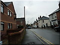
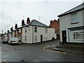
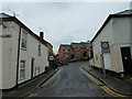
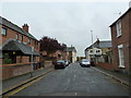
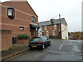
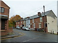
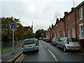
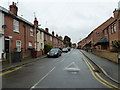
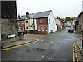
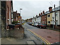
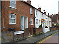
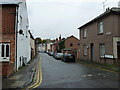
Photos of RG2 0BJ
Area Information
RG2 0BJ is a small, densely populated residential postcode area in England, covering just 4,775 square metres and home to 1,779 residents. Its compact size means it is a tightly knit community, with a population density of 372,557 people per square kilometre—among the highest in the country. The area’s character is defined by its mature demographic, with a median age of 47 and a majority of residents aged between 30 and 64. This suggests a stable, established community with a focus on long-term residency. Living here offers proximity to essential services and transport links, though the small footprint means amenities are concentrated. The area’s high density also implies a need for efficient planning, with homes likely arranged closely to maximise space. For those seeking a quiet, residential environment with easy access to nearby infrastructure, RG2 0BJ presents a mix of challenges and conveniences, shaped by its size and population profile.
- Area Type
- Postcode
- Area Size
- 4775 m²
- Population
- 1779
- Population Density
- 13580 people/km²
The property market in RG2 0BJ reflects a balance between owner-occupation and rental demand, with 43% of homes owned by residents. The accommodation type is predominantly houses, which may appeal to families seeking more space in a densely populated area. However, the small size of the postcode—just 4,775 square metres—suggests limited housing stock, potentially making the market competitive for buyers. The high population density may also influence property values, with proximity to amenities and transport links likely driving interest. For buyers, the area’s compact nature means opportunities are confined to a small radius, requiring careful consideration of location within the postcode. While the presence of houses indicates a focus on family homes, the relatively low home ownership rate suggests a significant portion of the market is rental-based, which could affect long-term investment potential.
House Prices in RG2 0BJ
Showing 19 properties
| Address | Type | Beds | Baths | Last Sale Price | Last Sale Date | |
|---|---|---|---|---|---|---|
| 30 Elgar Road, Reading, RG2 0BJ | Terraced | 2 | 1 | £452,000 | Feb 2023 | |
| 14 Elgar Road, Reading, RG2 0BJ | Terraced | 3 | 1 | £405,000 | Jan 2023 | |
| 38 Elgar Road, Reading, RG2 0BJ | Terraced | 3 | 1 | £452,800 | Jan 2023 | |
| 8 Elgar Road, Reading, RG2 0BJ | house | - | - | £390,000 | Mar 2022 | |
| 6 Elgar Road, Reading, RG2 0BJ | Terraced | 3 | 1 | £300,000 | Feb 2021 | |
| 16 Elgar Road, Reading, RG2 0BJ | Terraced | 2 | 1 | £227,600 | Oct 2016 | |
| 4 Elgar Road, Reading, RG2 0BJ | Terraced | 3 | 1 | £290,000 | Feb 2016 | |
| 18 Elgar Road, Reading, RG2 0BJ | Terraced | 3 | 1 | £200,000 | Dec 2011 | |
| 22 Elgar Road, Reading, RG2 0BJ | house | 2 | - | £227,500 | Oct 2011 | |
| 2 Elgar Road, Reading, RG2 0BJ | house | 3 | - | £227,000 | Sep 2011 |
Energy Efficiency in RG2 0BJ
Residents of RG2 0BJ have access to a range of nearby amenities, including five retail outlets such as Asda Berkeley, Tesco Crown, and Iceland Reading. These shops provide convenience for everyday shopping, reducing the need for longer trips. The area’s rail connectivity further enhances lifestyle options, with stations like Reading Railway Station offering links to broader transport networks. While the data does not specify parks or leisure facilities, the presence of multiple retail and transport hubs suggests a focus on practicality and accessibility. The compact nature of the postcode means amenities are closely clustered, potentially fostering a sense of community. For those prioritising convenience, the proximity to shopping and transport makes RG2 0BJ a functional choice, though it may lack expansive recreational spaces.
Amenities
Schools
The nearest school to RG2 0BJ is Katesgrove Primary School, a primary institution with a ‘good’ Ofsted rating. This provides families with a locally rated educational option for younger children. The absence of secondary schools in the immediate vicinity means parents may need to consider commuting for older children, though the area’s proximity to rail stations could ease this. The presence of a single primary school suggests a focus on early education within the community, which may be sufficient for families with young children. However, the lack of additional schools—such as secondary or specialist institutions—could be a limitation for households requiring a broader range of educational options. For those prioritising primary schooling, Katesgrove Primary’s ‘good’ rating offers reassurance about the quality of education available.
| Rank | School | Type | Entry gender | Ages |
|---|
Explore more schools in this area
Go to Schools tabDemographics
The community in RG2 0BJ is predominantly middle-aged, with a median age of 47 and the majority of residents falling within the 30-64 age range. This suggests a population largely composed of working-age adults and families with established careers. Home ownership accounts for 43% of households, meaning nearly half of residents rent their homes. The accommodation type is primarily houses, indicating a focus on family-friendly housing stock. The predominant ethnic group is White, though the data does not specify further diversity metrics. The high population density—372,557 people per square kilometre—implies a compact, possibly urbanised setting. While this density can lead to a vibrant, interconnected community, it may also contribute to pressure on local resources. The demographic profile suggests a stable, low-turnover area, with residents likely prioritising proximity to services and transport over expansive living spaces.
Household Size
Accommodation Type
Tenure
Ethnic Group
Religion
Household Composition
Age
Household Deprivation
NS-SEC
Explore more demographic insights in this area
Go to Demographics tabPlanning
Planning Constraints
- Flood RiskPremium
- Ramsar Wetland SitesPremium
- Area of Outstanding Natural BeautyPremium
- Protected Nature ReservePremium
- Protected WoodlandPremium