Area Overview for KT18 6JB
Photos of KT18 6JB
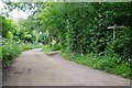
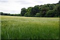
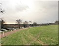
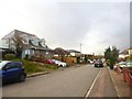
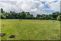
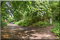
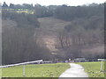
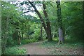
50 photos from this area
Area Information
Key information about the KT18 6JB including its size, population, and administrative classification.
- Area Type
- Postcode
- Area Size
- 2.6 hectares
- Population
- 1516
- Population Density
- 505 people/km²
House Prices in KT18 6JB
47
Properties
£511,290
Average Sold Price
£104,000
Lowest Price
£850,000
Highest Price
Showing 47 properties
| Address | Type | Beds | Baths | Last Sale Price | Last Sale Date | |
|---|---|---|---|---|---|---|
| 54 Grosvenor Road, Epsom, KT18 6JB | house | - | - | £625,000 | Nov 2023 | |
| 56 Grosvenor Road, Epsom, KT18 6JB | Terraced | 3 | 2 | £570,000 | Nov 2023 | |
| 62 Grosvenor Road, Epsom, KT18 6JB | Retail | 4 | 2 | £835,000 | Jul 2022 | |
| 86 Grosvenor Road, Epsom, KT18 6JB | Terraced | 4 | 3 | £650,000 | Jun 2022 | |
| 106 Grosvenor Road, Epsom, KT18 6JB | house | - | - | £850,000 | May 2022 | |
| 100A Grosvenor Road, Epsom, KT18 6JB | Semi-detached | 2 | 1 | £530,000 | Nov 2021 | |
| 104 Grosvenor Road, Epsom, KT18 6JB | Semi-detached | 5 | 2 | £570,000 | Mar 2021 | |
| 88 Grosvenor Road, Epsom, KT18 6JB | house | - | - | £647,000 | Mar 2021 | |
| 60 Grosvenor Road, Epsom, KT18 6JB | Semi-detached | 4 | 2 | £553,000 | Aug 2020 | |
| 66 Grosvenor Road, Epsom, KT18 6JB | Detached | 4 | 1 | £577,500 | Jun 2020 |
Page 1 of 5
Energy Efficiency in KT18 6JB
Amenities
Schools
| Rank | School | Type | Entry gender | Ages |
|---|
Explore more schools in this area
Go to Schools tabDemographics
Household Size
Family (3-5 people)
most common
Accommodation Type
Houses
most common
Tenure
90
majority
Ethnic Group
White
most common
Religion
N/A
most common
Household Composition
N/A
most common
Age
47
median
Adults (30-64 years)
most common
Household Deprivation
N/A
with no deprivation
NS-SEC
48
in Lower managerial occupations
Explore more demographic insights in this area
Go to Demographics tabPlanning
Planning Constraints
- Flood RiskPremium
- Ramsar Wetland SitesPremium
- Area of Outstanding Natural BeautyPremium
- Protected Nature ReservePremium
- Protected WoodlandPremium