Area Overview for KT18 6JD
Photos of KT18 6JD


Area Information
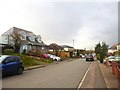
KT18 6JD is a small, tightly knit residential area in England, home to 1,516 residents spread across a compact footprint. With a population density of 505 people per square kilometre, this postcode reflects a modest, community-focused environment. The area’s character is defined by its proximity to essential amenities and its integration with surrounding infrastructure. Residents benefit from a balance of quiet living and practical connectivity, with nearby rail stations and retail outlets within easy reach. The demographic profile suggests a mature, stable population, with a median age of 47 and a strong presence of adults aged 30–64. This suggests a neighbourhood where long-term residency and family life are common. The low flood risk and absence of environmental constraints, such as protected woodlands or AONB designations, further underline the area’s appeal for those seeking a safe, straightforward living environment. For homebuyers, KT18 6JD offers a blend of affordability and accessibility, with homes predominantly in private ownership and a focus on single-family dwellings.
- Area Type
- Postcode
- Area Size
- Not available
- Population
- 1516
- Population Density
- 505 people/km²
The property market in KT18 6JD is dominated by owner-occupied homes, with 90% of properties in private hands. This high rate of home ownership suggests a stable market with limited rental activity, making it a less common destination for investors seeking buy-to-let opportunities. The accommodation types are predominantly houses, which are more likely to be family homes or long-term residences. This contrasts with areas where flats or apartments dominate, and it reflects a preference for private, standalone living. Given the small size of the postcode area, the housing stock is likely limited, meaning buyers may need to consider nearby postcodes for more options. The absence of planning constraints, such as protected woodlands or AONB designations, also makes the area more flexible for potential renovations or extensions. For those seeking a quiet, family-friendly home with a focus on stability, KT18 6JD presents a straightforward, low-risk proposition.
House Prices in KT18 6JD
No properties found in this postcode.
Energy Efficiency in KT18 6JD
The lifestyle in KT18 6JD is shaped by its proximity to essential amenities and a focus on practical living. Within reach are retail outlets like Spar, Morrisons Daily, and Co-op Tattenham, providing access to groceries and everyday goods. These shops cater to daily needs, reducing the necessity for long journeys to larger shopping centres. The area’s rail stations, including Tattenham Corner and Epsom Downs, offer easy access to commuting and regional travel, connecting residents to nearby towns and services. While the data does not mention parks or leisure facilities, the absence of environmental constraints such as protected woodlands or AONB designations suggests that the area is free from restrictions that might limit recreational opportunities. The character of KT18 6JD is defined by its straightforward, functional approach to living, with an emphasis on accessibility and stability. For those prioritising convenience and connectivity, this area offers a balanced lifestyle.
Amenities
Schools
Residents of KT18 6JD have access to two primary schools within practical reach: Epsom Downs County Infant School and The Vale Primary School. Both institutions cater to younger children, providing essential early education for families in the area. The duplication of The Vale Primary School in the data may indicate a nearby cluster of primary education options, though no secondary schools are listed. This suggests that families may need to travel to adjacent areas for secondary schooling, which is a consideration for those planning long-term stays. The presence of two primary schools within the vicinity offers convenience for parents, reducing the need for long commutes. However, the absence of detailed Ofsted ratings means that the quality of education cannot be assessed from this data alone. For families prioritising primary education, KT18 6JD’s proximity to these schools is a clear advantage.
| Rank | School | Type | Entry gender | Ages |
|---|
Explore more schools in this area
Go to Schools tabDemographics
The community in KT18 6JD is predominantly composed of adults aged 30–64, with a median age of 47. This indicates a mature population, likely with established careers and family ties to the area. Home ownership is exceptionally high at 90%, suggesting a stable, long-term resident base. The accommodation types are primarily houses, which aligns with the area’s residential character and the absence of high-density housing. The predominant ethnic group is White, with no specific data provided on diversity or deprivation levels. While this may imply a homogenous community, the lack of detailed demographic breakdowns means further analysis is not possible. The low crime risk score of 85/100 reinforces the area’s safety, which is a key consideration for families and retirees. The combination of high home ownership, adult demographics, and low risk factors paints a picture of a settled, low-maintenance neighbourhood.
Household Size
Accommodation Type
Tenure
Ethnic Group
Religion
Household Composition
Age
Household Deprivation
NS-SEC
Explore more demographic insights in this area
Go to Demographics tabPlanning
Planning Constraints
- Flood RiskPremium
- Ramsar Wetland SitesPremium
- Area of Outstanding Natural BeautyPremium
- Protected Nature ReservePremium
- Protected WoodlandPremium