Area Overview for KT18 6JE
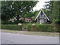
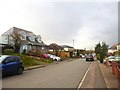
Photos of KT18 6JE


Area Information
KT18 6JE is a small residential postcode area in England, home to 1,516 people spread across a compact footprint. With a population density of 505 people per square kilometre, it reflects a tightly knit community. The area’s character is shaped by its modest size and the prevalence of owner-occupied homes, which make up 90% of properties. This suggests a stable, long-term resident base, with families and individuals drawn to its quiet, established environment. The median age of 47 indicates a mature demographic, with the majority of residents falling within the 30–64 age range. Daily life here is likely to revolve around local amenities, schools, and the nearby rail network. The proximity to primary schools and multiple railway stations adds practical convenience, supporting both family needs and commuting options. While the area lacks large-scale commercial hubs, its small-scale nature fosters a sense of familiarity and accessibility. For buyers seeking a low-maintenance, community-focused setting, KT18 6JE offers a blend of practicality and tranquillity, with homes primarily in single-family structures.
- Area Type
- Postcode
- Area Size
- Not available
- Population
- 1516
- Population Density
- 505 people/km²
The property market in KT18 6JE is dominated by owner-occupied homes, with 90% of properties in private hands. This high ownership rate suggests a community of long-term residents rather than a rental-focused area. The accommodation type is exclusively houses, which is uncommon in many urban postcode areas. This indicates a preference for single-family dwellings, likely appealing to families or individuals seeking space and privacy. The small size of the postcode area means the housing stock is limited, which could make the market competitive for buyers. The absence of flats or apartments implies that the area caters to those prioritising traditional home ownership over modern, high-density living. For prospective buyers, this means a focus on individual properties rather than shared spaces, with potential for family-oriented homes. However, the limited scale of the area may also mean fewer options for those seeking a broader range of property types.
House Prices in KT18 6JE
No properties found in this postcode.
Energy Efficiency in KT18 6JE
The lifestyle in KT18 6JE is shaped by its proximity to essential amenities. Residents have access to five retail outlets, including Spar, Morrisons Daily, and Co-op Tattenham, offering a range of grocery and convenience services. These shops support daily needs, though the absence of larger retail chains suggests a focus on local, smaller-scale commerce. The area’s rail network, with five stations nearby, provides easy access to broader transport links, enabling travel to nearby towns and cities. While the data does not mention parks or leisure facilities, the presence of schools and retail options indicates a community-oriented environment. The compact nature of the postcode area means amenities are within walking or short driving distance, fostering a sense of convenience. For those prioritising practicality over expansive recreational spaces, KT18 6JE offers a straightforward, accessible lifestyle with minimal need for long commutes or extensive travel.
Amenities
Schools
KT18 6JE is served by two primary schools: Epsom Downs County Infant School and The Vale Primary School. Both are primary institutions, catering to younger children and providing essential early education. The duplication of The Vale Primary School in the data may indicate a nearby cluster of educational facilities, though the exact relationship between the schools is unclear. For families, the presence of two primary schools within proximity offers options for schooling, though the absence of secondary schools or Ofsted ratings means further research would be needed to assess quality. The focus on primary education aligns with the area’s demographic profile, where the majority of residents fall within the 30–64 age range, likely including parents of young children. While the data does not provide details on school performance, the availability of local primary schools supports the practical needs of families in the area.
| Rank | School | Type | Entry gender | Ages |
|---|
Explore more schools in this area
Go to Schools tabDemographics
The community in KT18 6JE is predominantly composed of adults aged 30–64, with a median age of 47. This suggests a population that is largely settled, with few young families or retirees. The high home ownership rate of 90% indicates a strong presence of long-term residents, many of whom may have raised children in the area. The accommodation type is almost entirely houses, which aligns with the demographic profile of older, established households. The predominant ethnic group is White, reflecting the area’s homogeneity. There is no data on deprivation levels, but the high home ownership and stable age distribution suggest a relatively secure economic environment. The absence of significant diversity metrics means the community is likely to have a uniform cultural and social profile. For residents, this translates to a predictable, low-activity lifestyle with minimal pressure from transient populations. The area’s demographics position it as a place where stability and familiarity are prioritised over rapid change or urban dynamism.
Household Size
Accommodation Type
Tenure
Ethnic Group
Religion
Household Composition
Age
Household Deprivation
NS-SEC
Explore more demographic insights in this area
Go to Demographics tabPlanning
Planning Constraints
- Flood RiskPremium
- Ramsar Wetland SitesPremium
- Area of Outstanding Natural BeautyPremium
- Protected Nature ReservePremium
- Protected WoodlandPremium