Area Overview for KT18 6JG
Photos of KT18 6JG
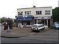
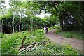
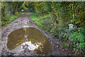
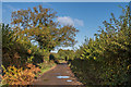
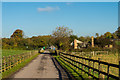
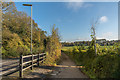
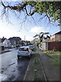
48 photos from this area
Area Information
Key information about the KT18 6JG including its size, population, and administrative classification.
- Area Type
- Postcode
- Area Size
- 1.6 hectares
- Population
- 1516
- Population Density
- 505 people/km²
House Prices in KT18 6JG
40
Properties
£362,344
Average Sold Price
£81,000
Lowest Price
£790,000
Highest Price
Showing 40 properties
| Address | Type | Beds | Baths | Last Sale Price | Last Sale Date | |
|---|---|---|---|---|---|---|
| 31 Grosvenor Road, Epsom, KT18 6JG | Bungalow | 3 | 2 | £630,000 | May 2024 | |
| 59 Grosvenor Road, Epsom, KT18 6JG | Semi-detached | 3 | 1 | £570,000 | Dec 2023 | |
| 53 Grosvenor Road, Epsom, KT18 6JG | Bungalow | 2 | 1 | £440,000 | Oct 2023 | |
| 33 Grosvenor Road, Epsom, KT18 6JG | house | - | - | £790,000 | Dec 2022 | |
| 43 Grosvenor Road, Epsom, KT18 6JG | house | - | - | £782,000 | Dec 2021 | |
| 11A Grosvenor Road, Epsom, KT18 6JG | house | - | - | £445,000 | Mar 2021 | |
| 25 Grosvenor Road, Epsom, KT18 6JG | Semi-detached | 5 | 1 | £525,000 | Jan 2020 | |
| 39 Grosvenor Road, Epsom, KT18 6JG | Semi-detached | 3 | 1 | £500,000 | Nov 2019 | |
| 67 Grosvenor Road, Epsom, KT18 6JG | Maisonette | 3 | 1 | £275,000 | Apr 2017 | |
| 63 Grosvenor Road, Epsom, KT18 6JG | Detached | 3 | 1 | £465,000 | Feb 2016 |
Page 1 of 4
Energy Efficiency in KT18 6JG
Amenities
Schools
| Rank | School | Type | Entry gender | Ages |
|---|
Explore more schools in this area
Go to Schools tabDemographics
Household Size
Family (3-5 people)
most common
Accommodation Type
Houses
most common
Tenure
90
majority
Ethnic Group
White
most common
Religion
N/A
most common
Household Composition
N/A
most common
Age
47
median
Adults (30-64 years)
most common
Household Deprivation
N/A
with no deprivation
NS-SEC
48
in Lower managerial occupations
Explore more demographic insights in this area
Go to Demographics tabPlanning
Planning Constraints
- Flood RiskPremium
- Ramsar Wetland SitesPremium
- Area of Outstanding Natural BeautyPremium
- Protected Nature ReservePremium
- Protected WoodlandPremium