Area Overview for M21 7NW
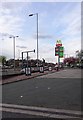
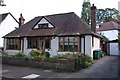
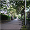
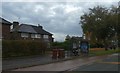
Photos of M21 7NW


Area Information
M21 7NW is a small, densely populated residential cluster in England, covering just 9,473 square metres and home to 1,677 residents. Its compact size and high population density of 177,038 people per square kilometre reflect a tightly knit community. The area is characterised by a mature demographic, with a median age of 47 and a majority of residents aged 30–64. This suggests a stable, established population, likely with strong local ties. Daily life here is shaped by proximity to transport networks and retail hubs, with easy access to rail, metro, and bus services. While the broadband connectivity is rated excellent, the area’s crime risk is critical, which may influence perceptions of safety. Despite this, the absence of environmental constraints like flood zones or protected landscapes means planning for housing or development faces fewer restrictions. For buyers, M21 7NW offers a mix of practicality and challenges, with a focus on rental properties and a community that prioritises convenience over expansive living spaces.
- Area Type
- Postcode
- Area Size
- 9473 m²
- Population
- 1677
- Population Density
- 3934 people/km²
The property market in M21 7NW is dominated by rental properties, with only 32% of homes owned by residents. This suggests a transient or economically driven population, where long-term investment in property may be less common. The accommodation type is primarily houses, which is notable given the area’s small size and high density. This could indicate that properties are designed for multi-family use or are smaller in scale to accommodate the limited space. For buyers, the market is likely to be competitive, with limited availability of owner-occupied homes. The area’s compact nature means that any property purchase would involve careful consideration of proximity to amenities and transport. Given the high population density, properties may be smaller or share communal spaces, which could influence buyer preferences.
House Prices in M21 7NW
Showing 34 properties
| Address | Type | Beds | Baths | Last Sale Price | Last Sale Date | |
|---|---|---|---|---|---|---|
| 61 Waincliffe Avenue, Manchester, M21 7NW | Semi-detached | 3 | - | £250,000 | May 2024 | |
| 67 Waincliffe Avenue, Manchester, M21 7NW | Semi-detached | 3 | 1 | £300,000 | May 2023 | |
| 65 Waincliffe Avenue, Manchester, M21 7NW | house | 3 | - | £115,000 | Feb 2015 | |
| 11 Waincliffe Avenue, Manchester, M21 7NW | house | 3 | - | £100,000 | Jun 2009 | |
| 57 Waincliffe Avenue, Manchester, M21 7NW | Semi-detached | - | - | £42,160 | Oct 2004 | |
| 5 Waincliffe Avenue, Manchester, M21 7NW | house | 3 | - | £56,000 | Nov 2002 | |
| 19 Waincliffe Avenue, Manchester, M21 7NW | Flat | - | - | - | - | |
| 17 Waincliffe Avenue, Manchester, M21 7NW | Flat | - | - | - | - | |
| 53 Waincliffe Avenue, Manchester, M21 7NW | house | - | - | - | - | |
| 43 Waincliffe Avenue, Manchester, M21 7NW | Flat | - | - | - | - |
Energy Efficiency in M21 7NW
Living in M21 7NW offers access to a range of retail and transport amenities. Local shops include Asda West, Co-op West, and Co-op Palatine, providing everyday essentials. The area’s transport network is extensive, with metro lines like Barlow Moor Road and Withington, rail stations such as East Didsbury and Burnage, and a bus coach station at Chorlton Street. Airports are also within reach, with Terminal One, Two, and Three accessible via nearby routes. These connections make the area convenient for both local travel and regional commuting. While the retail options are modest, the density of transport links ensures that residents can easily access larger shopping centres or leisure facilities elsewhere. The compact nature of the area means that amenities are closely clustered, reducing the need for long commutes. However, the lack of detailed data on parks or leisure spaces means the character of the area’s recreational offerings remains unclear.
Amenities
Schools
| Rank | School | Type | Entry gender | Ages |
|---|
Explore more schools in this area
Go to Schools tabDemographics
The community in M21 7NW is predominantly composed of adults aged 30–64, with a median age of 47. This suggests a population that is largely settled, possibly with families or long-term residents. Home ownership is relatively low at 32%, indicating that most residents are likely to be renters. The accommodation type is primarily houses, which is unusual for an area with such high population density. This could imply smaller, multi-family dwellings or shared housing arrangements. The predominant ethnic group is White, with no specific data on other demographics provided. The high population density of 177,038 people per square kilometre means living spaces are closely packed, which may affect privacy and communal dynamics. While no data on deprivation is available, the low home ownership rate and dense housing suggest potential challenges in affordability or housing availability.
Household Size
Accommodation Type
Tenure
Ethnic Group
Religion
Household Composition
Age
Household Deprivation
NS-SEC
Explore more demographic insights in this area
Go to Demographics tabPlanning
Planning Constraints
- Flood RiskPremium
- Ramsar Wetland SitesPremium
- Area of Outstanding Natural BeautyPremium
- Protected Nature ReservePremium
- Protected WoodlandPremium